
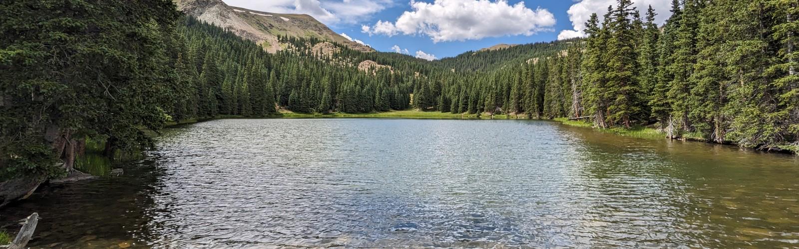

Ready to explore Venado Peak, New Mexico? Here's everything you need to know before you go!
Discover the trail
Oh no! We don't have any photos 😢
This trail hasn't been captured yet. Be the first to share your adventure!Trail description
Venado Peak is one of those summits in New Mexico that rewards the effort with a genuine sense of accomplishment. Tucked within the Sangre de Cristo Mountains in northern New Mexico, this peak draws hikers looking for a real mountain experience — rugged terrain, big elevation, and the kind of quiet you only find when you've earned it with your legs.
The Terrain
The approach to Venado Peak takes you through classic northern New Mexico high country. Expect a mix of dense conifer forest in the lower sections — spruce, fir, and aspen — that gradually gives way to open subalpine meadows and rocky slopes as you gain elevation. The upper mountain is exposed and rocky, with loose talus and scree requiring careful foot placement. This isn't a casual stroll; the terrain demands attention and solid footwear.
The trail corridor follows natural drainage patterns and ridgelines typical of the Sangre de Cristo range. As you climb, the views open up progressively, offering long sightlines across the surrounding peaks and valleys. The final push to the summit is steep and requires some scrambling depending on the exact route you choose.
What Makes Venado Peak Stand Out
Venado Peak sits in a part of New Mexico that doesn't get the same tourist traffic as some of the more well-known summits in the state. That relative quietness is a big part of its appeal. You're likely to share the trail with a handful of other hikers at most, and on weekdays, solitude is very much on the table.
The peak is also part of a broader landscape that includes several other summits in the area, making it a natural target for peak baggers working through the high points of northern New Mexico. The surrounding wilderness character — minimal infrastructure, no maintained facilities at the trailhead in the traditional sense — means this is a place that rewards self-sufficiency and preparation.
Wildlife and Nature
The ecosystems you pass through on the way to Venado Peak are rich and varied. The lower forested zones support mule deer, elk, and a healthy bird population including Clark's nutcracker and various woodpecker species. As you move into the subalpine zone, watch for marmots sunning on boulders and pikas calling from the talus fields near the summit. Raptors are commonly spotted riding thermals above the ridgelines.
Wildflowers in the meadow sections can be impressive during the summer months, with a mix of columbine, paintbrush, and various alpine species adding color to the landscape. The aspen groves lower on the mountain are particularly striking in early fall when the leaves turn.
Practical Information
Venado Peak is a serious mountain objective and should be treated as such. A few things to keep in mind before you head out:
- Navigation: Trails in this area can be faint or unmarked in sections, particularly on the upper mountain. Bring a map and compass or a GPS device loaded with the route. Don't rely solely on a phone signal.
- Weather: Northern New Mexico's high country is notorious for fast-moving afternoon thunderstorms, especially in July and August. Start early, aim to be off exposed ridges and the summit by early afternoon, and watch the sky constantly.
- Water: There may be seasonal water sources along the route, but don't count on them. Carry enough water for the full day and bring a filter as a backup.
- Footwear: Sturdy hiking boots with ankle support are strongly recommended given the rocky and uneven terrain, especially on the upper slopes.
- Leave No Trace: This is a wilderness environment. Pack out everything you bring in, stay on established trails where they exist, and give wildlife plenty of space.
Getting There
Access to Venado Peak is through northern New Mexico's mountain road network. Road conditions can vary significantly by season, and some access roads may require a high-clearance vehicle, particularly after wet weather or early in the season when snow lingers. Check current conditions before you go and confirm the trailhead access point is open and passable.
The area falls within the Carson National Forest, so be aware of any current fire restrictions, closures, or permit requirements that may be in effect. These can change seasonally and are worth verifying with the relevant ranger district before your trip.
Who This Hike Is For
Venado Peak is best suited for hikers with solid mountain experience. The combination of significant elevation gain, exposed terrain, route-finding challenges, and the ever-present risk of afternoon lightning makes this a poor choice for beginners or those unfamiliar with high-altitude hiking. If you're comfortable on rugged, off-trail terrain and have experience reading mountain weather, you'll find this to be a deeply satisfying objective.
Fit and experienced hikers who enjoy peak bagging, wilderness solitude, and the raw character of New Mexico's high country will feel right at home on Venado Peak.
The Essential Hiking Checklist
Everything you need for your next hike. Bilingual, printable, 1 page.
Get your free hiking checklistRecommended gear for this trail
As an Amazon Associate I earn from qualifying purchases.


Ready to go?
Everything you need to know before you goWhen?
How much?
As an Amazon Associate I earn from qualifying purchases.
Affiliate links — LGPO may earn a commission at no extra cost to you.
- Hiking shoes Essential
- → Salomon Elixir Tour Mid WP · 203.38 $
- Layered clothing Essential
- Rain jacket Essential
- Trekking poles
- → Black Diamond Trail Ergo Cork · 69.99 $
- Headlamp
- → Petzl Actik Core 625 · 103.95 $
FAQ - Frequently asked questions
Everything you need to knowSimilar hikes nearby
Discover other trails you might enjoy
Tesuque Peak, New Mexico
North Central New Mexico
Lake Peak, New Mexico
North Central New Mexico

Truchas Peak, New Mexico
North Central New Mexico

Santa Fe Baldy
North Central New Mexico
Old Santa Fe Trail
North Central New Mexico
Santa Fe National Historic Trail
North Central New Mexico
Hiking near Brandon
5 trails to explore ~1517 km away
We work hard to provide the most up-to-date and error-free data possible. If something seems incorrect, let us know! Your contribution helps the whole community.
Hikers' opinions
Be the first to review!
No hiker has shared their experience yet. Share your impressions and help other hikers!