
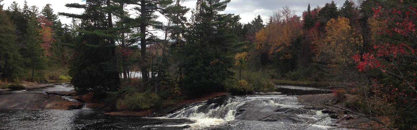

Ready to explore Mount Morris, New York? Here's everything you need to know before you go!
Discover the trail

Trail description
Mount Morris is one of those Adirondack climbs that earns its reputation the hard way — through a serious 955-meter elevation gain packed into 3.2 kilometers of trail. That ratio alone tells you what kind of day you're signing up for. This is a mountain that demands respect and preparation, but it pays you back with the kind of summit experience that sticks with you.
Plan on roughly 2.5 hours to complete the route at a steady pace. Strong hikers moving efficiently might trim that down, while those stopping frequently for photos or breaks should budget a bit more time. Either way, the elevation gain is the defining factor here — this isn't a trail where you can zone out and cruise. You'll be working consistently from start to finish.
The Climb
The lower sections of the trail move through dense Adirondack forest, where a full canopy overhead keeps things cool and shaded even when temperatures climb. The forest floor here is classic northeastern hardwood terrain — root systems weaving across the path, occasional rocky outcroppings breaking the surface, and ferns carpeting the ground between the trees. It's beautiful, but it demands attention underfoot.
As elevation builds, the character of the forest shifts. Trees thin out gradually, the canopy opens up, and you start catching glimpses of what's waiting at the top. The upper sections are where the trail gets genuinely demanding — steeper pitches, rockier footing, and the kind of sustained uphill that separates a moderate hike from a casual walk. Trekking poles are worth bringing if you have them, both for the ascent and for the descent when tired legs meet technical terrain.
Wet conditions change the equation significantly. Root systems and rock faces that are manageable when dry become genuinely slippery after rain. Footwear with solid traction isn't optional here — it's the difference between a good day and a rough one.
The Summit
The payoff at the top is real. Mount Morris delivers panoramic views across the Adirondacks — rolling ridgelines stacking up toward the horizon, dense forest filling the valleys below, and the occasional glint of a lake catching the light. On a clear day, the visibility is substantial enough to pick out individual peaks and orient yourself within the broader landscape.
The summit has multiple vantage points, so it's worth moving around rather than settling at the first open spot you reach. Different angles reveal different slices of the surrounding terrain, and finding a comfortable rock to sit on while you take it all in is one of the better parts of the whole experience.
Wildlife Along the Trail
The forest ecosystem here supports a solid cross-section of Adirondack wildlife. White-tailed deer are common, especially if you're moving through the lower sections in the early morning or late afternoon. The bird life is consistently active — woodpeckers drumming against tree trunks, warblers moving through the canopy during migration seasons, and the general background noise of a healthy forest doing its thing.
Chipmunks and red squirrels are reliable trail companions throughout the climb, and black bears do inhabit the area, though daytime encounters are uncommon. Standard bear awareness practices apply: don't leave food unattended, and make enough noise on the trail that you're not surprising anything.
Botanically, the elevation change creates a noticeable shift in plant communities as you climb. The fern-heavy forest floor of the lower trail gives way to hardier mountain vegetation near the summit, and paying attention to that transition adds another layer to the hike beyond just the physical challenge.
Historical Connection
Mount Morris carries a cultural footnote worth knowing: the area has ties to Francis Bellamy, the author of the Pledge of Allegiance. It's a small piece of American history embedded in the landscape, and it adds a bit of context to a region that has seen centuries of human presence — from indigenous peoples through early European settlement and into the era of Adirondack recreation culture that defines the area today.
What to Bring
Given the elevation gain and the 2.5-hour time commitment, a few basics make a real difference:
- Water: Carry more than you think you need. The sustained climb increases fluid loss, and there are no facilities on the trail.
- Footwear: Hiking boots or trail shoes with solid ankle support and good traction. This is not a sneaker trail.
- Layers: Summit temperatures run cooler than the trailhead, and conditions in the Adirondacks can shift quickly.
- Trekking poles: Helpful on both the steep ascent and the technical descent.
- Snacks: A 955-meter elevation gain burns through energy. Bring enough to fuel the whole round trip.
Getting the Most Out of the Hike
Early starts work well here for a few reasons: cooler temperatures, better wildlife activity in the lower forest, and the best chance at clear summit views before afternoon clouds build. The Adirondacks are famous for their fall foliage, and Mount Morris in autumn — when the forest below is running through its full color palette — is a particularly compelling reason to make the drive out.
The 3.2-kilometer distance might look modest on paper, but the 955-meter elevation gain puts this squarely in the category of a serious half-day effort, and treating it that way from the start will make for a much better experience on the mountain.
The Essential Hiking Checklist
Everything you need for your next hike. Bilingual, printable, 1 page.
Get your free hiking checklistRecommended gear for this trail
As an Amazon Associate I earn from qualifying purchases.


Ready to go?
Everything you need to know before you goStarting Point
To access the hiking trails, you can start at several trailheads. One option is to head to the parking area located at 44.1121° N, 73.9235° W, which provides access to a network of trails. Another popular starting point is the trailhead at 43.9700° N, 74.4300° W, where you will find ample parking and clear signage for various routes. Both locations are well-marked and offer convenient entry points for exploring the surrounding natural areas.
When?
How much?
As an Amazon Associate I earn from qualifying purchases.
Affiliate links — LGPO may earn a commission at no extra cost to you.
- Hiking shoes Essential
- → Salomon Elixir Tour Mid WP · 203.38 $
- Layered clothing Essential
- Rain jacket Essential
- Trekking poles
- → Black Diamond Trail Ergo Cork · 69.99 $
- Headlamp
- → Petzl Actik Core 625 · 103.95 $
FAQ - Frequently asked questions
Everything you need to knowSimilar hikes nearby
Discover other trails you might enjoy

Algonquin Peak, New York
Adirondacks

Big Slide Mountain, New York
Adirondacks

Boundary Peak, New York
Adirondacks
Crane Mountain
Adirondacks
Avalanche Pass
Adirondacks
Ampersand Mountain, New York
Adirondacks
Hiking near Lake Placid
0 trails to explore ~42 km away
We work hard to provide the most up-to-date and error-free data possible. If something seems incorrect, let us know! Your contribution helps the whole community.
Hikers' opinions
Be the first to review!
No hiker has shared their experience yet. Share your impressions and help other hikers!