

Ready to explore Wright Peak, New York? Here's everything you need to know before you go!
Discover the trail
Trail description
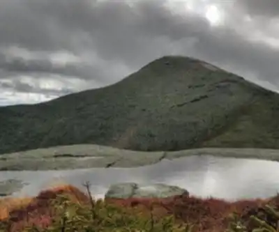
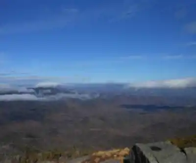
Wright Peak stands as a prominent summit in the Adirondack High Peaks at 1,364 meters (4,477 feet), commanding the northern end of the MacIntyre Range in Essex County's town of North Hudson. Named after New York Governor Silas Wright (1795–1847), this formidable peak has earned a reputation as one of the windiest summits in the park and ranks among the most challenging hikes in the region.
Recommended gear for this trail


Ready to go?
Everything you need to know before you goStarting Point
The Wright Peak is located in the Adirondacks. To get to the start of the trails, take exit 29 off of the Northway (I-87) and head east on State Route 73. The trailhead is located about 9 miles from the exit.
When?
How much?
- Hiking shoes Essential
- → Salomon Elixir Tour Mid WP · 203.38 $
- Layered clothing Essential
- Rain jacket Essential
- Trekking poles
- → Black Diamond Trail Ergo Cork · 69.99 $
- Headlamp
- → Petzl Actik Core 625 · 103.95 $
FAQ - Frequently asked questions
Everything you need to knowThe Essential Hiking Checklist
Everything you need for your next hike. Bilingual, printable, 1 page.
Download the free checklistSimilar hikes nearby
Discover other trails you might enjoy

Algonquin Peak, New York
Adirondacks

Big Slide Mountain, New York
Adirondacks

Boundary Peak, New York
Adirondacks

Crane Mountain
Adirondacks
Avalanche Pass
Adirondacks
Ampersand Mountain, New York
Adirondacks
Hiking near Lake Placid
0 trails to explore ~14 km away
We work hard to provide the most up-to-date and error-free data possible. If something seems incorrect, let us know! Your contribution helps the whole community.
Hikers' opinions