
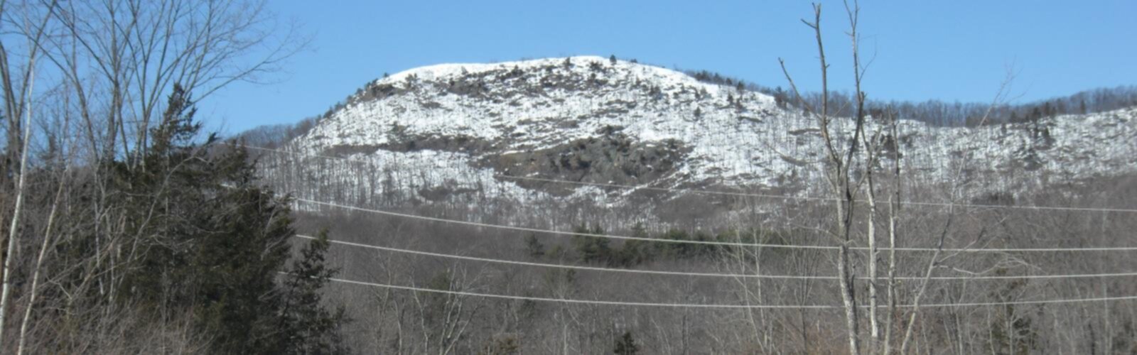

Ready to explore Sugarloaf Mountain, New York? Here's everything you need to know before you go!
Discover the trail

Trail description
Sugarloaf Mountain rises from the heart of the Catskill Mountains in New York's Hudson Valley, offering hikers a rewarding challenge with panoramic views that stretch across rolling peaks and valleys. This 10.14-kilometer trail gains 457 meters of elevation over moderate terrain, making it accessible to hikers with some experience while still providing enough challenge to feel accomplished at the summit.
The Trail Experience
The Sugarloaf Loop Trail forms the backbone of this hiking experience, winding through diverse terrain that showcases the best of Catskill Mountain ecology. The well-maintained path begins in dense hardwood forest, where the canopy filters sunlight into dappled patterns on the forest floor. As you climb steadily upward, the character of the forest shifts, with different tree species dominating at various elevations.
The moderate to strenuous difficulty rating reflects the sustained climbs rather than technical challenges. Most of the trail follows established footpaths with good footing, though some sections become rocky and require careful attention, especially when wet. The ascent is steady but manageable, with natural rest spots where the trail levels out or offers glimpses through the trees.
Wildlife encounters add an element of discovery to the hike. White-tailed deer are commonly spotted in the early morning or late afternoon, often pausing to observe hikers before bounding away through the underbrush. The diverse bird population includes both year-round residents and seasonal migrants, with woodpeckers, nuthatches, and various songbirds providing a natural soundtrack to your climb.
Summit Views and Highlights
The summit of Sugarloaf Mountain delivers the payoff that makes the climb worthwhile. From the top, sweeping views unfold across the surrounding Catskill peaks and valleys, with layers of mountains receding into the distance. This vantage point provides an excellent perspective on the region's geography and helps hikers appreciate the scale of the Catskill range.
The summit area offers space to rest, eat, and take photos without feeling crowded, even on busier weekend days. The views change throughout the day as light shifts across the landscape, making this an excellent spot to spend some time rather than simply turning around immediately.
Trail Connections and Nearby Options
Sugarloaf Mountain's location within the Catskill trail network opens up possibilities for extended adventures. The nearby Devil Path presents a more challenging option for experienced hikers seeking rugged terrain and thrilling climbs. This demanding trail connects with other notable routes including the Mink Hollow Trail and Pecoy Notch Trail, creating opportunities for longer loop hikes or multi-day adventures.
For those looking to explore beyond Sugarloaf, Breakneck Ridge in Hudson Highlands State Park offers a different style of hiking with steep, scrambling climbs and spectacular views over the Hudson River. On the gentler side, Worden Hill provides easier walking with equally captivating scenery, making it a good option for families or those seeking a less strenuous day out.
Planning Your Visit
The 3 to 5 hour duration estimate accounts for a comfortable pace with time to enjoy the views and take breaks. Stronger hikers may complete the loop more quickly, while those who prefer a leisurely pace or spend extended time at the summit may take longer. Starting early in the day provides the best chance for clear views and helps avoid afternoon crowds.
Late spring through early fall offers the most reliable hiking conditions, with mild weather and vibrant foliage enhancing the experience. Spring brings wildflowers and fresh green growth, while fall transforms the forest into a tapestry of reds, oranges, and yellows. Summer provides the most stable weather, though it can be warm on exposed sections of trail.
Weather conditions can change quickly in the mountains, so checking forecasts before departure is essential. Even on clear days, temperatures at the summit may be cooler than at the trailhead, especially with wind exposure.
Essential Gear and Preparation
Sturdy hiking boots provide the ankle support and traction needed for the rocky sections and sustained climbs. The trail's length and elevation gain make adequate water essential – carry more than you think you'll need, especially in warm weather. High-energy snacks help maintain stamina during the longer climbs and provide fuel for the return journey.
The United States Geological Survey provides detailed topographic maps of the Catskill region that help with route planning and navigation. While the main trail is well-marked, having a map adds confidence and helps identify landmarks and trail junctions.
A small first aid kit, headlamp or flashlight, and extra layer of clothing round out the essential gear list. Even day hikes benefit from basic emergency preparedness, and the mountain environment can present unexpected challenges.
Trail Etiquette and Conservation
Following Leave No Trace principles helps preserve Sugarloaf Mountain's natural beauty for future visitors. Staying on marked trails prevents erosion and protects fragile vegetation, while packing out all trash maintains the pristine environment that makes this area special.
Respecting wildlife habitats means observing animals from a distance and avoiding actions that might disturb their natural behaviors. The diverse ecosystem of the Catskills depends on minimal human impact to remain healthy and vibrant.
Trail courtesy enhances everyone's experience – yielding to uphill hikers, keeping noise levels moderate, and being friendly to fellow outdoor enthusiasts creates a positive atmosphere on the mountain. Whether hiking solo for solitude or with friends and family for shared adventure, Sugarloaf Mountain provides an authentic Catskill Mountains experience that showcases the natural wonders of New York's Hudson Valley region.
The Essential Hiking Checklist
Everything you need for your next hike. Bilingual, printable, 1 page.
Get your free hiking checklistRecommended gear for this trail
As an Amazon Associate I earn from qualifying purchases.


Ready to go?
Everything you need to know before you goStarting Point
To access the hiking trails, you can start at the main trailhead located at the end of Roaring Brook Road in the town of Garrison. The parking area is available there for visitors. Another option is to begin your hike from the Breakneck Ridge trailhead, which is accessible from Route 9D near Cold Spring. Both locations provide convenient access to the trails and have designated parking areas.
When?
How much?
As an Amazon Associate I earn from qualifying purchases.
Affiliate links — LGPO may earn a commission at no extra cost to you.
- Hiking shoes Essential
- → Salomon Elixir Tour Mid WP · 203.38 $
- Layered clothing Essential
- Rain jacket Essential
- Trekking poles
- → Black Diamond Trail Ergo Cork · 69.99 $
- Headlamp
- → Petzl Actik Core 625 · 103.95 $
FAQ - Frequently asked questions
Everything you need to knowSimilar hikes nearby
Discover other trails you might enjoy

Old Mill Falls
Catskills

Catskill Scenic Trail
Catskills
Cliff Lake
Catskills

Plattekill Falls
Catskills

Ashokan Reservoir
Catskills

Devil's Path Trail
Catskills
Hiking near Poughkeepsie
0 trails to explore ~51 km away
We work hard to provide the most up-to-date and error-free data possible. If something seems incorrect, let us know! Your contribution helps the whole community.
Hikers' opinions
Be the first to review!
No hiker has shared their experience yet. Share your impressions and help other hikers!