
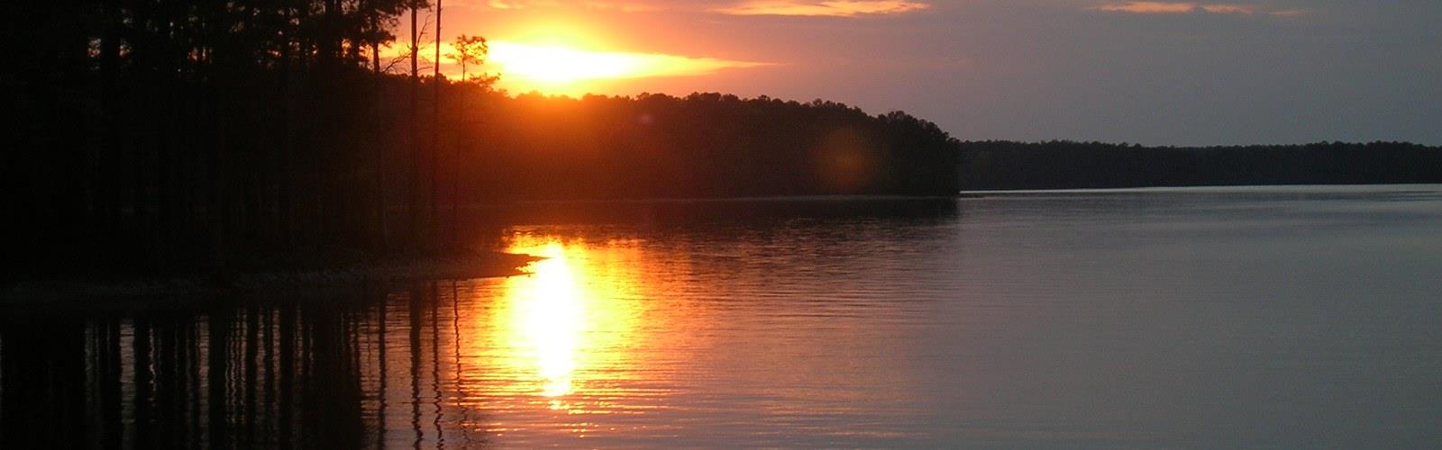

Ready to explore Clarks Hill Lake? Here's everything you need to know before you go!
Discover the trail
Oh no! We don't have any photos 😢
This trail hasn't been captured yet. Be the first to share your adventure!Trail description
Clarks Hill Lake sits on the border between South Carolina and Georgia, making it one of the largest reservoirs in the eastern United States. The lake spans 71,100 acres with 1,200 miles of shoreline. Managed by the U.S. Army Corps of Engineers, this massive body of water draws outdoor enthusiasts year-round for hiking, fishing, boating, camping, and wildlife watching. The shoreline offers a wide range of recreational access points and trail experiences across the surrounding public lands on both the Georgia and South Carolina sides.
The Landscape
The terrain around Clarks Hill Lake is classic Piedmont landscape — gently rolling hills covered in mixed pine and hardwood forest, with the land dropping down to meet the water's edge in coves, inlets, and open shoreline stretches. The forest is a mix of loblolly pine, oak, hickory, and sweetgum, with dense understory vegetation that provides excellent wildlife habitat. The transition between upland forest and the lake's edge creates a rich riparian zone where you'll often spot birds, turtles, and other wildlife going about their business.
The lake itself was created by the Thurmond Dam on the Savannah River, and the surrounding land managed by the Corps of Engineers includes multiple recreation areas, day-use parks, and campgrounds spread across both the South Carolina and Georgia shorelines. Each access point has its own character — some are more developed with boat ramps and picnic facilities, while others offer quieter, more natural shoreline access.
Hiking Around Clarks Hill Lake
Hiking at Clarks Hill Lake isn't a single-trail experience — it's more of a network of opportunities spread across different recreation areas along both the South Carolina and Georgia sides of the reservoir. With 13 established trails in the area, hikers have numerous options ranging from day-use trails to longer backcountry routes. Trails tend to follow the shoreline or wind through the surrounding forest, giving you consistent views of the water and access to quieter coves away from the boat traffic.
The paths here are generally well-suited for hikers of most experience levels. Popular options include the Clark Hill Lakeview Trail (10.8 km with 111 m elevation gain, rated 4.5 stars), trails in Sumter National Forest on the South Carolina side, and trails through Mistletoe State Park and Elijah Clark State Park on the Georgia side. The terrain doesn't throw dramatic elevation changes at you, but the rolling Piedmont landscape means you'll still get a decent workout on longer outings. Footing is typically good on established trails, though sections closer to the water can get muddy after rain, and exposed roots are common in the forested stretches.
One of the real draws of hiking here is the sense of space. The lake is enormous, and even on busy weekends, it's not hard to find a stretch of trail where you're mostly on your own. The combination of forest and open water views keeps the scenery interesting throughout a hike.
Wildlife and Nature
Clarks Hill Lake is a serious destination for wildlife watchers. The mix of open water, forested shoreline, and wetland edges supports a diverse range of species. Bald eagles are regularly spotted here, particularly during cooler months when they congregate around the lake. Osprey are a common sight during warmer seasons, diving for fish in the shallower coves.
Waterfowl use the lake heavily during migration, and the quieter inlets and marshy areas are good spots to sit and watch. White-tailed deer are abundant throughout the surrounding forest, and you're likely to encounter them on morning or evening hikes. Wild turkey, great blue heron, and various woodpecker species round out the wildlife experience.
The lake itself supports a healthy fish population, which is part of why the bird life is so active. Largemouth bass, striped bass, crappie, and catfish are all present, and the fishing pressure keeps the water lively with activity.
Recreation Areas and Access
The U.S. Army Corps of Engineers manages multiple recreation areas along both the South Carolina and Georgia shorelines of Clarks Hill Lake. On the Georgia side, Elijah Clark State Park on the western shore and Mistletoe State Park offer excellent recreational opportunities. These areas vary in terms of facilities and the type of experience they offer. Some are primarily oriented toward boating and camping, while others have dedicated day-use areas with picnic shelters, swimming beaches, and trail access.
Most developed recreation areas have parking available, and day-use fees may apply depending on the specific site and time of year. It's worth checking the Corps of Engineers website or contacting the Thurmond Lake project office directly before your visit to confirm current fees, facility availability, and any seasonal closures.
Access roads to the various recreation areas are generally paved, though some of the more remote shoreline access points involve gravel roads. A standard passenger vehicle handles most of the access routes without issue.
Camping
Camping is one of the most popular ways to experience Clarks Hill Lake, and the Corps of Engineers operates several campgrounds along both the South Carolina and Georgia shorelines. Sites range from basic tent camping to full hookup RV sites, and many campgrounds are positioned right on the water with direct lake access. Reservations are strongly recommended during peak season, particularly on holiday weekends when the lake sees heavy use from the surrounding region.
Practical Information
- Management: U.S. Army Corps of Engineers, Savannah District (J. Strom Thurmond Lake project)
- Lake Size: 71,100 acres with 1,200 miles of shoreline
- Access: Multiple entry points along both South Carolina and Georgia shorelines — check the Corps of Engineers website for specific recreation area locations
- Available Trails: 13 established trails in the area offering hiking, walking, and camping options
- Fees: Day-use fees apply at developed recreation areas; verify current rates before visiting
- Dogs: Generally permitted on trails and in recreation areas; keep on leash in developed areas
- Facilities: Varies by recreation area — boat ramps, picnic areas, restrooms, and campgrounds available at multiple locations
- Best seasons: Spring and fall offer the most comfortable hiking conditions and the best wildlife activity; summer brings heavy recreational use on the water
Getting There
Clarks Hill Lake is accessible from multiple points along both the South Carolina and Georgia sides of the reservoir. The town of McCormick, South Carolina serves as a practical base for exploring the lake's South Carolina recreation areas, while Lincolnton, Georgia provides access to Georgia-side recreation areas. Signage for individual recreation areas is generally clear from the main highways in the region.
Whether you're coming for a day hike along the shoreline, a weekend camping trip, or a longer stay to explore multiple recreation areas, Clarks Hill Lake delivers a genuine outdoor experience in the Piedmont that goes well beyond what most people expect from a reservoir.
The Essential Hiking Checklist
Everything you need for your next hike. Bilingual, printable, 1 page.
Get your free hiking checklistRecommended gear for this trail
As an Amazon Associate I earn from qualifying purchases.


Ready to go?
Everything you need to know before you goWhen?
How much?
As an Amazon Associate I earn from qualifying purchases.
Affiliate links — LGPO may earn a commission at no extra cost to you.
- Hiking shoes Essential
- → Salomon Elixir Tour Mid WP · 203.38 $
- Layered clothing Essential
- Rain jacket Essential
- Trekking poles
- → Black Diamond Trail Ergo Cork · 69.99 $
- Headlamp
- → Petzl Actik Core 625 · 103.95 $
FAQ - Frequently asked questions
Everything you need to knowHiking near Pittsburgh
0 trails to explore ~777 km away
We work hard to provide the most up-to-date and error-free data possible. If something seems incorrect, let us know! Your contribution helps the whole community.
Hikers' opinions
Be the first to review!
No hiker has shared their experience yet. Share your impressions and help other hikers!