
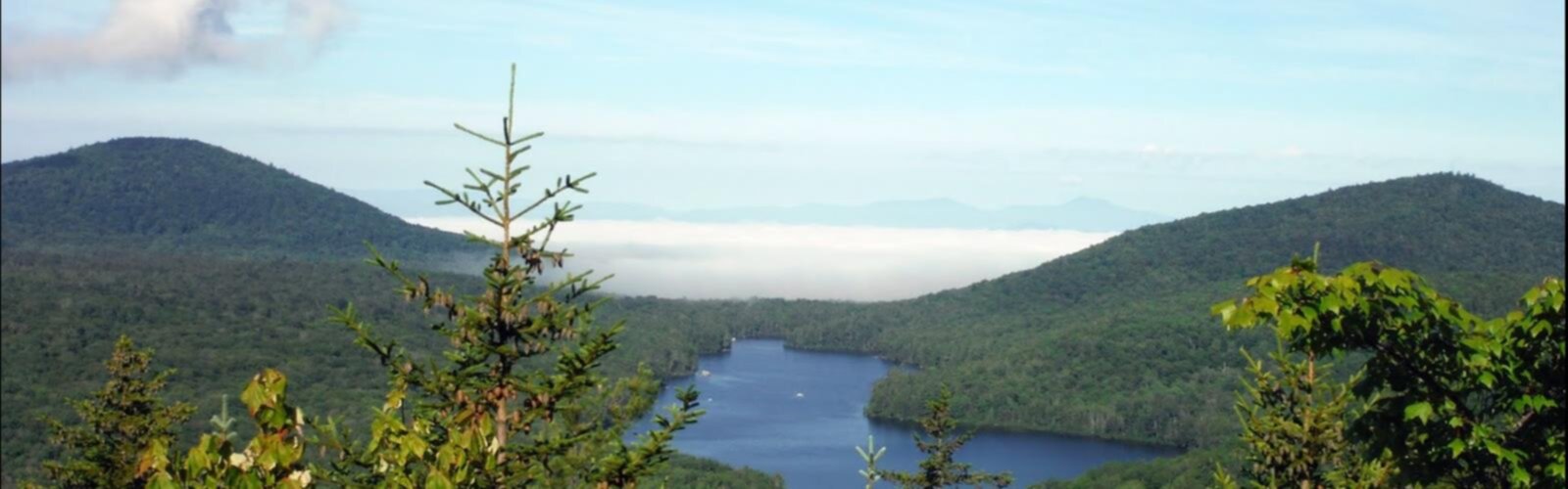

Ready to explore Spruce Mountain, Vermont? Here's everything you need to know before you go!
Discover the trail


Available trails
| TrailTrails | Dist.Distance | GainElevation | TimeDuration | Difficulty | GPX |
|---|---|---|---|---|---|
|
|
3.4 km | — | 45min | GPX |
GPX track: © OpenStreetMap contributors — ODbL 1.0
Trail description
Spruce Mountain in central Vermont is one of those hikes that rewards you without making you suffer for it. The trail leads to a fire tower at the summit — a working piece of Vermont history that still stands tall and gives you one of the better 360-degree views in the region. It's the kind of place that locals know about and out-of-staters discover once and then keep coming back to.
The Trail Experience
The route up Spruce Mountain follows a well-established forest trail through classic northern hardwood and boreal forest. As you gain elevation, the tree cover shifts — the maples and beeches of the lower slopes give way to spruce and fir closer to the top, which is exactly what you'd expect given the mountain's name. The trail is generally clear and well-maintained, with some rocky and rooted sections in the upper portion that ask you to pay attention to your footing.
The climb is steady but not brutal. It's the kind of ascent that gets your heart rate up and makes the summit feel earned, without leaving you wrecked at the top. Families with older kids, casual hikers, and anyone looking for a solid half-day outing will find this trail hits a comfortable sweet spot.
The Fire Tower
The big draw at the summit is the historic fire tower. Fire towers like this one were once essential tools for spotting and reporting wildfires across Vermont's forested landscape. Many have been decommissioned or removed over the decades, so the fact that Spruce Mountain's tower is still standing — and still climbable — makes this summit genuinely special.
Climbing the tower adds significant elevation to your view. From the cab at the top, you get an unobstructed panorama that stretches across central Vermont's rolling hills and valleys. On a clear day, the views extend to the Green Mountains to the west and the White Mountains of New Hampshire to the east. It's the kind of view that makes you stop talking for a minute.
What You'll Find at the Summit
Beyond the tower itself, the summit area of Spruce Mountain has a small clearing that makes for a decent rest stop. It's a good place to eat lunch, catch your breath, and take in the surroundings before heading back down. The summit isn't crowded with infrastructure — it's a simple, honest mountain top, and that's part of the appeal.
The forest around the summit supports the kind of wildlife you'd expect in Vermont's boreal transition zone. Keep your eyes and ears open — birds are particularly active here, and the spruce-fir habitat near the top attracts species you won't find lower on the mountain.
Land and Access
Spruce Mountain sits within the Groton State Forest, which is managed by the Vermont Department of Forests, Parks and Recreation. Groton State Forest is one of the largest contiguous state-owned land areas in Vermont, and Spruce Mountain is one of its signature hiking destinations. The trailhead is accessible by car, with parking available at the designated lot.
The trail is open to hikers. If you're planning to bring a dog or are curious about specific access rules, it's worth checking current conditions and regulations with Vermont State Parks or the Groton State Forest directly before your visit, as policies can be updated seasonally.
When to Go
Spruce Mountain is a three-season hike in the truest sense. Summer brings full green canopy and the best conditions for the fire tower views on clear days. Fall is exceptional — the hardwood forest on the lower slopes puts on a serious color show, and the cooler temperatures make the climb comfortable. Spring can be muddy, particularly on the upper trail, so timing matters if you want to avoid churning up the path during mud season.
Winter hiking is possible for those with the right gear and experience, but the trail is not groomed or maintained for winter use, so snowshoes or microspikes are typically necessary depending on conditions.
Tips Before You Go
- Check the fire tower status: Before your trip, confirm the tower is open for climbing. Maintenance or weather conditions can occasionally affect access.
- Wear layers: The summit is exposed and can be significantly cooler and windier than the trailhead, even on warm days.
- Bring water: There are no water sources on the trail that should be relied upon without treatment, so carry what you need.
- Start early in summer: Parking at popular Vermont trailheads can fill up on weekends during peak season. An early start gives you the trail to yourself and better odds of clear summit views before afternoon clouds build.
- Footwear matters: The rocky and rooted upper section of the trail is much more manageable in proper hiking boots than in trail runners or casual shoes.
Why Spruce Mountain Stands Out
Central Vermont has no shortage of good hiking, but Spruce Mountain earns its place near the top of the list for a specific reason: the fire tower. It transforms a solid forest hike into something with a genuine destination and a tangible piece of Vermont's land management history. You're not just walking to a viewpoint — you're climbing a structure that has its own story, and the views from the top are better for it.
The combination of accessible terrain, meaningful summit reward, and the context of Groton State Forest's broader landscape makes Spruce Mountain a hike worth putting on your list whether you're a Vermont regular or visiting the region for the first time.
The Essential Hiking Checklist
Everything you need for your next hike. Bilingual, printable, 1 page.
Get your free hiking checklistRecommended gear for this trail
As an Amazon Associate I earn from qualifying purchases.


Ready to go?
Everything you need to know before you goStarting Point
The starting point for the hiking trails can be accessed from the trailhead located at 1551 Spruce Mountain Road, Plainfield, VT 05667. There is a parking area available at this location.
When?
How much?
As an Amazon Associate I earn from qualifying purchases.
Affiliate links — LGPO may earn a commission at no extra cost to you.
- Hiking shoes Essential
- → Salomon Elixir Tour Mid WP · 203.38 $
- Layered clothing Essential
- Rain jacket Essential
- Trekking poles
- → Black Diamond Trail Ergo Cork · 69.99 $
- Headlamp
- → Petzl Actik Core 625 · 103.95 $
FAQ - Frequently asked questions
Everything you need to knowSimilar hikes nearby
Discover other trails you might enjoy

Vermont Association of Snow Travelers
Central Vermont
Northern Forest Canoe Trail
Central Vermont

Sterling Pond Trail
Central Vermont
Lake Mansfield Trout Club
Central Vermont
Moss Glen Falls
Central Vermont
Mill Trail
Central Vermont
Hiking near Montpelier
0 trails to explore ~18 km away
We work hard to provide the most up-to-date and error-free data possible. If something seems incorrect, let us know! Your contribution helps the whole community.
Hikers' opinions
Be the first to review!
No hiker has shared their experience yet. Share your impressions and help other hikers!