
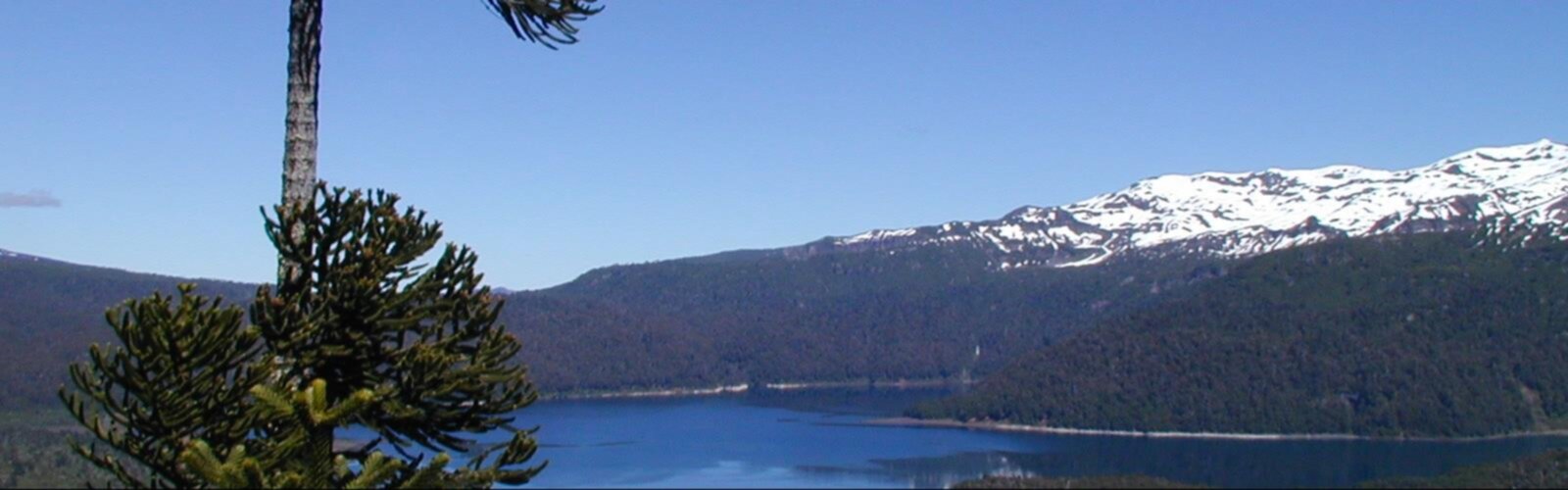

Ready to explore Sierra Nevada, Argentina_Chile? Here's everything you need to know before you go!
Discover the trail


Trail description
The Sierra Nevada straddles the border between Argentina and Chile, forming one of the most dramatic high-altitude landscapes in the southern Andes. This is big mountain terrain — volcanic peaks, sweeping ridgelines, and a raw, open environment that rewards hikers who come prepared and ready to move slowly through serious elevation.
The Landscape
The Sierra Nevada in this border zone sits within the Andean cordillera, where the geology is shaped by volcanic activity and glacial history. The terrain is rugged and exposed, with rocky slopes, loose scree fields, and wide-open views that stretch across both countries on a clear day. There's very little tree cover at the higher elevations — this is puna and high-altitude steppe country, where the wind moves freely and the sky feels enormous.
The landscape shifts depending on which side of the range you're approaching from. The Argentine side tends to be drier and more open, with characteristic Patagonian and Andean steppe vegetation. The Chilean side catches more Pacific moisture, which can mean different conditions underfoot and more variable weather rolling in from the west.
What to Expect on the Trail
Hiking in the Sierra Nevada along the Argentina-Chile border is not a casual day outing. The altitude alone demands respect — your body needs time to acclimatize before pushing hard on the ascents. Hikers who come from lower elevations should plan extra days at intermediate altitude before attempting the higher routes.
The terrain is physically demanding. Expect long stretches of exposed ridgeline where footing requires attention, sections of loose rock, and potentially significant elevation gain depending on your chosen route. Navigation can be challenging in poor visibility, and weather in the Andes can shift quickly — clear mornings can turn into afternoon storms with little warning.
Water sources exist in the high Andes, but their reliability varies by season and by specific location on the route. Carrying sufficient water and a reliable filtration system is essential. There are no services, no rescue infrastructure nearby, and cell coverage is minimal to nonexistent in most of this terrain.
Wildlife and Flora
The high Andes along this stretch support wildlife adapted to extreme conditions. Andean condors are a real possibility — these birds use the thermal currents along the ridgelines and are one of the most memorable sights you can have in this part of the world. Guanacos move through the lower slopes, and smaller Andean species like vizcachas are often spotted on rocky outcrops.
Vegetation at altitude is sparse but interesting — cushion plants, hardy grasses, and low-growing shrubs that have adapted to cold temperatures, intense UV radiation, and dry conditions. The flora changes noticeably as you gain elevation, transitioning from more diverse plant communities lower down to the near-barren high-altitude zones near the peaks.
Access and Logistics
Access to the Sierra Nevada in this border region requires planning. The nearest towns on the Argentine side serve as the logical base for most hikers approaching from the east. Road conditions on the approach routes can be rough, and a high-clearance vehicle is often necessary to reach trailheads. Confirm current road conditions locally before heading out, especially outside of the main summer season.
Because this area sits on an international border, hikers should be aware of border crossing regulations. Crossing between Argentina and Chile in remote mountain areas is not always straightforward — there are designated crossing points, and informal crossings can create legal complications. Check with Argentine and Chilean border authorities before planning any route that crosses the frontier.
Permits and regulations in this zone depend on which protected areas or land management zones your route passes through. Requirements can differ between the Argentine and Chilean sides, and they can change. Contacting the relevant national park or land management offices in advance is strongly recommended.
Best Conditions
The window for high-altitude hiking in the Sierra Nevada is defined by the Andean seasons. Summer in the southern hemisphere — roughly December through March — offers the most stable conditions, longer daylight hours, and the best chance of snow-free passes. Outside of this window, snow and ice can make the higher terrain dangerous or impassable without mountaineering equipment.
Even in summer, afternoon thunderstorms are common in the Andes. Starting early and being off exposed ridgelines by early afternoon is standard practice. Temperatures at altitude can drop sharply even on warm days, so layering is essential regardless of how sunny the morning looks.
Gear and Preparation
This is not the place to test new gear or push beyond your experience level. A few things that matter here:
- Navigation: A detailed topographic map and compass, plus a GPS device with downloaded offline maps. Do not rely on cell signal.
- Sun protection: UV intensity at high altitude in the Andes is extreme. Sunscreen, sunglasses with UV protection, and a hat are non-negotiable.
- Layers: Temperatures swing dramatically between sun and shade, and between morning and afternoon. Wind-proof and waterproof outer layers are essential.
- Water: Carry more than you think you need and have a filtration or purification system for refilling from natural sources.
- Emergency preparedness: A first aid kit, emergency shelter, and a satellite communicator are strongly recommended given the remoteness of this terrain.
Who This Is For
The Sierra Nevada on the Argentina-Chile border is best suited to experienced hikers and trekkers who are comfortable with high-altitude conditions, self-sufficient navigation, and multi-day wilderness travel. The combination of elevation, remoteness, border logistics, and variable weather makes this a destination that rewards careful preparation. If you've done serious mountain hiking elsewhere in the Andes or in comparable high-altitude environments and you're looking for a route with genuine scale and solitude, this is the kind of place that delivers.
The Essential Hiking Checklist
Everything you need for your next hike. Bilingual, printable, 1 page.
Get your free hiking checklistRecommended gear for this trail
As an Amazon Associate I earn from qualifying purchases.


Ready to go?
Everything you need to know before you goWhen?
How much?
As an Amazon Associate I earn from qualifying purchases.
Affiliate links — LGPO may earn a commission at no extra cost to you.
- Hiking shoes Essential
- → Salomon Elixir Tour Mid WP · 203.38 $
- Layered clothing Essential
- Rain jacket Essential
- Trekking poles
- → Black Diamond Trail Ergo Cork · 69.99 $
- Headlamp
- → Petzl Actik Core 625 · 103.95 $
FAQ - Frequently asked questions
Everything you need to knowHiking near Philadelphia
0 trails to explore ~7387 km away
We work hard to provide the most up-to-date and error-free data possible. If something seems incorrect, let us know! Your contribution helps the whole community.
Hikers' opinions
Be the first to review!
No hiker has shared their experience yet. Share your impressions and help other hikers!