Let's Go Play Outside
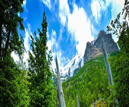
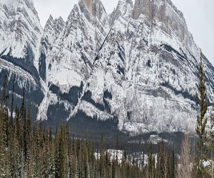
Hiking Castle Mountain, Alberta - panoramic view  tree outdoor landscape nature mountain sky autumn plant cloud background lake painting forest surrounded distance
--°C
Loading...
See forecast →

Hiking in Castle Mountain, Alberta: trails, map and practical info

Canadian Rockies • Alberta

Castle Mountain, Alberta (Canadian Rockies, Alberta) : hike, 2,840 m of elevation gain.

2,840 m
Elevation

Ready to explore Castle Mountain, Alberta? Here's everything you need to know before you go!

Discover the trail

Oh no! We don't have any photos 😢

This trail hasn't been captured yet. Be the first to share your adventure!

Trail description

Castle Junction, also known as the locale of Castle Mountain, is a highway junction where the north extent of the Windermere Highway (Highway 93) intersects with the Trans-Canada Highway (Highway 1), the Bow River, the historic CPR rail line, and Highway 1A in Banff National Park, Alberta. It is named after the nearby Castle Mountain, clearly visible from the junction. Work started here in 1910 on the Auto Route of the Great Divide, a project to build a highway across the Rocky Mountains, when construction began on a road from Castle Junction to Banff. Following an interruption caused by the outbreak of World War I, construction wrapped up between 1920 and 1922 when the newly constructed road between Calgary and Banff was joined to the Windermere Highway via the road between Castle Junction and Banff. Prime Minister Mackenzie King changed the name of Castle Mountain to Mount Eisenhower in 1946 to honour the World War II general Dwight D. Eisenhower. Correspondingly, Castle Junction was called Eisenhower Junction. Castle Mountain was officially restored to its original name in 1979, at which time Eisenhower Junction was also renamed Castle Junction. A group of lodges and the Castle Mountain campground are located within a kilometre of the junction. Several hiking trails are available in the vicinity. The trailhead for hikes to Silverton Falls and Rockbound Lake is located approximately 200 metres east of Castle Junction. The remains of Silver City, a 19th-century settlement founded by prospectors at the base of Castle Mountain, are located nearby. Also nearby is the site of the Castle Mountain Internment Camp used during World War I.
Free 1 page
The Essential Hiking Checklist

Everything you need for your next hike. Bilingual, printable, 1 page.

Get your free hiking checklist

Recommended gear for this trail

As an Amazon Associate I earn from qualifying purchases.

LGPO Pick
Elixir Tour Mid WP
Salomon
Elixir Tour Mid WP
4.5 (2847 reviews)
Waterproof mid-height boot ideal for rocky terrain
203.38 $
See price
Best Value
Trail Ergo Cork
Black Diamond
Trail Ergo Cork
4.4 (1456 reviews)
Comfortable cork grip for long ascents
69.99 $
See price
Daylite Plus 20L
Osprey
Daylite Plus 20L
4.7 (3215 reviews)
Lightweight and versatile for day hikes
109.99 $
See price
Actik Core 625
Petzl
Actik Core 625
4.6 (1893 reviews)
USB rechargeable with 600 lumens for early starts
103.95 $
See price
Most Popular
Wide Mouth 1L
Nalgene
Wide Mouth 1L
4.8 (12540 reviews)
Unbreakable and BPA-free — a hiking essential
23.11 $
See price
Affiliate links — LGPO may earn a commission at no extra cost to you.

Ready to go?

Everything you need to know before you go

Where?

Address
Not available
GPS coordinates
51.326536, -115.965757
Phone
Not available

Starting Point

To access the hiking trails, you can start from several trailheads. One option is to begin at the Castle Mountain Lookout Trailhead, located off the Bow Valley Parkway (Highway 1A). Another starting point is the Rockbound Lake Trailhead, also accessible from the Bow Valley Parkway. Both trailheads have parking areas available for visitors.

When?

Opening hours
No information
Weather (next days)
Loading
What to bring?

As an Amazon Associate I earn from qualifying purchases.

Affiliate links — LGPO may earn a commission at no extra cost to you.

General hiking tips, to adapt to your outing.
Gear
Download the PDF checklist
Water & food
Tip: bring water
Good to know
In an emergency
Emergency
911
GPS coordinates
51.326536, -115.965757

Hikers' opinions

Be the first to review!

No hiker has shared their experience yet. Share your impressions and help other hikers!

FAQ - Frequently asked questions

Everything you need to know
The elevation gain of Castle Mountain, Alberta is 2,840 m.
Didn't find your answer?
Top 10 best hiking in Canadian Rockies
Our ranking based on hiker reviews

Hiking near Banff

197 trails to explore ~32 km away

View trails
Did you spot an error?

We work hard to provide the most up-to-date and error-free data possible. If something seems incorrect, let us know!

Update : November 2026