

Ready to explore Bridge Lake? Here's everything you need to know before you go!
Discover the trail
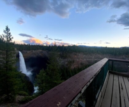
Oh no! We don't have any photos 😢
This trail hasn't been captured yet. Be the first to share your adventure!Trail description
Description
Bridge Lake sits in the heart of British Columbia's Cariboo Chilcotin Coast, where the landscape transitions between the Coast Mountains and the Interior Plateau. This is genuine backcountry territory — the kind of place where the trail earns your attention and the payoff feels real. At 6.4 km with 610 m of elevation gain, the main route here is rated Hard and takes most hikers around 3 hours 15 minutes to complete. Come prepared.
What the Trail Actually Looks Like
The hike starts near the lake and climbs steadily from the outset. The lower section moves through mixed forest — lodgepole pine, Douglas fir, and aspen — with the lake visible through the trees in the early going. It's pleasant walking, but don't let it lull you into a false sense of ease. The trail gets progressively more demanding as you gain elevation.
Higher up, the terrain turns rugged. Rocky sections, exposed roots, and the occasional fallen log across the path require you to stay focused on your footing. The forest canopy thickens as you climb, which keeps things cool even when summer temperatures are pushing into the high twenties down at the lake. The trail rewards hikers who move at a steady, deliberate pace rather than those who sprint the flats and bonk on the climbs.
With 610 m of gain packed into 6.4 km, the average grade is consistent enough that you'll feel it in your legs by the time you reach the upper sections. Trekking poles are genuinely useful here, both on the ascent and on the way back down when tired legs meet uneven ground.
The Ice Caves
The ice caves are the defining feature of this trail and the main reason hikers make the drive out to Bridge Lake. These are natural formations that hold freezing temperatures year-round — a result of their depth and orientation — so you'll find actual ice inside even during the hottest stretch of summer. Walking out of warm hiking conditions into a cavern where your breath fogs immediately is one of those experiences that sticks with you.
The main viewing areas are accessible to most hikers who've made it this far on the trail. Getting deeper into the caves requires some basic scrambling, so assess your comfort level before pushing further in. Bring a headlamp regardless — the light drops off fast once you're inside.
Wildlife and the Surrounding Ecosystem
The Cariboo Chilcotin Coast is one of British Columbia's most biodiverse regions, and Bridge Lake reflects that. The varied habitat — open water, mixed boreal forest, rocky outcrops — supports a wide range of species across a relatively compact area.
Eagles and ospreys are a consistent presence around the lake, particularly in the early morning and late afternoon when they're actively fishing. If you're moving quietly along the lower trail sections, these are reliable sightings rather than lucky ones. Binoculars are worth the extra weight in your pack.
The forests show regular signs of deer, black bears, and smaller predators. Actual sightings depend on timing and luck, but the evidence — tracks, scat, claw marks on trees — is a reminder that you're moving through active wildlife habitat. Standard bear country protocols apply: make noise on the trail, store food properly, and carry bear spray.
Seasonal Timing
Summer is the most reliable window for this trail. The combination of clear conditions underfoot and the ice caves offering a cool contrast to warm hiking temperatures makes July and August particularly good. The lake's elevation and northern position mean snow can persist into late spring and return earlier in fall than you might expect — check conditions before heading out if you're visiting outside the core summer season.
The ice caves remain active longer than similar formations at lower elevations, which extends the interesting window for that part of the experience into shoulder seasons for hikers willing to deal with variable trail conditions.
Camping and Multi-Day Options
Campsites around Bridge Lake range from basic tent clearings to spots that can handle small RVs. Facilities are minimal — this is a wilderness camping experience, not a serviced campground. What you get in return is direct access to the trail network, excellent stargazing away from light pollution, and the option to hit the ice caves trail early in the morning when wildlife activity is highest and the day's heat hasn't built yet.
Lakeside sites also put you in a good position for kayaking or fishing without needing to drive anywhere. The lake's calm conditions and manageable size make it well-suited for paddling, and the fish populations attract both anglers and the eagles and ospreys that make the birdwatching here so consistent.
Practical Notes
- Distance: 6.4 km
- Elevation gain: 610 m
- Difficulty: Hard
- Estimated time: 3 hours 15 minutes
- Trekking poles recommended for the descent
- Headlamp required for ice cave exploration
- Bear country — carry bear spray and store food appropriately
- Check trail conditions before visiting in spring or fall
Bridge Lake rewards hikers who come ready for a genuine physical effort — the elevation gain is real, the terrain demands attention, and the ice caves at the top deliver an experience that's genuinely unlike anything else in the region.
Recommended gear for this trail


Ready to go?
Everything you need to know before you goStarting Point
The bridge lake trails can be accessed from the east side of the lake. There is a parking lot and trailhead near the dam.
When?
How much?
- Hiking shoes Essential
- → Salomon Elixir Tour Mid WP · 203.38 $
- Layered clothing Essential
- Rain jacket Essential
- Trekking poles
- → Black Diamond Trail Ergo Cork · 69.99 $
- Headlamp
- → Petzl Actik Core 625 · 103.95 $
FAQ - Frequently asked questions
Everything you need to knowThe Essential Hiking Checklist
Everything you need for your next hike. Bilingual, printable, 1 page.
Download the free checklistSimilar hikes nearby
Discover other trails you might enjoy

Emma Lake
Cariboo Chilcotin Coast
Horn Lake
Cariboo Chilcotin Coast
Moul Falls
Cariboo Chilcotin Coast
Helmcken Falls Rim
Cariboo Chilcotin Coast
Big Bar Lake
Cariboo Chilcotin Coast
Murtle Lake
Cariboo Chilcotin Coast
Hiking near Kelowna
45 trails to explore ~198 km away
We work hard to provide the most up-to-date and error-free data possible. If something seems incorrect, let us know! Your contribution helps the whole community.
Hikers' opinions