
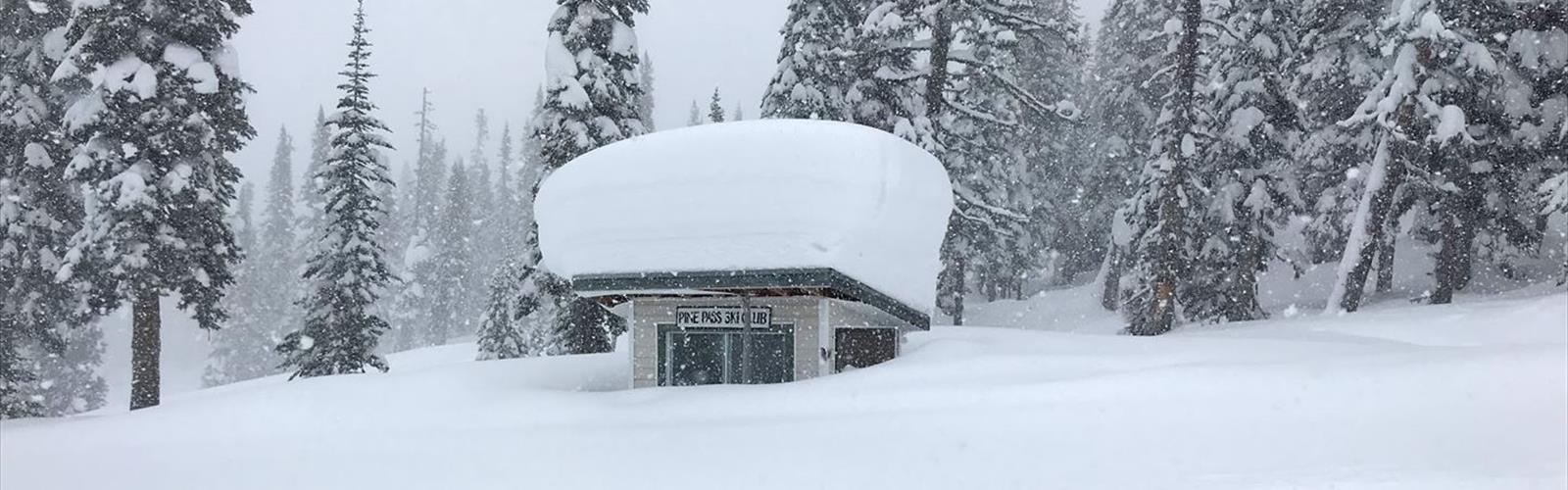

Ready to explore Powder King Mountain Resort? Here's everything you need to know before you go!
Discover the trail
Trail description
Powder King Mountain Resort sits in the heart of Northern British Columbia, tucked into the Pine Pass area of the Rocky Mountains. It's one of those places that feels genuinely off the beaten path — and that's exactly the point. The resort has built a reputation around deep, dry powder snow and a laid-back atmosphere that's a world away from the crowded mega-resorts further south. But beyond the winter ski scene, the surrounding terrain offers a compelling reason to visit when the snow melts too.
The Setting
The resort is located along the Hart Highway (Highway 97), which cuts through some of the most dramatic and undervisited mountain scenery in the province. The Pine Pass itself sits at a relatively modest elevation, but the peaks rising on either side tell a different story — rugged, forested ridgelines that give way to open alpine zones above treeline. The landscape here is shaped by the transition between the interior plateau and the Rocky Mountain trench, which means you get a mix of dense boreal forest, subalpine meadows, and exposed rocky terrain depending on how high you push.
The area around Powder King is genuinely remote. The nearest services are a significant drive away, and that isolation is part of what makes it special. Wildlife sightings are common in this corridor — moose, black bears, and mountain goats are all part of the local ecosystem. The Hart Highway itself is a well-maintained route, but once you leave it, you're in serious backcountry territory.
Hiking and Outdoor Exploration
While Powder King is best known as a ski destination, the surrounding terrain is worth exploring on foot during the warmer months. The resort infrastructure — including access roads and cleared areas — provides a starting point for getting into the alpine. The open ski runs offer straightforward routes to gain elevation quickly, and from the upper mountain, the views across the Pine Pass corridor are expansive and largely unobstructed.
The terrain around the resort rewards those who are comfortable with route-finding in unmarked backcountry. There are no groomed summer hiking trails in the traditional sense, so visitors should come prepared with navigation tools, appropriate footwear for mixed terrain, and a solid understanding of mountain travel. The subalpine and alpine zones above the resort are the real draw — open, rocky, and genuinely wild.
What Makes This Place Stand Out
Powder King's location in Northern BC puts it in a category of its own. This isn't a destination you stumble across — you come here intentionally, and that filters out the casual crowd. The Pine Pass area sees far less foot traffic than comparable terrain in the southern Rockies or the Sea-to-Sky corridor, which means you're likely to have the mountain largely to yourself outside of ski season.
The boreal forest that dominates the lower elevations has a character that's distinct from the cedar and hemlock forests of the coast or the dry ponderosa pine zones of the interior south. Spruce, fir, and lodgepole pine dominate here, and the forest floor is dense with undergrowth. As you gain elevation, the trees thin out and the landscape opens up into the kind of wide, windswept alpine that Northern BC does exceptionally well.
Getting There
Powder King Mountain Resort is accessible via Highway 97 (the Hart Highway) between Prince George and Chetwynd. The resort sits directly off the highway, making it straightforward to reach by vehicle. That said, the drive through Pine Pass can be challenging in winter conditions, and even in summer, the remoteness of the location means you should arrive with a full tank of gas and any supplies you need for the day.
There is no public transit serving this area. A personal vehicle is essential. The resort's parking area provides a logical staging point for any exploration of the surrounding terrain.
Planning Your Visit
- Season: The resort operates as a ski area in winter. Summer and shoulder-season visits are possible for those interested in the surrounding landscape, but services on-site will be limited or unavailable outside of ski season — confirm current operations before making the trip.
- Navigation: There are no marked summer hiking trails at the resort. Bring a topographic map, a compass or GPS device, and the skills to use them.
- Wildlife awareness: This is active bear country. Carry bear spray, make noise on the trail, and know how to store food properly.
- Self-sufficiency: The remote location means emergency services are not nearby. Come prepared with a first aid kit, extra food and water, and appropriate layers for rapidly changing mountain weather.
- Weather: Mountain weather in Northern BC can shift quickly at any time of year. Snow is possible even in midsummer at higher elevations. Check the forecast before heading out and build flexibility into your plans.
Who This Is For
Powder King and the surrounding Pine Pass terrain is best suited to experienced outdoor travelers who are comfortable in remote, unmarked backcountry. If you're looking for a well-signed trail network with facilities along the way, this isn't the right destination. But if you want genuine Northern BC wilderness — big skies, real solitude, and terrain that hasn't been polished for mass tourism — this area delivers in a way that few places in the province can match.
It's also a compelling stop for anyone driving the Hart Highway who wants to stretch their legs and get a feel for the mountain environment that defines this stretch of Northern British Columbia.
The Essential Hiking Checklist
Everything you need for your next hike. Bilingual, printable, 1 page.
Get your free hiking checklistRecommended gear for this trail
As an Amazon Associate I earn from qualifying purchases.


Ready to go?
Everything you need to know before you goWhen?
How much?
As an Amazon Associate I earn from qualifying purchases.
Affiliate links — LGPO may earn a commission at no extra cost to you.
- Hiking shoes Essential
- → Salomon Elixir Tour Mid WP · 203.38 $
- Layered clothing Essential
- Rain jacket Essential
- Trekking poles
- → Black Diamond Trail Ergo Cork · 69.99 $
- Headlamp
- → Petzl Actik Core 625 · 103.95 $
FAQ - Frequently asked questions
Everything you need to knowSimilar hikes nearby
Discover other trails you might enjoy

Mount Robson
Northern British Columbia
Kinney Lake
Northern British Columbia

Liard Hot Springs Lodge
Northern British Columbia
Boya Lake
Northern British Columbia
Kinuseo Falls
Northern British Columbia
Hudson Bay Mountain
Northern British Columbia
Hiking near Jasper
82 trails to explore ~390 km away
We work hard to provide the most up-to-date and error-free data possible. If something seems incorrect, let us know! Your contribution helps the whole community.
Hikers' opinions
Be the first to review!
No hiker has shared their experience yet. Share your impressions and help other hikers!