

Ready to explore Jamieson DH? Here's everything you need to know before you go!
Discover the trail
Trail description
Jamieson DH sits in the Kootenay Rockies region of British Columbia, and if the name gives it away, this one is built with descending in mind. The "DH" stands for downhill, and the trail delivers exactly what that implies — a fast, technical descent that draws riders and trail users looking for something with a bit more bite than a casual forest walk.
The Kootenay Rockies is one of BC's most trail-rich corners, and Jamieson fits right into that culture. The area has a long history of community-built trail networks, and Jamieson DH carries that same grassroots energy — the kind of trail that exists because locals wanted it to, and put in the work to make it happen.
The Terrain
Jamieson DH runs through classic interior BC forest — a mix of conifer stands, rocky outcroppings, and the kind of rooty, variable ground that keeps you honest from top to bottom. The trail follows the natural fall line of the slope, which means the grade is consistent and the descent moves quickly. Expect exposed roots, loose over hardpack in spots, and sections where the trail tightens up through the trees.
The soil composition in the Kootenays tends to drain well after rain, but the shadier sections of Jamieson can hold moisture longer than you'd expect. Early season and late fall, those shaded corners can be slick. Mid-summer through early fall is typically when the trail is at its best — dry, fast, and predictable underfoot.
The surrounding landscape is quintessential Kootenay Rockies: rugged ridgelines visible through the tree canopy, the smell of pine and cedar, and that particular quality of light you get in mountain valleys during the afternoon. It's not a scenic overlook trail — Jamieson is heads-down, focused terrain — but the setting still delivers.
What to Expect on the Trail
This is a downhill-oriented trail, so the experience is shaped by that direction of travel. The descent is the main event. Users typically access the top via a separate climb route or shuttle, then commit to the descent on Jamieson DH itself.
The trail rewards riders and users who are comfortable reading terrain at speed. There are features that require commitment — you'll want to scout anything unfamiliar on your first run rather than assuming the line is obvious. That said, the trail isn't gratuitously aggressive. It's built to flow, and when you're dialed in, it does exactly that.
First-timers on Jamieson should take a slower first pass to understand where the trail goes and where the technical cruxes sit. The Kootenays trail community generally keeps things well-marked, but downhill trails by nature have consequences when you get it wrong, so a conservative first run is always the smart call.
Getting There
Jamieson DH is located in the Kootenay Rockies region of British Columbia. Access details and current trailhead conditions are best confirmed locally before heading out — trail access in this region can shift with seasonal road conditions, forestry activity, and annual maintenance schedules. Connecting with local trail associations or checking recent trip reports will give you the most accurate picture of what to expect on arrival.
If you're shuttling, coordinate your drop-off and pick-up points in advance. Downhill trails in this region often share parking areas with other trail users, so arriving early on busy summer weekends is a practical move.
Who This Trail Is For
Jamieson DH is best suited for users who are already comfortable on technical descending terrain. Whether you're on a mountain bike or on foot, the downhill orientation and trail character mean this isn't the place to be learning the basics. Intermediate to advanced skill level is the honest baseline here.
If you're newer to the area or to downhill trails in general, spending time on some of the more approachable trails in the Kootenay Rockies network first makes sense. Build familiarity with the terrain type, then come back to Jamieson when you're ready to push a bit harder.
Gear and Preparation
For mountain biking, full-face helmet and body armor are standard on DH trails — Jamieson is no exception. A well-maintained bike with appropriate suspension travel for the terrain will make a significant difference in how the trail feels. Carry basic tools and a spare tube regardless of how short the descent looks on paper.
For anyone on foot, trail runners or hiking boots with solid grip are the call. The variable surface — roots, rock, loose dirt — rewards footwear with real traction. Trekking poles can help on the steeper pitches if you're descending on foot.
Regardless of how you're traveling, bring water. The Kootenay Rockies can be deceptively warm in summer, and even a short descent followed by a climb back up adds up quickly in terms of exertion.
The Kootenay Rockies Trail Culture
One thing that stands out about trails like Jamieson DH is the community behind them. The Kootenay Rockies has a deeply embedded outdoor culture — people here take their trails seriously, maintain them voluntarily, and expect users to show up with the same respect. That means staying on designated lines, not cutting new routes, and packing out everything you bring in.
Trail conditions and any seasonal closures are typically communicated through local trail societies and online trail platforms. Checking in before your visit — especially early or late in the season — is a habit worth building. It keeps you informed and it supports the people doing the work to keep trails like Jamieson open and in good shape.
The broader Kootenay Rockies network surrounding Jamieson DH offers plenty of options to build a full day or a multi-day trip around, making it a worthwhile destination whether you're based locally or traveling specifically for the trails.
The Essential Hiking Checklist
Everything you need for your next hike. Bilingual, printable, 1 page.
Get your free hiking checklistRecommended gear for this trail
As an Amazon Associate I earn from qualifying purchases.


Ready to go?
Everything you need to know before you goWhen?
How much?
As an Amazon Associate I earn from qualifying purchases.
Affiliate links — LGPO may earn a commission at no extra cost to you.
- Hiking shoes Essential
- → Salomon Elixir Tour Mid WP · 203.38 $
- Layered clothing Essential
- Rain jacket Essential
- Trekking poles
- → Black Diamond Trail Ergo Cork · 69.99 $
- Headlamp
- → Petzl Actik Core 625 · 103.95 $
FAQ - Frequently asked questions
Everything you need to knowSimilar hikes nearby
Discover other trails you might enjoy

Big White Ski Resort
Thompson Okanagan
Cougar Canyon
Thompson Okanagan
Spectrum Lake
Thompson Okanagan
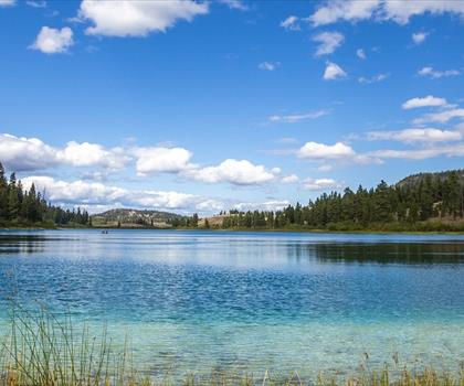
Kentucky Lake
Thompson Okanagan
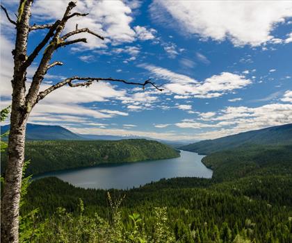
Clearwater Lake
Thompson Okanagan
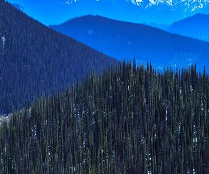
Mahood Lake
Thompson Okanagan
Hiking near Kelowna
45 trails to explore ~128 km away
We work hard to provide the most up-to-date and error-free data possible. If something seems incorrect, let us know! Your contribution helps the whole community.
Hikers' opinions
Be the first to review!
No hiker has shared their experience yet. Share your impressions and help other hikers!