

Ready to explore Belwood Lake Conservation Area? Here's everything you need to know before you go!
Discover the trail
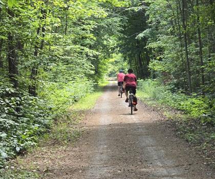
Oh no! We don't have any photos 😢
This trail hasn't been captured yet. Be the first to share your adventure!Trail description
Description
Belwood Lake Conservation Area overview
Belwood Lake Conservation Area sits in the heart of southern Ontario's Huron, Perth, Waterloo and Wellington region, offering a different kind of outdoor experience than the rugged terrain found further north. This conservation area centers around Belwood Lake, a reservoir created by damming the Grand River, and provides a mix of water-based recreation and land-based trail opportunities. The area represents the kind of accessible, family-friendly conservation space that southern Ontario does well—close enough to major population centers to make for easy day trips, but still offering genuine natural experiences.What sets Belwood Lake apart from other conservation areas in the region is its combination of lake access and varied terrain. The property includes both shoreline environments and upland areas, creating habitat diversity that supports different types of wildlife and offers hikers multiple ways to experience the landscape. The conservation area serves as both a recreational destination and an important piece of the Grand River watershed system.
Trail network and terrain character
The trail system at Belwood Lake Conservation Area takes advantage of the property's natural features, winding through different habitat zones and offering varying perspectives on the lake and surrounding countryside. With 50 meters of elevation change across the property, the trails provide enough topographic interest to keep things engaging without being overly demanding.The terrain here reflects the rolling character typical of this part of southern Ontario. You'll encounter a mix of wooded sections, open meadow areas, and shoreline environments. The trails generally follow natural contours, which means you'll experience gradual climbs and descents rather than steep, sustained ascents. This makes for comfortable hiking where you can focus on the surroundings rather than managing intense physical effort.
The lake itself becomes a central reference point for navigation and adds a water element that many inland conservation areas lack. Depending on which trails you choose, you might find yourself walking along shoreline sections where the water is visible through the trees, or climbing to higher ground where you can look down on the lake from above.
Wildlife and natural environment
The habitat diversity at Belwood Lake Conservation Area supports a range of wildlife typical of southern Ontario's mixed environments. The combination of water, wetland edges, forest, and open areas creates conditions that attract both resident and migratory species. Waterfowl use the lake throughout the year, while the wooded areas provide habitat for songbirds and small mammals.The shoreline and wetland areas are particularly active during spring and fall migration periods, when the lake serves as a stopover point for various bird species. The mixed forest sections include both deciduous and coniferous trees, creating year-round cover and food sources for wildlife.
For hikers, this diversity means the experience changes depending on the season and the specific trails you choose. Early morning and late afternoon tend to offer the best wildlife viewing opportunities, when animals are most active and lighting conditions make observation easier.
Hiking experience and trail character
Hiking at Belwood Lake Conservation Area feels relaxed and accessible, making it well-suited to a wide range of fitness levels and hiking experience. The moderate elevation changes mean you'll get some physical activity without the route becoming an endurance challenge. This makes it an excellent choice for families, casual hikers, or anyone looking for an outdoor experience that emphasizes enjoyment over physical accomplishment.The trail system allows for different types of outings depending on your goals. You can focus on shoreline walking for a more leisurely experience, or include the higher elevation sections if you want a bit more physical engagement. The variety means you can customize your hike based on weather conditions, energy levels, or simply what kind of environment appeals to you on a given day.
Because the conservation area includes both water and land-based recreation, you'll often encounter other users—anglers, families having picnics, or people simply enjoying the lake access. This creates a friendly, community-oriented atmosphere that some hikers prefer over more remote, wilderness-style experiences.
Seasonal considerations and timing
Belwood Lake Conservation Area offers different experiences throughout the year, with each season highlighting different aspects of the property. Spring brings migrating waterfowl and emerging vegetation, while summer offers full foliage and warm weather that makes lake access particularly appealing. Fall provides excellent conditions for hiking with cooler temperatures and changing leaf colors.Winter use depends on conditions and conservation area policies, but the property can offer opportunities for winter activities when snow cover and ice conditions are appropriate. The relatively gentle terrain makes winter access more feasible than in areas with steep or technical trail sections.
For hiking specifically, spring through fall generally provides the most comfortable conditions. The moderate elevation changes mean the trails are less affected by seasonal weather extremes than higher elevation routes, making this a reliable choice for year-round outdoor activity.
Planning your visit
Belwood Lake Conservation Area works well for both planned outings and spontaneous visits. The accessible terrain and multiple trail options mean you can adjust your plans based on conditions, available time, or energy levels. The combination of hiking opportunities and other recreational amenities makes it a good choice for groups with different interests or activity preferences.The conservation area's location in southern Ontario means it's easily accessible from multiple urban centers, making it practical for day trips or shorter outdoor excursions. This accessibility, combined with the varied terrain and habitat diversity, makes Belwood Lake Conservation Area a solid representative of what southern Ontario conservation areas offer—outdoor experiences that are both accessible and genuinely rewarding.
Ready to go?
Everything you need to know before you goStarting Point
The trails at the belwood lake conservation area in Ontario can be accessed from Wellington County Road 18, which is also known as the Fergus-Elora Road.
When?
How much?
- Hiking shoes Essential
- Layered clothing Essential
- Rain jacket Essential
- Trekking poles
- Headlamp
FAQ - Frequently asked questions
Everything you need to knowThe Essential Hiking Checklist
Everything you need for your next hike. Bilingual, printable, 1 page.
Download the free checklistSimilar hikes nearby
Discover other trails you might enjoy
Perth Harvest Pathway Milverton- G2G Rail Trail
Huron, Perth, Waterloo and Wellington

Health Valley Trail
Huron, Perth, Waterloo and Wellington
Mill Run Trail
Huron, Perth, Waterloo and Wellington
Waterloo Park
Huron, Perth, Waterloo and Wellington
Point Farms Provincial Park
Huron, Perth, Waterloo and Wellington
Conestogo Lake
Huron, Perth, Waterloo and Wellington
Hiking near Guelph
166 trails to explore ~25 km away
We work hard to provide the most up-to-date and error-free data possible. If something seems incorrect, let us know! Your contribution helps the whole community.
Hikers' opinions