

Ready to explore Elora Gorge? Here's everything you need to know before you go!
Discover the trail
Available trails
| Trails | Distance | Elevation | Duration | Difficulty | GPX |
|---|---|---|---|---|---|
| 6.46 km | 471 m | 2h30 |
Trail description
Description
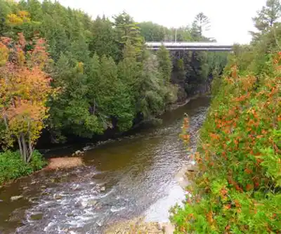
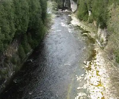
The Elora Gorge is one of southern Ontario's most striking natural features, a place where the Grand River has spent millions of years cutting through limestone bedrock to create a canyon that genuinely stops you in your tracks. Sitting at the western edge of the historic village of Elora in Wellington County, this conservation area managed by the Grand River Conservation Authority delivers 11 kilometers of trail, 400 meters of elevation gain, and a landscape that feels far more remote than its location — just 25 kilometers north of Guelph via Highway 6 — would suggest.
The moderate difficulty rating is accurate: this isn't a casual stroll, but it's well within reach for hikers with basic outdoor experience and a reasonable fitness level. Budget around 3 hours and 45 minutes for the full route, and wear footwear with solid grip. The limestone underfoot can be smooth and unforgiving, especially after rain.
What the Trail Actually Looks Like
The experience shifts constantly as you move through the gorge system. One stretch has you walking the canyon rim, looking straight down at the Grand River threading through the rocky corridor below. The next drops you closer to water level, where the sound of the current fills the air and the scale of the cliffs above becomes genuinely impressive. That variation is what makes this trail worth the drive — you're not just walking beside a river, you're moving through a three-dimensional landscape that keeps revealing new angles.
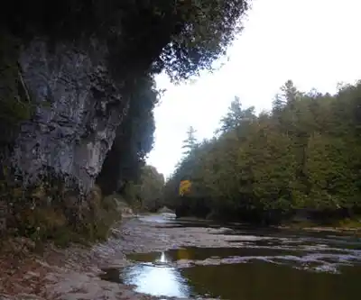
The limestone geology defines the character of the place. The cliffs are smooth in places, fractured in others, and riddled with caves and crevices that invite a closer look. These features add a real sense of exploration to the hike, though they also demand attention — the terrain near the canyon edge requires focus, and the rock scrambles scattered throughout the route are where those 400 meters of elevation gain make themselves felt.
Several lookout points are positioned along the route at natural high points above the gorge. These aren't just photo stops — they function as useful waymarks that help you track your progress through the canyon and make sure you're not rushing past the best views. Take the time to stop at each one.
The Canyon Environment
The gorge creates its own microclimate, and the plant life reflects that. Moisture-loving species cluster near the river at the base of the canyon, while hardier vegetation clings to the drier conditions along the cliff tops. That contrast in plant communities is visible as you move up and down through the terrain, and it contributes to the sense that this is a genuinely distinct ecosystem rather than a generic Ontario forest walk.
White-tailed deer are a common sight along the trails, particularly in the early morning and at dusk. Coyotes and foxes also inhabit the area, though they tend to stay out of sight unless you're moving quietly and paying attention. The Grand River itself supports fish populations and draws wildlife to its banks, adding another layer to what you might encounter on any given visit.
Beyond Hiking
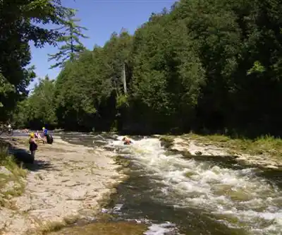
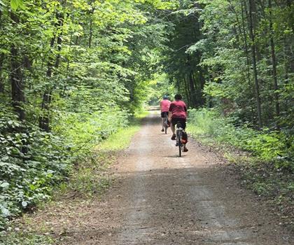
The smooth limestone faces that line the gorge have made this a recognized spot for climbing and rappelling, and the trail system is also open to cyclists. The terrain works for both uses without feeling compromised for either. If you're looking to turn a hiking day into something more, the vertical rock offers legitimate challenge for those with the gear and experience to use it.
Getting There and Getting Around
The conservation area is straightforward to reach from most of southern Ontario's major population centers. The approach north from Guelph on Highway 6 is direct, and the village of Elora itself is worth time before or after the hike — it's a well-preserved historic community with enough character to make a full day out of the trip.
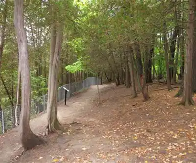
The trail system has multiple access points, which means you can adapt the route to fit your available time. The full 11-kilometer loop gives you the most complete picture of the gorge, but shorter segments still hit the key viewpoints if you're working with a tighter schedule. The well-marked lookouts make navigation intuitive even on a first visit, and they ensure that a shorter outing doesn't mean missing the gorge's most dramatic moments.
Appropriate footwear is non-negotiable here — the combination of limestone surfaces, canyon-edge sections, and elevation change makes trail runners or hiking boots a practical requirement rather than a suggestion.
Recommended gear for this trail


Ready to go?
Everything you need to know before you goStarting Point
The elora gorge trails are located in Elora, Ontario. To get to the start of the trails, take Highway 6 north from Guelph and exit onto County Road 21. Head east on County Road 21 and take the first left onto River Road. The entrance to the trails will be on your right.
When?
How much?
- Hiking shoes Essential
- → Salomon Elixir Tour Mid WP · 203.38 $
- Layered clothing Essential
- Rain jacket Essential
- Trekking poles
- → Black Diamond Trail Ergo Cork · 69.99 $
- Headlamp
- → Petzl Actik Core 625 · 103.95 $
FAQ - Frequently asked questions
Everything you need to knowThe Essential Hiking Checklist
Everything you need for your next hike. Bilingual, printable, 1 page.
Download the free checklistSimilar hikes nearby
Discover other trails you might enjoy
Perth Harvest Pathway Milverton- G2G Rail Trail
Huron, Perth, Waterloo and Wellington

Health Valley Trail
Huron, Perth, Waterloo and Wellington
Mill Run Trail
Huron, Perth, Waterloo and Wellington
Waterloo Park
Huron, Perth, Waterloo and Wellington
Point Farms Provincial Park
Huron, Perth, Waterloo and Wellington
Breithaupt Park
Huron, Perth, Waterloo and Wellington
Hiking near Guelph
166 trails to explore ~21 km away
We work hard to provide the most up-to-date and error-free data possible. If something seems incorrect, let us know! Your contribution helps the whole community.
Hikers' opinions