

Ready to explore Elora Gorge Conservation Area? Here's everything you need to know before you go!
Discover the trail
Oh no! We don't have any photos 😢
This trail hasn't been captured yet. Be the first to share your adventure!Trail description
Description
The Elora Gorge Conservation Area carves a dramatic limestone canyon through the heart of southwestern Ontario, where the Grand River has spent millennia sculpting one of the province's most striking natural landscapes. Located in Wellington County, this conservation area draws hikers and outdoor enthusiasts to experience towering cliffs, rushing rapids, and surprisingly diverse ecosystems packed into a relatively compact area.
The Gorge Experience
The moment you arrive at Elora Gorge, the landscape announces itself with authority. Limestone cliffs rise up to 22 meters above the Grand River, their weathered faces telling the story of ancient seas that once covered this region. The rock formations create natural viewing platforms and dramatic backdrops that make this conservation area feel more like a western canyon than typical Ontario terrain.
The Grand River flows through the gorge with varying intensity depending on the season and recent rainfall. During spring runoff, the water churns white through narrow channels and over rocky ledges. By late summer, the flow often mellows to reveal more of the riverbed's limestone shelves and create the perfect conditions for water activities.
Trail Network and Hiking Options
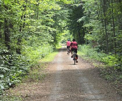
Elora Gorge offers a network of well-maintained trails that accommodate different hiking preferences and abilities. The trail system follows both sides of the gorge, providing multiple vantage points and loop options for exploring the area. What makes hiking here unique is the constant interplay between forest paths and dramatic cliff-edge walking, where you're never far from a spectacular view.
The riverside trails offer the most direct access to the water and provide close-up views of the limestone formations. These paths tend to be relatively flat but can be rocky and uneven in places, requiring attention to footing. The terrain here shifts between packed earth, exposed bedrock, and occasional muddy sections, especially after rain. Walking along the river level gives you an intimate perspective on how the water has carved and continues to shape the rock formations.
For those seeking elevated perspectives, the cliff-top trails deliver some of the most spectacular views in the region. These paths wind along the gorge rim, offering dramatic overlooks where you can peer down into the canyon and watch the river navigate its rocky course below. The elevation changes are moderate but noticeable, with the 22-meter height difference between river level and cliff tops providing a good workout without being overly strenuous.
The trail surfaces vary throughout the conservation area. Expect well-packed dirt paths in most areas, with sections of exposed limestone that can be slippery when wet. Some trails include wooden boardwalks and bridges that help protect sensitive areas while providing safe passage over wet or unstable ground. The limestone bedrock creates natural steps and platforms in many areas, making for interesting terrain that keeps the hiking experience engaging.
Water Activities and River Access
The Grand River through Elora Gorge offers some of Ontario's most accessible whitewater experiences. Tubing down the gentle rapids has become a signature activity here, providing a refreshing way to experience the gorge from water level. The rapids are generally Class I, making them suitable for most ages and skill levels, though the water can be surprisingly cold even in summer.
Kayaking and canoeing provide more controlled ways to navigate the river system. The relatively short section of river through the gorge allows paddlers to focus on maneuvering around rocks and enjoying the unique perspective of looking up at the limestone walls from below. Several access points along the river make it possible to customize your water experience based on conditions and comfort level.
Swimming opportunities exist in the calmer pools, though the limestone bottom and cool water temperatures make this more of a quick dip than a leisurely swim for most visitors. The combination of hiking and water activities makes Elora Gorge particularly appealing during hot summer days when you can cool off in the river between trail segments.
Wildlife and Natural Features
The diverse habitats within Elora Gorge support an impressive variety of wildlife for such a compact area. The limestone cliffs provide nesting sites for various bird species, while the mixed forest and meadow areas support different communities of plants and animals. The microclimate created by the gorge itself supports species that might not thrive in the surrounding agricultural landscape.
Deer are commonly spotted in the quieter sections of the conservation area, particularly in the early morning or late afternoon. The meadow areas provide grazing opportunities, and the forest edges offer cover and travel corridors. Birdwatchers will find the area particularly rewarding, with songbirds active throughout the forest canopy and water birds often visible along the river.
The plant communities reflect the unique growing conditions created by the limestone geology and river microclimate. The cliff faces support specialized plants adapted to thin soils and exposed conditions, while the river valley supports lush growth thanks to consistent moisture and protection from wind. Wildflowers bloom throughout the growing season, with different species taking advantage of the varied light and moisture conditions found throughout the conservation area.
Facilities and Amenities
Elora Gorge Conservation Area provides well-developed facilities that enhance the outdoor experience without overwhelming the natural setting. Multiple designated picnic areas are strategically located throughout the conservation area, offering tables and basic amenities in scenic locations. These spots work well for lunch breaks during longer hikes or as destinations for families looking to combine outdoor time with meal opportunities.
For visitors wanting to extend their stay, camping facilities allow for overnight experiences in the conservation area. The camping options provide a chance to experience the gorge during different times of day and catch the changing light conditions that make the limestone cliffs particularly photogenic during golden hour.
The conservation area maintains parking facilities that can handle typical visitor loads, though popular weekends and holidays may see capacity challenges. Restroom facilities and basic visitor services support day-use activities. The infrastructure strikes a good balance between providing necessary amenities and maintaining the natural character of the area.
Planning Your Visit
Elora Gorge works well for various types of outdoor experiences, from quick afternoon visits to full-day adventures combining hiking and water activities. The compact nature of the area means you can sample different activities and see the main features without committing to extremely long hikes or complex logistics.
Water levels and conditions change seasonally, affecting both the hiking experience and water activity options. Spring typically brings higher water levels and more dramatic rapids, while late summer often provides the most comfortable conditions for tubing and swimming. The limestone can be slippery when wet, so footwear with good traction becomes particularly important during rainy periods or early morning when dew is present.
The conservation area's location in the Huron, Perth, Waterloo, and Wellington region makes it accessible as a day trip from several major population centers, while still providing a genuine escape into a distinctive natural landscape that feels removed from urban environments.
Ready to go?
Everything you need to know before you goStarting Point
The elora gorge conservation area is located in Elora, Ontario. To get to the start of the trails, take Highway 6 north from Guelph and exit onto County Road 21. Head east on County Road 21 and turn left onto Wellington Road 21. The conservation area will be on your right.
When?
How much?
- Hiking shoes Essential
- Layered clothing Essential
- Rain jacket Essential
- Trekking poles
- Headlamp
FAQ - Frequently asked questions
Everything you need to knowThe Essential Hiking Checklist
Everything you need for your next hike. Bilingual, printable, 1 page.
Download the free checklistSimilar hikes nearby
Discover other trails you might enjoy
Perth Harvest Pathway Milverton- G2G Rail Trail
Huron, Perth, Waterloo and Wellington

Health Valley Trail
Huron, Perth, Waterloo and Wellington
Mill Run Trail
Huron, Perth, Waterloo and Wellington
Waterloo Park
Huron, Perth, Waterloo and Wellington
Point Farms Provincial Park
Huron, Perth, Waterloo and Wellington
Conestogo Lake
Huron, Perth, Waterloo and Wellington
Hiking near Guelph
166 trails to explore ~21 km away
We work hard to provide the most up-to-date and error-free data possible. If something seems incorrect, let us know! Your contribution helps the whole community.
Hikers' opinions