

Ready to explore Victoria Rail Trail? Here's everything you need to know before you go!
Discover the trail
Oh no! We don't have any photos 😢
This trail hasn't been captured yet. Be the first to share your adventure!Trail description
Description
The Victoria Rail Trail runs through the heart of Kawarthas Northumberland, converting 85 kilometers of abandoned railway corridor into one of Ontario's most accessible multi-use trails. The route stretches from Bethany in the south all the way north to Kinmount, threading through rural communities and connecting a surprisingly diverse range of landscapes along the way.
Trail Character and Terrain
Because it follows the original rail bed, the Victoria Rail Trail stays remarkably flat for most of its length. That gentle, consistent grade is one of the trail's defining features — there are no steep climbs, no technical scrambles, and no confusing route-finding. The path is well-defined and wide, a direct inheritance from its railway past, which also means good sight lines ahead and plenty of room to walk comfortably.
The surface shifts as you move along the corridor. You'll encounter packed earth, gravel stretches, and occasional boardwalks where the trail crosses wetland areas. None of these transitions create real obstacles — they just add a bit of variety to the underfoot experience. The consistent width of the old rail corridor gives the whole trail an open, unhurried feel that's hard to find on narrower singletrack routes.
Landscapes Along the Route
What keeps the Victoria Rail Trail interesting over its length is how much the scenery changes. Dense mixed forest gives way to open meadows, then to wetland edges and lakefront stretches — and these transitions happen gradually enough that you notice them without feeling abrupt. The forests are primarily mixed deciduous and coniferous, with maple, oak, and birch making up much of the canopy. In summer, that canopy provides real shade; in fall, the same trees put on a serious color show.
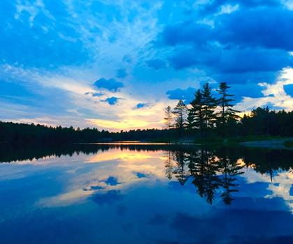
Water is a recurring theme along the trail. The route passes near Balsam Lake and Cameron Lake, getting close enough to the shorelines that you can hear the water and watch for waterfowl. These lakefront sections make natural stopping points — there's no reason to rush past them. Between the forested stretches, open agricultural land reveals the working rural character of Kawarthas Northumberland: fields, farmsteads, and pastoral views that contrast nicely with the enclosed forest walking on either side.
Wildlife and Birdwatching
The mix of habitats along the Victoria Rail Trail supports a solid variety of wildlife. White-tailed deer show up regularly, especially during early morning and evening hours when they move into the open sections of the corridor. They're worth watching for, though they tend to keep their distance from trail users.
Birdwatching is genuinely rewarding here. The proximity to lakes and wetlands draws waterfowl, and the common loon is one of the highlights — its calls carry across the water at dawn and dusk in a way that's hard to forget. Woodland birds populate the forested sections, while raptors and shorebirds appear near the water features. Binoculars are worth bringing. Chipmunks, squirrels, and other small mammals are common throughout, particularly where the trail passes through transitional habitat zones.
History on the Trail
The railway history here isn't just background context — it's part of what you experience while walking. The original line was an important part of how people and goods moved through Kawarthas Northumberland, and remnants of that past appear periodically along the route. Interpretive features help fill in the story where they're present. The trail also passes through several small communities that have held onto their rural character, offering a glimpse into the slower pace of life that defines this part of Ontario.
Planning Your Visit
The 85-kilometer total length gives you a lot of flexibility. Day hikers can pick a section that fits their available time without any pressure to cover the whole thing, while those looking for a bigger challenge can tackle longer segments or plan a multi-day trip along the full corridor. Because the terrain is flat and the footing is predictable, estimating your pace and planning logistics is straightforward compared to more technical trails.
Even on easy terrain, water and snacks matter. The open sections expose you to sun and wind, and the potential distances mean you'll want more supplies than a short hike might suggest. Pack more water than you think you need, particularly in warmer months. Check trail conditions before heading out — seasonal changes and maintenance work can occasionally affect access — and be ready for weather that can shift quickly in this part of Ontario.
A camera is worth having along for the variety of scenes the trail delivers: forest light, lake reflections, wildlife encounters, and the occasional historical detail that catches your eye.
Recommended gear for this trail


Ready to go?
Everything you need to know before you goStarting Point
The victoria rail trail is located in the town of Victoria, Ontario. To get to the start of the trails, take Highway 6 north from Guelph and exit at Victoria Road. Turn left onto Victoria Road and drive for about 2 km until you reach the trailhead on your right.
When?
How much?
- Hiking shoes Essential
- → Salomon Elixir Tour Mid WP · 203.38 $
- Layered clothing Essential
- Rain jacket Essential
- Trekking poles
- → Black Diamond Trail Ergo Cork · 69.99 $
- Headlamp
- → Petzl Actik Core 625 · 103.95 $
FAQ - Frequently asked questions
Everything you need to knowThe Essential Hiking Checklist
Everything you need for your next hike. Bilingual, printable, 1 page.
Download the free checklistSimilar hikes nearby
Discover other trails you might enjoy

Chandos Lake
Kawarthas Northumberland
Petroglyphs Provincial Park
Kawarthas Northumberland
Presqu'ile Provincial Park
Kawarthas Northumberland
Ranney Gorge Suspension Bridge
Kawarthas Northumberland
Head Lake
Kawarthas Northumberland
Kawartha Highlands Provincial Park
Kawarthas Northumberland
Hiking near Barrie
146 trails to explore ~84 km away
We work hard to provide the most up-to-date and error-free data possible. If something seems incorrect, let us know! Your contribution helps the whole community.
Hikers' opinions