

Ready to explore Oak Ridges Trail? Here's everything you need to know before you go!
Discover the trail


Available trails
| Trails | Distance | Elevation | Duration | Difficulty | GPX |
|---|---|---|---|---|---|
| 4.2 km | 122 m | 1h | Beginner |
Trail description
Description
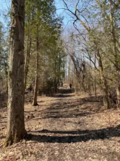
The Oak Ridges Trail is one of southern Ontario's most ambitious trail projects, stretching 290 kilometers across the Oak Ridges Moraine — a massive glacial landform that runs east to west through York, Durham, and Headwaters country. The moraine itself was shaped thousands of years ago by retreating glaciers, and the rolling hills, kettle lakes, and stream-cut valleys you'll walk through today are a direct result of that ancient ice work. The trail follows this natural spine between Lake Ontario to the south and Lake Simcoe to the north, threading through some of the most ecologically intact land left in southern Ontario.
What gives this trail its character — and its ecological importance — is its role as a continental watershed divide. Roughly 64 rivers and streams have their headwaters along the moraine. Depending on which side of the ridge you're standing on, the water at your feet is either heading south toward Lake Ontario or north toward Lake Simcoe, Lake Scugog, and eventually Lake Huron. You'll cross and follow many of these waterways as you hike, and the ponds, wetlands, and stream corridors they create are a constant presence along the route.
Terrain and Landscape
The trail earns its easy difficulty rating across most of its length, with a maximum elevation gain of around 250 meters. The terrain is characterized by the gentle, rolling topography typical of the moraine — you're not grinding up steep escarpments, but you're rarely on flat ground either. The constant variation in grade keeps the hiking engaging without being punishing, which is part of why this trail works well for a wide range of fitness levels.
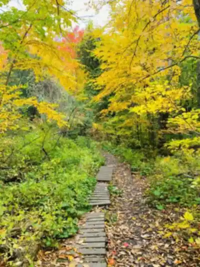
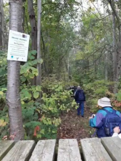
Forest cover is extensive throughout the route, shifting between dense hardwood stands, mixed forest, and more open edge environments depending on the section. These aren't plantation forests — much of what you're walking through represents some of the most intact natural habitat remaining in the greater Toronto area's broader region. The canopy provides good shade in summer and opens up dramatically in fall when the hardwoods turn.
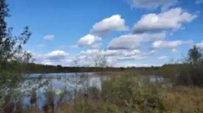
Wetlands are a recurring feature, particularly near stream crossings and in lower-lying sections of the moraine. These areas add to the scenic variety but also mean you should expect muddy conditions in spring and after heavy rain. Waterproof footwear or at minimum trail shoes with decent grip will serve you better than road runners on those stretches.
Wildlife and Birdwatching
The Oak Ridges Trail has a well-established reputation as a birdwatching destination, with over 150 bird species recorded along the corridor throughout the year. The diversity of habitats — mature forest interior, wetland edges, open meadows, and shrubby transition zones — means you're moving through different bird communities as you hike. The trail's function as a wildlife corridor connecting larger natural areas amplifies this, giving species the connected habitat they need to move and thrive.
Beyond birds, the trail sees regular wildlife activity. Chipmunks are practically guaranteed company on most sections. The wetland areas and stream corridors support amphibians and a range of small mammals, and the intact forest patches provide habitat for species that can't survive in fragmented landscapes.
Activities and Connections
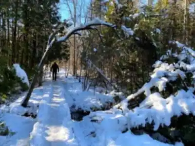
Hiking is the primary use, but the Oak Ridges Trail accommodates several other activities depending on the section. Off-road cycling is permitted on portions of the trail, making it a viable option for mountain bikers looking for varied terrain with genuine natural character. Horseback riding is allowed on designated sections. In winter, the trail is used for snowshoeing, and the snow-covered moraine landscape offers a noticeably different experience from the warmer months.
Dogs are welcome on many sections of the trail, which makes it a popular choice for hikers who want to bring their dogs along for longer outings in a natural setting.
One of the trail's most significant connections is to the Bruce Trail, Ontario's oldest and longest marked footpath. This link opens up extended route options and allows hikers to combine sections of both trails for multi-day trips or varied day hike itineraries. The Oak Ridges Trail's 290-kilometer length also means there's no shortage of sections to explore — most people approach it by choosing specific segments rather than attempting the full route end to end.
Planning Your Visit
At 290 kilometers, the Oak Ridges Trail is designed for repeated visits and section hiking rather than a single outing. Access points are distributed along the route, so you can pick a segment that fits your available time and start from a trailhead that makes sense for where you're coming from within the York, Durham, and Headwaters region.
The easy overall difficulty rating makes this trail genuinely accessible — it's a solid choice for newer hikers, families with older kids, or anyone looking for a long, low-stress day in the woods. That said, the cumulative distance of any given section and the variable terrain mean you should still plan your water and footwear accordingly, especially in shoulder seasons when trail conditions can be unpredictable.
The moraine's position between two large bodies of water creates localized weather patterns, and the dense forest cover means conditions on the trail can differ noticeably from what you'd expect based on a weather app. Layers are a reasonable precaution regardless of season, and the numerous stream crossings make waterproof boots worth considering for spring visits in particular.
Recommended gear for this trail


Ready to go?
Everything you need to know before you goStarting Point
The trail starts southeast of Mono Hills. Parking amenities are also situated throughout the entire trail. They are located along Lakeridge road, Houston road, Allbright road, and Goodwood road.
When?
How much?
- Hiking shoes Essential
- → Salomon Elixir Tour Mid WP · 203.38 $
- Layered clothing Essential
- Rain jacket Essential
- Trekking poles
- → Black Diamond Trail Ergo Cork · 69.99 $
- Headlamp
- → Petzl Actik Core 625 · 103.95 $
FAQ - Frequently asked questions
Everything you need to knowThe Essential Hiking Checklist
Everything you need for your next hike. Bilingual, printable, 1 page.
Download the free checklistSimilar hikes nearby
Discover other trails you might enjoy

North Maple Regional Park
York, Durham and Headwaters
Tobacco Trails
York, Durham and Headwaters
Forest Therapy Trail
York, Durham and Headwaters
Eldred King Woodlands
York, Durham and Headwaters

Hockley Valley
York, Durham and Headwaters
Vicki Barron Lakeside Trail
York, Durham and Headwaters
Hiking near Toronto
168 trails to explore ~36 km away
We work hard to provide the most up-to-date and error-free data possible. If something seems incorrect, let us know! Your contribution helps the whole community.
Hikers' opinions