

Ready to explore Sentier De La Rivière Rupert? Here's everything you need to know before you go!
Discover the trail

Trail description
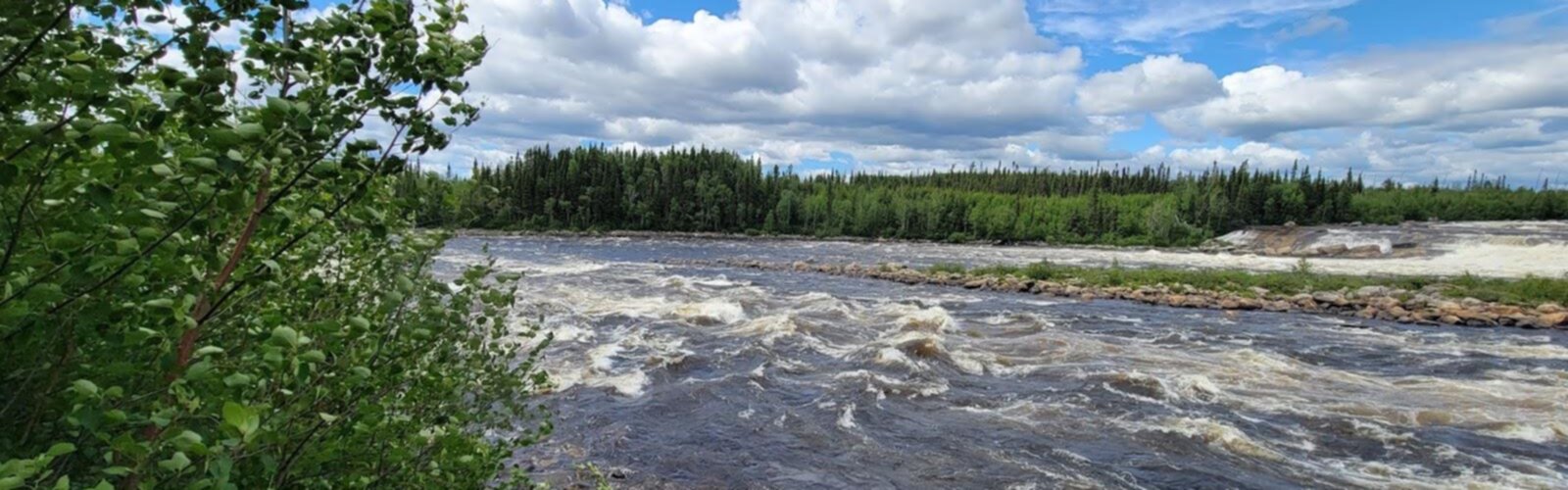
Sentier De La Rivière Rupert is a short, calm hike set in the wide-open wilderness of Nord-du-Québec, following the edge of the Rupert River. It’s the kind of trail that feels immediately removed from day-to-day noise: you’re walking with the steady presence of moving water nearby, and most of what you hear is the river, wind in the leaves, and your own footsteps.
What the trail is like
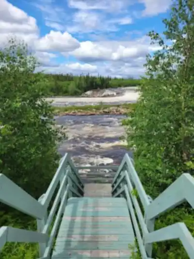
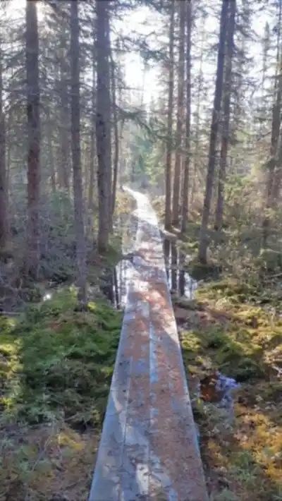
The route is described as well-marked and suited to various skill levels, so it works for both experienced hikers and people who are newer to the outdoors. Over its 1 km length, you move through a mix of settings rather than a single look from start to finish. Expect sections that feel enclosed by lush forest, where the trail is framed by trees and the sounds are softened, and then more open areas where the view widens and you can take in panoramic vistas of the surrounding landscape.
Because the path runs alongside the river, the experience is anchored by water—sometimes you’ll be close enough to appreciate the detail of the shoreline, and other times the river will feel more like a constant backdrop. The changing viewpoint is a big part of what makes this hike stand out: it’s not just “a walk in the woods,” it’s a riverside route where you’re repeatedly drawn to look up, look out, and pay attention to the terrain around you.
Scenery and atmosphere
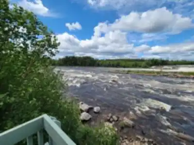
The main feature here is the Rupert River itself. Hiking beside it gives you an ongoing set of views and a steady soundtrack of flowing water. That river presence tends to shape the pace of the walk—people naturally stop more often to look at the water, listen, and take photos. Even on a short outing, it can feel like you’ve spent real time in nature because the setting is so immersive.
What also defines the Sentier De La Rivière Rupert is the sense that you’re in a place that feels untouched by urban life. The trail is described as peaceful and ideal for anyone wanting to disconnect from daily stresses. This isn’t a hike built around busy infrastructure or lots of built viewpoints; it’s more about being outside in a quiet stretch of Nord-du-Québec, with the river acting as your guide.
Terrain and landscapes you’ll pass through
Along the way, you’ll encounter diverse landscapes. In the forest sections, the feeling is sheltered and intimate—good for noticing smaller details like shifting light through the canopy, the way the breeze moves through the understory, and the subtle changes in sound as you move away from or closer to the riverbank. In the open spaces, the trail offers room to breathe and look farther out, with broader sightlines that highlight just how expansive this region can feel.
The hike includes about 100 m of elevation gain overall, but it’s still rated easy. That combination usually means any ups and downs are manageable for most people who are comfortable walking on natural trail surfaces. Plan for typical outdoor footing: a path that can vary from firm and straightforward to slightly uneven depending on the exact stretch you’re on, especially near a river environment where conditions can change with weather.
Wildlife you might see
Nord-du-Québec is known for feeling wild, and this trail offers a real chance to see animals that live near forest and water. The area is home to moose, beavers, and a variety of bird species. The best approach is to move quietly and keep scanning ahead and to the sides, especially near the river where animals may come to feed or travel along the shoreline. Even if you don’t spot larger wildlife, you’ll often notice signs of activity in a place like this—movement in the trees, bird calls, or the subtle presence of life around the water.
Who this hike works for
Because the trail is well-marked and designed for different experience levels, it can work well for a wide range of hikers. It’s a good fit if you want a short outing that still feels like a real wilderness experience—something you can do solo when you want quiet time, or with friends or family when you want a shared outdoor moment without committing to an all-day trek.
The setting also naturally supports slower hikers and groups that like to stop often. With river views and open vantage points, you can shape the outing around breaks—walk a little, pause to listen to the water, look for birds, then continue at an easy pace.
Camping nearby
If you want to extend your time outside, there are several camping spots nearby. Camping in this kind of riverside environment is all about the evening atmosphere: settling in as the light changes, listening to the river as the day cools off, and ending the night under a canopy of stars. The description also highlights the classic experience of wrapping up the day with a cozy campfire by the riverbank, sharing stories and marshmallows with fellow nature lovers.
Planning and safety notes
Even with an easy, well-marked trail, it’s worth treating this as true wilderness travel. Before you go, bring appropriate gear and supplies for hiking in a remote-feeling region. Think in practical terms: what you need to stay comfortable and handle changes in conditions while you’re out on the trail.
The hike is described as generally safe, but it’s still smart to take a few basic precautions. Check weather conditions before you head out so you’re not surprised by wind, rain, or sudden temperature shifts. It’s also wise to inform someone about your plans—where you’re going and when you expect to be back—especially since the appeal of the Sentier De La Rivière Rupert is how far it can feel from everyday services and crowds.
If you take your time, keep an eye out for moose and beavers, and let the river set the rhythm of your walk, this trail delivers a quiet, grounded experience of Nord-du-Québec that’s focused on nature, space, and the simple pleasure of moving alongside water.
The Essential Hiking Checklist
Everything you need for your next hike. Bilingual, printable, 1 page.
Get your free hiking checklistRecommended gear for this trail
As an Amazon Associate I earn from qualifying purchases.


Ready to go?
Everything you need to know before you goStarting Point
To access the hiking trails, you can start at the main trailhead located near the Rupert River. The primary parking area is accessible via Route de la Baie James (James Bay Road). From there, follow signs directing you to the designated parking lot for hikers. Note that this is a remote area, so ensure your vehicle is well-prepared for long-distance travel and check local conditions before heading out.
When?
How much?
As an Amazon Associate I earn from qualifying purchases.
Affiliate links — LGPO may earn a commission at no extra cost to you.
- Hiking shoes Essential
- → Salomon Elixir Tour Mid WP · 203.38 $
- Layered clothing Essential
- Rain jacket Essential
- Trekking poles
- → Black Diamond Trail Ergo Cork · 69.99 $
- Headlamp
- → Petzl Actik Core 625 · 103.95 $
FAQ - Frequently asked questions
Everything you need to knowSimilar hikes nearby
Discover other trails you might enjoy

Hiking near Gatineau
48 trails to explore ~666 km away
We work hard to provide the most up-to-date and error-free data possible. If something seems incorrect, let us know! Your contribution helps the whole community.
Hikers' opinions
Be the first to review!
No hiker has shared their experience yet. Share your impressions and help other hikers!