

Ready to explore Mont Saint-Pierre? Here's everything you need to know before you go!
Discover the trail


Photos: Annie Doucet — Google Maps (Google Maps) PoulpoZoR — Google Maps (Google Maps) Olivier Lepage — Google Maps (Google Maps)
Available trails
| TrailTrails | Dist.Distance | GainElevation | Est. timeEstimated time | Difficulty | GPX |
|---|---|---|---|---|---|
|
Intermediate
|
8.2 km | — | Intermediate | ||
|
Advanced
|
27 km | — | Advanced | ||
|
Advanced
|
16.2 km | 700 m | ≈ 5h | Advanced | |
|
Advanced
|
1.6 km | 430 m | ≈ 1h | Advanced | |
|
Advanced
|
32.5 km | 500 m | ≈ 8h | Advanced | |
|
Advanced
|
13.9 km | 400 m | ≈ 4h | Advanced | |
|
Advanced
|
4 km | 500 m | ≈ 1h30 | Advanced |
Trail description
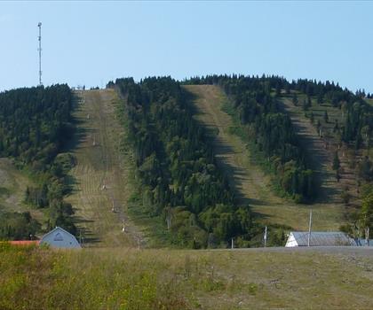
Mont-Saint-Pierre is a small village municipality in the La Haute-Gaspésie regional county, within Quebec's Gaspésie–Îles-de-la-Madeleine administrative region. With around 230 inhabitants recorded in the 2006 census, it's a quiet, tightly knit community built around a single defining feature: Mount Saint-Pierre, a 410-metre (1,345 ft) peak that rises sharply from the shoreline and pushes out into the Gulf of Saint Lawrence. That combination—steep mountain, open water, narrow coastal strip—shapes everything about how this place looks and feels.
Trail details
- Distance: 6.1 km (round trip)
- Elevation gain: 410 m
- Difficulty: Intermediate to Advanced
- Estimated time: 2-3 hours
- Region: Gaspésie–Îles-de-la-Madeleine, Quebec
- Notable features: 551 steps to summit, stunning valley views including Mont Jacques-Cartier in the distance
- Located in La Haute-Gaspésie, Gaspésie–Îles-de-la-Madeleine, Quebec
- Mount Saint-Pierre rises to 410 metres (1,345 ft) and projects into the Gulf of Saint Lawrence
- The mountain separates Cove Mont-Louis from Cove Mont-Saint-Pierre
- The Mont-Saint-Pierre River flows into Cove Mont-Saint-Pierre
- The village was formerly called Rivière-à-Pierre
- Home to the Mont-Saint-Pierre Ecological Reserve
- Known internationally for hang-gliding and paragliding
- The Festival of Free Flight (Fête de Vol Libre) has been held annually since 1978
- The Delta Trail features 551 steps to the summit with panoramic views
Key facts at a glance
Services and amenities
Everything you need for your next hike. Bilingual, printable, 1 page.
Get your free hiking checklistRecommended gear for this trail
As an Amazon Associate I earn from qualifying purchases.


Ready to go?
Everything you need to know before you goWhen?
How much?
As an Amazon Associate I earn from qualifying purchases.
Affiliate links — LGPO may earn a commission at no extra cost to you.
- Hiking shoes Essential
- → Salomon Elixir Tour Mid WP · 203.38 $
- Layered clothing Essential
- Rain jacket Essential
- Trekking poles
- → Black Diamond Trail Ergo Cork · 69.99 $
- Headlamp
- → Petzl Actik Core 625 · 103.95 $
FAQ - Frequently asked questions
Everything you need to knowOutings near Mont Saint-Pierre
Discover other trails you might enjoy
Parc régional de Val-d'Irène
Gaspésie · 17.7 km away

Le Parc régional de la Seigneurie du Lac Matapédia
Gaspésie · 27.2 km away

Parc du Mont-Comi
Bas-Saint-Laurent · 29.8 km away

Sentier Fleuriault
Bas-Saint-Laurent · 29.8 km away

Les Jardins de Métis / Reford Gardens
Bas-Saint-Laurent · 33.5 km away

Parc de la Rivière Mitis
Bas-Saint-Laurent · 34.3 km away
Hiking near Fredericton
11 trails to explore ~287 km away
We work hard to provide the most up-to-date and error-free data possible. If something seems incorrect, let us know! Your contribution helps the whole community.
Hikers' opinions
Be the first to review!
No hiker has shared their experience yet. Share your impressions and help other hikers!