
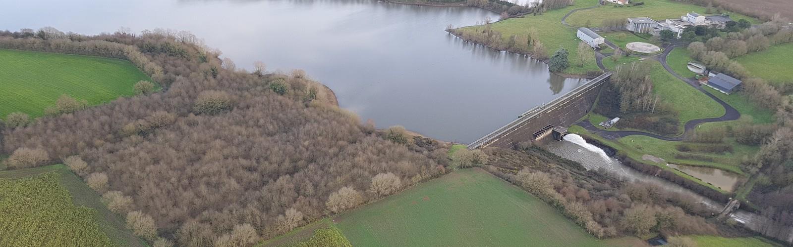

Ready to explore Retenue de la Bultière? Here's everything you need to know before you go!
Discover the trail
Oh no! We don't have any photos 😢
This trail hasn't been captured yet. Be the first to share your adventure!Trail description
The Retenue de la Bultière is one of those spots that rewards hikers who prefer calm water and open countryside over crowds and elevation. Tucked into the inland heart of Vendée, this reservoir offers a genuinely relaxed walking experience — 3.5 kilometers of well-maintained paths, just 20 meters of elevation gain, and enough natural variety to keep things interesting for the full hour and fifteen minutes you'll spend out there.
The reservoir itself was created by damming local waterways, but decades of natural processes have softened what was once an engineered shoreline into something that feels entirely organic. Shallow bays, fallen logs, and varied vegetation have turned the water's edge into a patchwork of small habitats that support both aquatic and terrestrial wildlife. It's a good reminder that artificial lakes can develop genuine ecological value over time.
Trail Experience and Terrain
The paths here follow a mix of packed earth and gravel, tracing the shoreline and dipping occasionally into the adjacent bocage countryside. The surface holds up reasonably well after rain, though sections closest to the water can get muddy during extended wet stretches — waterproof footwear is worth considering if you're visiting in wetter seasons or plan to wander close to the edge.
The 20-meter elevation gain is spread gradually across the route, so you won't notice any single climb. What you will notice are the gentle rises that open up views across the water and the shallow dips that lead into quieter coves where the surface goes glassy and still. It's subtle terrain, but it gives the walk a natural rhythm that keeps it from feeling flat in the monotonous sense.
The bocage hedgerows that frame much of the route are a defining feature of inland Vendée, and here they do double duty — creating natural corridors that guide you through the landscape while also providing habitat for the birds and small mammals that make this area worth slowing down for. Mature oak and chestnut trees offer shade along the wooded sections, and seasonal wildflowers fill in the understory during warmer months.
Wildlife and What to Watch For
The reservoir draws a solid mix of water-dependent species year-round. Great herons are a reliable sighting, working the shallows with that particular patience that makes them easy to watch for extended periods. Various duck species are present across the calmer sections of the water, and the surrounding woodlands support songbirds, red squirrels, and deer that occasionally come to the shoreline during quieter hours.
Early morning and evening visits consistently produce the best wildlife encounters — the light is better, the paths are quieter, and the animals are more active. The shallow bays along the shoreline function as nursery areas for fish, and the structure created by natural debris along the water's edge benefits the broader ecosystem in ways that are visible if you take the time to look.
Migratory waterfowl use the reservoir as a stopover point, which adds seasonal variety to what you might encounter. The open water and surrounding woodland create enough habitat diversity to make wildlife observation a genuine draw here, not just a secondary benefit of the walk.
Practical Information
The area has multiple access points, which gives you some flexibility in how you approach the route. Parking is available near the main entry points and accommodates standard vehicles without issue, though spaces fill up on busy weekend days in spring and summer — arriving earlier in the day helps.
The flat, well-maintained terrain makes this a strong choice for families with young children, hikers returning from injury, or anyone who wants a genuine outdoor experience without committing to a demanding route. The 3.5-kilometer distance and 1h15 estimated duration are realistic for a relaxed pace with stops for wildlife observation.
Standard hiking footwear handles most conditions here without difficulty. If you're visiting after a period of rain or planning to explore close to the water's edge, waterproof boots will serve you better. The open sections of the route are exposed to wind off the water, which can be refreshing in summer but worth accounting for in cooler months.
Where This Fits in Vendée
Vendée is best known for its Atlantic coastline, and most visitors head straight for the beaches and coastal trails. The Retenue de la Bultière offers something genuinely different — a quieter, more contemplative experience in the department's interior bocage landscape. That contrast makes it particularly useful when coastal weather turns difficult, but it also stands on its own merits as a destination worth seeking out.
The reservoir connects to the broader network of rural paths that run through Vendée's agricultural interior, so hikers looking to extend their time outdoors can link up with surrounding routes and explore more of the bocage countryside. The working agricultural landscape around the reservoir adds context to the natural features — this is a place where recreation and traditional land use share the same space without conflict, which gives it a character that more purpose-built recreational areas tend to lack.
The Essential Hiking Checklist
Everything you need for your next hike. Bilingual, printable, 1 page.
Get your free hiking checklistRecommended gear for this trail
As an Amazon Associate I earn from qualifying purchases.


Ready to go?
Everything you need to know before you goWhen?
How much?
As an Amazon Associate I earn from qualifying purchases.
Affiliate links — LGPO may earn a commission at no extra cost to you.
- Hiking shoes Essential
- → Salomon Elixir Tour Mid WP · 203.38 $
- Layered clothing Essential
- Rain jacket Essential
- Trekking poles
- → Black Diamond Trail Ergo Cork · 69.99 $
- Headlamp
- → Petzl Actik Core 625 · 103.95 $
FAQ - Frequently asked questions
Everything you need to knowHiking near Sydney
22 trails to explore ~4417 km away
We work hard to provide the most up-to-date and error-free data possible. If something seems incorrect, let us know! Your contribution helps the whole community.
Hikers' opinions
Be the first to review!
No hiker has shared their experience yet. Share your impressions and help other hikers!