

Ready to explore Lake Piru? Here's everything you need to know before you go!
Discover the trail
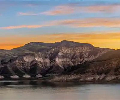
Photos: Jeff Turner from Santa Clarita, CA, United States — CC BY 2.0 (Wikimedia Commons)
Trail description
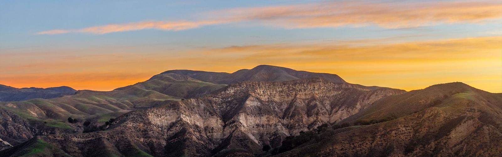
Lake Piru sits tucked into the hills of Ventura County, about an hour north of Los Angeles, and it's the kind of spot that rewards people who are willing to look a little beyond the obvious. While most folks come here for the water — boating, fishing, swimming — the surrounding terrain offers solid hiking through open chaparral country with big views and a genuine sense of getting away from the city sprawl.
The Setting
The lake itself is a reservoir created by the Santa Felicia Dam on Piru Creek, sitting within Los Padres National Forest and the surrounding Santa Clara River watershed. The landscape here is classic Southern California backcountry: rolling golden hills covered in sage, chamise, and scrub oak, with the Santa Susana and Topatopa mountains forming a rugged backdrop. It's dry, open terrain — the kind that smells like dust and wild sage after the first hint of rain.
The area around Lake Piru doesn't have the manicured trail network you'd find at a state park. What it offers instead is a more raw, less crowded experience. Trails and fire roads wind through the hills surrounding the reservoir, giving hikers access to elevated viewpoints where the lake spreads out below and the surrounding ridgelines stretch toward the horizon.
What the Hiking Is Actually Like
Hiking around Lake Piru means dealing with exposed terrain for most of the year. There's minimal shade once you leave the creek corridor, so the chaparral-covered slopes bake in the afternoon sun. Early morning starts make a real difference here — the light is better, the temperature is manageable, and wildlife is more active. You're likely to spot mule deer, coyotes, and a solid variety of raptors working the thermals above the ridges.
The trails and fire roads in this area tend to follow the contours of the hills, climbing steadily before opening up to panoramic views of the reservoir and the broader Santa Clara River valley. The terrain underfoot is typically packed dirt and loose rock — nothing technical, but enough to warrant decent footwear. After any significant rainfall, some sections can get muddy or slippery, and creek crossings on lower routes may be affected by water levels.
Because this is chaparral country, trail conditions can shift significantly with the seasons. Spring brings green hills and wildflowers — lupine, poppies, and wild mustard are common. By midsummer, the vegetation dries out and the hills turn that familiar straw-gold color. Fall can bring warm, clear days that are ideal for hiking, while winter occasionally delivers cooler temperatures and the chance of rain.
The Reservoir and Recreation Area
Lake Piru Recreation Area is operated by United Water Conservation District, and access to the lake and surrounding area typically requires a day-use fee. The recreation area includes camping, boat rentals, and swimming areas, which means weekends can get busy — especially in summer. If you're coming primarily to hike, a weekday visit gives you a noticeably quieter experience.
The lake itself covers a substantial area when full, and water levels fluctuate depending on the year's precipitation and regional water management. In dry years, the shoreline can recede significantly, exposing rocky banks and changing the character of the lower trails. In wet years, the reservoir fills out and the surrounding vegetation responds accordingly.
Getting There and Practical Info
Lake Piru is accessed via Piru Canyon Road, which heads north from the town of Piru off Highway 126 in Ventura County. The road winds through the canyon before reaching the recreation area entrance. It's a paved route, accessible to regular passenger vehicles, though the canyon road requires some attention — it's narrow in sections and follows the creek closely.
- Access road: Piru Canyon Road off Highway 126, north of the town of Piru
- Managed by: United Water Conservation District
- Day-use fees: Apply at the recreation area entrance — check current rates before visiting
- Dogs: Check current recreation area policy before bringing pets, as rules can vary by zone
- Parking: Available within the recreation area
- Facilities: Restrooms, camping, boat launch, and swimming area on site
What Makes This Place Worth the Drive
Lake Piru doesn't show up on most people's radar when they're thinking about hiking near Los Angeles, and that's actually part of what makes it appealing. The Gold Country region of California — stretching through these inland valleys and foothills — tends to get overlooked in favor of the coast or the high Sierra. But the terrain here has its own character: open, honest, and genuinely quiet once you get away from the recreation area's busier zones.
The combination of a reservoir, chaparral hills, and proximity to Los Padres National Forest means the area supports a diverse mix of wildlife and plant communities. Birders will find the lake edges and surrounding scrub productive, particularly during migration. The open ridgelines above the reservoir offer some of the better hawk-watching in the region during fall migration.
For hikers who want a half-day outing with real views and minimal crowds, Lake Piru delivers without requiring a long drive into the backcountry. It's the kind of place that feels like a local secret — and largely still is.
Best Times to Visit
- Spring (March–May): Wildflowers, green hills, comfortable temperatures — the best overall window for hiking
- Fall (October–November): Clear skies, cooler air, good conditions for longer outings
- Summer: Hot and exposed — start early or plan a shorter outing; the lake swimming makes it worthwhile for a full-day trip
- Winter: Mild but variable; rain can affect trail conditions and road access in the canyon
The Essential Hiking Checklist
Everything you need for your next hike. Bilingual, printable, 1 page.
Get your free hiking checklistRecommended gear for this trail
As an Amazon Associate I earn from qualifying purchases.


Ready to go?
Everything you need to know before you goWhen?
How much?
As an Amazon Associate I earn from qualifying purchases.
Affiliate links — LGPO may earn a commission at no extra cost to you.
- Hiking shoes Essential
- → Salomon Elixir Tour Mid WP · 203.38 $
- Layered clothing Essential
- Rain jacket Essential
- Trekking poles
- → Black Diamond Trail Ergo Cork · 69.99 $
- Headlamp
- → Petzl Actik Core 625 · 103.95 $
FAQ - Frequently asked questions
Everything you need to knowSimilar hikes nearby
Discover other trails you might enjoy

Mount Lowe, California
Greater Los Angeles
Mount Lukens, California
Greater Los Angeles
Mount Wilson, California
Greater Los Angeles
Mount Zion, California
Greater Los Angeles
South Coast Botanic Garden
Greater Los Angeles
Port Hueneme
Greater Los Angeles
Hiking near Victoria
93 trails to explore ~1596 km away
We work hard to provide the most up-to-date and error-free data possible. If something seems incorrect, let us know! Your contribution helps the whole community.
Hikers' opinions
Be the first to review!
No hiker has shared their experience yet. Share your impressions and help other hikers!