


Ready to explore St. Joe River? Here's everything you need to know before you go!
Discover the trail
Oh no! We don't have any photos 😢
This trail hasn't been captured yet. Be the first to share your adventure!Trail description
The St. Joe River corridor in Idaho is one of those places that feels like a well-kept secret — even though anyone who's spent time in the northern Idaho panhandle knows exactly how special it is. Flowing through dense forest and rugged mountain terrain, the St. Joe River offers a natural setting that draws hikers, anglers, and outdoor enthusiasts looking for something a little wilder than the typical trailhead experience.
The River and Its Surroundings
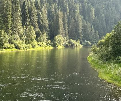
The St. Joe River is often called the highest navigable river in the United States — a distinction that speaks to both its elevation and its character. The river winds through the St. Joe National Forest, carving a valley flanked by steep ridgelines, old-growth timber, and the kind of quiet that's getting harder to find. The water runs clear and cold, fed by snowmelt and mountain tributaries, and the riparian corridor along its banks creates a distinct ecosystem that contrasts sharply with the drier upland terrain above.
Hiking along or near the St. Joe River means moving through a landscape shaped by water. The valley bottom is lush — expect dense stands of cedar and hemlock, ferns carpeting the forest floor, and the constant sound of moving water nearby. As you gain elevation on the surrounding ridges, the vegetation shifts toward pine and fir, and the views open up considerably.
What to Expect on the Trail
The St. Joe River area isn't a single defined trail so much as a network of routes and access points spread across a broad stretch of national forest. Some sections follow the river closely, offering flat, easy walking along gravel bars and forested banks. Other routes climb away from the valley floor and demand more effort, rewarding hikers with elevated perspectives over the drainage below.
Trail surfaces vary depending on where you're exploring. Lower routes near the river tend to be well-worn and relatively straightforward. Higher terrain can involve rougher footing, downed timber, and less-maintained paths — the kind of hiking that asks you to pay attention and move at your own pace. This is not a manicured park experience. It's genuine backcountry Idaho, and that's exactly the appeal.
Wildlife is a real presence here. The St. Joe drainage supports healthy populations of white-tailed deer, black bear, moose, and a wide variety of bird species. The river itself is well known among fly fishers for its native westslope cutthroat trout, and the riparian zone attracts songbirds, osprey, and the occasional bald eagle working the water. Keep your eyes open and your noise level down, and you're likely to see something worth remembering.
Access and Getting There
The St. Joe River corridor is accessible via Forest Service roads that run along much of the river's length. The main access route follows the river upstream from the town of St. Maries, with numerous pullouts, trailheads, and camping areas along the way. Road conditions can vary seasonally, and some upper sections may require a higher-clearance vehicle, particularly earlier in the season when roads are recovering from winter.
Cell service is limited to nonexistent once you're deep in the drainage, so downloading offline maps before you go is a practical necessity rather than just a suggestion. Let someone know your plans, especially if you're heading into the more remote upper reaches of the watershed.
Seasons and Timing
The St. Joe River area is most accessible from late spring through early fall. Snow lingers at higher elevations well into May or even June in some years, and the Forest Service roads that provide access to upper trailheads may not be fully open until early summer. Fall is a particularly rewarding time to visit — the larch trees that dot the surrounding hillsides turn a brilliant gold in October, creating a color display that's genuinely striking and unique to this part of Idaho.
Summer brings the most reliable conditions for hiking, with long days and generally stable weather. Afternoon thunderstorms are possible in July and August, so starting early and keeping an eye on the sky is good practice. Spring hiking near the river can mean high water and muddy trails, but it also means wildflowers and a landscape that feels freshly alive.
Practical Notes
- Land management: The St. Joe River corridor falls within the St. Joe National Forest, managed by the U.S. Forest Service. Regulations and permit requirements can vary by specific area, so checking with the local ranger district before your trip is worthwhile.
- Leave No Trace: This is a working forest as well as a recreation area. Pack out everything you bring in, stay on established routes where they exist, and respect any posted closures or restrictions.
- Water: The river and its tributaries provide plenty of water sources, but treat or filter all water before drinking. Even clear mountain water can carry giardia and other pathogens.
- Dogs: Dogs are generally welcome in national forest areas, but keep them under control, particularly in areas with wildlife activity. Check current regulations for any specific zones you plan to visit.
- Fishing: If you're combining hiking with fishing, make sure you have a valid Idaho fishing license and are familiar with the specific regulations for the St. Joe River, which has special rules in certain sections to protect native cutthroat populations.
Why the St. Joe River Stands Out
Northern Idaho has no shortage of beautiful river valleys, but the St. Joe has a quality that's hard to pin down precisely. It's less trafficked than some of the more famous destinations in the region, which means you're more likely to find solitude here — a real stretch of forest where the only sounds are the river, the wind, and whatever wildlife happens to be moving through. The combination of accessible lower-valley hiking and more demanding ridge routes gives the area genuine range, making it worth a full day or even a multi-day visit if you have the time and the gear for it.
Whether you're following the river on a casual walk through old-growth cedar or pushing up into the high country above the drainage, the St. Joe River area delivers the kind of Idaho experience that keeps people coming back.
The Essential Hiking Checklist
Everything you need for your next hike. Bilingual, printable, 1 page.
Get your free hiking checklistRecommended gear for this trail
As an Amazon Associate I earn from qualifying purchases.


Ready to go?
Everything you need to know before you goWhen?
How much?
As an Amazon Associate I earn from qualifying purchases.
Affiliate links — LGPO may earn a commission at no extra cost to you.
- Hiking shoes Essential
- → Salomon Elixir Tour Mid WP · 203.38 $
- Layered clothing Essential
- Rain jacket Essential
- Trekking poles
- → Black Diamond Trail Ergo Cork · 69.99 $
- Headlamp
- → Petzl Actik Core 625 · 103.95 $
FAQ - Frequently asked questions
Everything you need to knowSimilar hikes nearby
Discover other trails you might enjoy

Hiking near Kelowna
45 trails to explore ~398 km away
We work hard to provide the most up-to-date and error-free data possible. If something seems incorrect, let us know! Your contribution helps the whole community.
Hikers' opinions
Be the first to review!
No hiker has shared their experience yet. Share your impressions and help other hikers!