

Ready to explore Western Maryland Rail Trail? Here's everything you need to know before you go!
Discover the trail

Trail description
The Western Maryland Rail Trail is one of the finest rail-trail conversions in the Mid-Atlantic region. Built on the former Western Maryland Railway corridor, this hard-surface path follows the Potomac River through a stretch of western Maryland that feels genuinely remote — even though it's accessible by car. Whether you're walking, running, or cycling, this trail delivers a rare combination of flat, easy terrain and spectacular natural scenery.
The Trail Surface and Layout
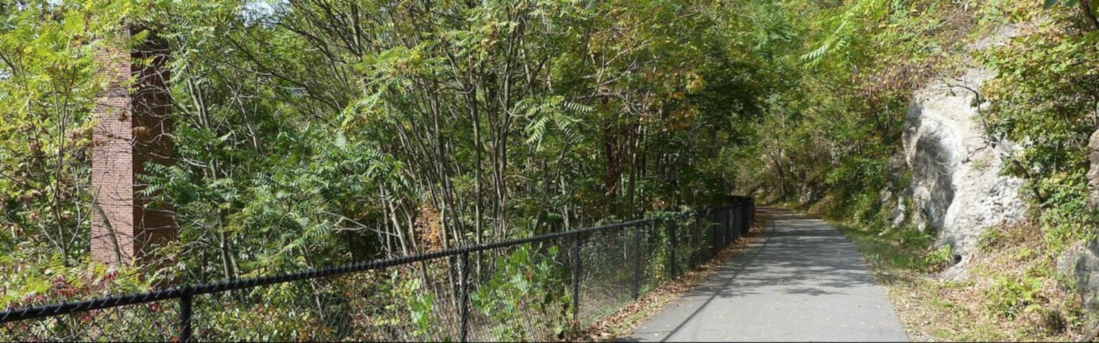
The Western Maryland Rail Trail is paved with asphalt for its entire length, making it accessible to a wide range of users — walkers, joggers, road cyclists, and anyone pushing a stroller or using a wheelchair. Because it follows an old rail corridor, the grade is extremely gentle throughout. There are no significant climbs or descents to worry about. The path is wide enough that foot traffic and cyclists can share it comfortably without feeling crowded.
The trail runs parallel to and is sandwiched between I-70 to the north and the C&O Canal Towpath and Potomac River to the south. The two trails complement each other well: the Rail Trail offers a smooth, fast surface, while the C&O Canal Towpath next to it provides a more rugged, natural-surface alternative for those who prefer a softer path underfoot.
What You'll See Along the Way
The scenery along the Western Maryland Rail Trail is consistently impressive. The Potomac River is a constant presence — wide, rocky, and wild-looking in this part of Maryland. The river corridor here is flanked by steep, forested ridgelines that rise sharply on both sides, giving the valley a dramatic, enclosed feel that's quite different from the open farmland you find elsewhere in the state.
The forest canopy along the trail is dense in the warmer months, providing good shade for most of the route. You'll pass through sections of mature hardwood forest, with views opening up periodically toward the river and the West Virginia hillsides across the water. Wildlife sightings are common — great blue herons are a regular sight along the riverbanks, and white-tailed deer frequently appear at the forest edge, especially in the early morning or late afternoon.
The historic context adds another layer to the experience. The Western Maryland Railway was a major freight corridor, and remnants of that industrial past are woven into the landscape. The C&O Canal itself, running parallel, is a National Historical Park — one of the longest linear parks in the United States — and the combination of rail history and canal history makes this corridor unusually rich for anyone interested in the region's past.
Trailheads and Access
The Western Maryland Rail Trail has multiple access points along its length, with parking available at several trailheads. The trail is located in Washington County, Maryland, stretching approximately 28 miles between Little Orleans (western terminus) and Big Pool (eastern terminus). Hancock and Pearre are major intermediate access points. Hancock is the most commonly used eastern access point and offers parking, restrooms, and easy access to the town's amenities. The eastern end near Big Pool also has parking and connects to the Fort Frederick State Park area, which is worth exploring if you have extra time.
The trail is well-signed and easy to navigate. Because it's a linear rail corridor, there are no route-finding challenges — you simply follow the path. Many users choose to park at one end and shuttle back, while others prefer to do an out-and-back from whichever trailhead is most convenient.
Who This Trail Works For
The Western Maryland Rail Trail is genuinely one of the most accessible trails in the region. The flat grade and paved surface make it suitable for:
- Families with young children — the smooth surface and lack of elevation change make it manageable even for small kids on bikes or in strollers
- Road cyclists and recreational riders — the pavement and gentle grade make for fast, enjoyable riding
- Runners and walkers — the surface is easy on joints, and the scenery keeps the miles interesting
- People with mobility considerations — the paved, flat surface is among the most accessible trail options in western Maryland
Dogs are welcome on the trail and are a common sight. Keep them leashed, as the trail is shared with cyclists moving at speed in some sections.
Pairing with the C&O Canal Towpath
One of the best things about this trail is its proximity to the C&O Canal Towpath. The two trails run parallel through much of this section, and it's easy to combine them into a longer outing or simply cross between them at various points. The Towpath has a natural, unpaved surface — packed dirt and gravel — which offers a completely different feel from the Rail Trail's asphalt. If you want variety, doing one direction on the Rail Trail and returning on the Towpath is a popular approach.
Fort Frederick State Park, near the eastern end of the trail, is another natural add-on. The park features an 18th-century stone fort that's one of the best-preserved colonial-era fortifications in the eastern United States, and it sits right along the trail corridor.
Practical Notes
- Distance: Approximately 28 miles total length
- Surface: Paved asphalt throughout — good for road bikes and all non-motorized users
- Grade: Flat rail-trail grade with no significant elevation change
- Parking: Available at multiple trailheads including Hancock, Pearre, Little Orleans, and Big Pool
- Dogs: Permitted, leash required
- Bikes: Welcome — this is a multi-use trail
- Restrooms: Available at main trailheads
- Managed by: Maryland Department of Natural Resources
The Western Maryland Rail Trail is the kind of place that rewards repeat visits — close enough to the Baltimore-Washington corridor to be a realistic day trip, but far enough removed that it genuinely feels like you've left the city behind once you're moving along the river.
The Essential Hiking Checklist
Everything you need for your next hike. Bilingual, printable, 1 page.
Get your free hiking checklistRecommended gear for this trail
As an Amazon Associate I earn from qualifying purchases.


Ready to go?
Everything you need to know before you goWhen?
How much?
As an Amazon Associate I earn from qualifying purchases.
Affiliate links — LGPO may earn a commission at no extra cost to you.
- Hiking shoes Essential
- → Salomon Elixir Tour Mid WP · 203.38 $
- Layered clothing Essential
- Rain jacket Essential
- Trekking poles
- → Black Diamond Trail Ergo Cork · 69.99 $
- Headlamp
- → Petzl Actik Core 625 · 103.95 $
FAQ - Frequently asked questions
Everything you need to knowHiking near Pittsburgh
0 trails to explore ~175 km away
We work hard to provide the most up-to-date and error-free data possible. If something seems incorrect, let us know! Your contribution helps the whole community.
Hikers' opinions
Be the first to review!
No hiker has shared their experience yet. Share your impressions and help other hikers!