Let's Go Play Outside
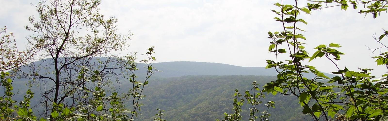
Hiking Lost Turkey Trail - panoramic view
--°C
Loading...
See forecast →

Hiking in Lost Turkey Trail: trails, map and practical info

Pennsylvania Dutch Country • Pennsylvania

Photo: Calzarette, Public domain, via Wikimedia Commons

Lost Turkey Trail (Pennsylvania Dutch Country, Pennsylvania) : hike, 27 km.

27 km
Distance

Ready to explore Lost Turkey Trail? Here's everything you need to know before you go!

Discover the trail

Oh no! We don't have any photos 😢

This trail hasn't been captured yet. Be the first to share your adventure!

Trail description

The long-distance Lost Turkey Trail was built by the Youth Conservation Corps in 1976 and playfully named in tribute of the original trailblazers. This challenging trail provides a quiet passageway through the forest west of the Allegheny Front, before plunging down off the Front and then climbing steeply up to the second-highest point in Pennsylvania. The trail winds through parts of Somerset, Cambria, and Bedford Counties, cutting through Gallitzin State Forest, state game lands, and Blue Knob State Park. Backpack camping along the trail is permitted only in the state forest, creating a challenge in mapping out backpacking routes. Fee campgrounds are available at the state park, but these are near the trail’s northeastern terminus, near the ski area. The southwestern terminus of Lost Turkey Trail is at a parking lot on Pennsylvania Route 56, across the road from Babcock Picnic Area, about 10 miles (16 km) southeast of Johnstown. From its southwestern terminus, Lost Turkey Trail leads for about 14 miles (23 km) through easy to moderately challenging terrain along Pot Ridge. It then meets Little Break Hollow in the crest of the Allegheny Front, and the hiking becomes very challenging for the remainder of the route. The trail descends to Burnt House Picnic Area, crosses Pennsylvania Route 869, and follows the edge of Forks Ridge above an impressive canyon. It then descends to beautiful Bobs Creek, climbs steeply up and down Hogback Ridge, and at mile 24 reaches a monument to two pioneer children who got lost in the area and died mysteriously in 1856, after which it begins a challenging climb to the top of Blue Knob. Lost Turkey Trail was constructed on existing trails with the addition of some new connectors. It is marked with 2-by-6-inch orange blazes. In the state forest section, part of the trail shares a pathway with an existing snowmobile trail, and in this area the red blazes share space with orange diamond-shaped blazes. Another part of the trail passes through private land; permission has been secured, but the landowners have requested the prohibition of fires, motorized vehicles, and littering. This creates another challenge for the planning of backpacking trips. Day hikes on Lost Turkey Trail are certainly possible, but the limited access points usually necessitate car shuttling.
Free 1 page
The Essential Hiking Checklist

Everything you need for your next hike. Bilingual, printable, 1 page.

Get your free hiking checklist

Recommended gear for this trail

As an Amazon Associate I earn from qualifying purchases.

LGPO Pick
Elixir Tour Mid WP
Salomon
Elixir Tour Mid WP
4.5 (2847 reviews)
Waterproof mid-height boot ideal for rocky terrain
203.38 $
See price
Best Value
Trail Ergo Cork
Black Diamond
Trail Ergo Cork
4.4 (1456 reviews)
Comfortable cork grip for long ascents
69.99 $
See price
Daylite Plus 20L
Osprey
Daylite Plus 20L
4.7 (3215 reviews)
Lightweight and versatile for day hikes
109.99 $
See price
Actik Core 625
Petzl
Actik Core 625
4.6 (1893 reviews)
USB rechargeable with 600 lumens for early starts
103.95 $
See price
Most Popular
Wide Mouth 1L
Nalgene
Wide Mouth 1L
4.8 (12540 reviews)
Unbreakable and BPA-free — a hiking essential
23.11 $
See price
Affiliate links — LGPO may earn a commission at no extra cost to you.

Ready to go?

Everything you need to know before you go

Where?

Address
Not available
GPS coordinates
40.224, -78.6472405
Phone
Not available

When?

Opening hours
No information
Weather (next days)
Loading
What to bring?

As an Amazon Associate I earn from qualifying purchases.

Affiliate links — LGPO may earn a commission at no extra cost to you.

General hiking tips, to adapt to your outing.
Gear
Download the PDF checklist
Water & food
Tip: bring water
Good to know
In an emergency
Emergency
911
GPS coordinates
40.224, -78.6472405

Hikers' opinions

Be the first to review!

No hiker has shared their experience yet. Share your impressions and help other hikers!

FAQ - Frequently asked questions

Everything you need to know
Didn't find your answer?
Top 10 best hiking in Pennsylvania Dutch Country
Our ranking based on hiker reviews

Hiking near Pittsburgh

3 trails to explore ~117 km away

View trails near Pittsburgh
Did you spot an error?

We work hard to provide the most up-to-date and error-free data possible. If something seems incorrect, let us know!

Update : November 2026