
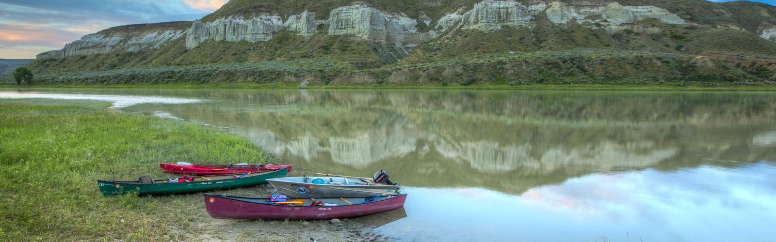
Ready to explore Missouri River Three Forks to the Montana-North Dakota border? Here's everything you need to know before you go!
Discover the trail
Oh no! We don't have any photos 😢
This trail hasn't been captured yet. Be the first to share your adventure!Trail description
The Landscape Along the Corridor
As the Missouri moves southeast and then east across Montana, the character of the land changes considerably. Near Three Forks and through the upper stretches, the river valley is flanked by rolling hills and agricultural land, with riparian zones providing habitat corridors for wildlife. Further east, the river cuts through the Missouri Breaks — a rugged, remote landscape of eroded badlands, coulees, and dramatic bluffs that rise sharply above the water. This section is among the most wild and least-developed parts of the entire river.
Everything you need for your next hike. Bilingual, printable, 1 page.
Get your free hiking checklistRecommended gear for this trail
As an Amazon Associate I earn from qualifying purchases.


Ready to go?
Everything you need to know before you goWhen?
As an Amazon Associate I earn from qualifying purchases.
Affiliate links — LGPO may earn a commission at no extra cost to you.
- Hiking shoes Essential
- → Salomon Elixir Tour Mid WP · 203.38 $
- Layered clothing Essential
- Rain jacket Essential
- Trekking poles
- → Black Diamond Trail Ergo Cork · 69.99 $
- Headlamp
- → Petzl Actik Core 625 · 103.95 $
FAQ - Frequently asked questions
Everything you need to knowOutings near Missouri River Three Forks to the Montana-North Dakota border
Discover other trails you might enjoy

Garnet Mountain, Montana
Yellowstone Country · 58.2 km away
Moonlight Basin
Yellowstone Country · 68.1 km away
Sky Rim
Yellowstone Country · 100.6 km away
Gardiner, Montana, to Mammoth Hot Springs, Wyoming
Yellowstone Country · 116.2 km away
Smith River Its confluence to the Missouri River
Southwest Montana · 125.1 km away
Hiking near Calgary
128 trails to explore ~602 km away
We work hard to provide the most up-to-date and error-free data possible. If something seems incorrect, let us know! Your contribution helps the whole community.
Hikers' opinions
Be the first to review!
No hiker has shared their experience yet. Share your impressions and help other hikers!