
Ready to explore Shark River Park? Here's everything you need to know before you go!
Discover the trail
Trail description
The park
According to the Monmouth County Park System, Shark River Park is the first park in its network. The park system describes a park where ponds, sandy hills, forests and waterways draw anglers and hikers in summer, cross-country skiers and ice skaters in winter.
From the trails you can spot plants and animals typical of wetlands and floodplains, as well as those of the pine and oak forest. A fitness trail is available.
The trails
The park system announces 7.5 miles of trails on the park page and 6 miles in its brochure (2022 edition), which is the source of the lengths below.
- Cedar Trail: a wide 1.2-mile (1.9 km) loop through the centre of the park. A 0.2-mile extension through an Atlantic white cedar bog connects to Gully Road.
- Fitness trail: 20 exercise stations, with illustrated signs, along the Cedar Trail.
- Hidden Creek: a 2-mile (3.2 km) loop through red maple forest (lowland) and pine-oak forest (upland). The section from Schoolhouse Road to Pine Hills is foot traffic only.
- Pine Hills: a 1.4-mile (2.3 km) loop that branches off Hidden Creek to explore the hills of the park.
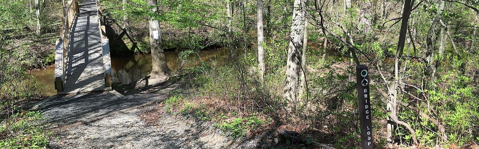
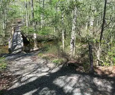
- Bridge Loop: a short 0.8-mile (1.3 km) trail along the Shark River. Foot traffic only.
- River's Edge: a short, primitive 1-mile (1.6 km) trail that follows the river on the north side of the park. Foot traffic only. It can be very wet after heavy rain.
At a brisk pace, the park system estimates about 20 minutes to walk one mile (1.6 km). It does not publish an elevation gain for these trails. Its brochure, with the park map and a legend of trail levels (easy, moderate, challenging), can be downloaded from its website. Cyclists yield to all other users, and pedestrians yield to horse riders.
Before you go
- Hours: open every day of the year from 7 a.m. Closing time is 7:30 p.m. through October 31, 5:30 p.m. from November 1 to January 18 and 6 p.m. from January 19 to February 8. The park system does not publish a closing time for the rest of the year; its brochure says dusk.
- Access: according to the park system's brochure (2022 edition), the park is open free of charge every day of the year. Check before you go.
- Entrances: the main entrance is at 1101 Schoolhouse Road in Wall; a second entrance is at 1043 Gully Road. A small area of the park on Hillside Road gives access to the river (wildlife watching, fishing, kayak launch; small car-top vessels only, and water access is challenging, especially at low tide). To reach the main trail system, the park system says to cross Schoolhouse Road. It also announces an access improvement project in the Hillside Road area.
- Parking: no parking fee is published; if in doubt, call the ranger station at 732-922-4080.
- Facilities: a playground open all year, more than 95 picnic tables and 35 grills on a first-come, first-served basis (bring your own charcoal).
- Tobacco and alcohol: all county parks are tobacco free, e-cigarettes included. Alcohol is not permitted.
With a dog
Monmouth County Park System rules require domestic animals to be kept on a leash and under control at all times, and handlers to clean up after them. Animals are not allowed in areas indicated by signs, and dogs are not permitted to swim at any park system facility. Ticks can be active year-round: the park system also advises protecting pets.
Hunting and ticks
- Hunting: according to the park system, parts of the park are open to deer hunting during the regulated season, and hunting areas are posted with signs. Hunting there is archery only, in designated areas. Hunting season: see the county website, which publishes the list of dates and maps. Trails remain open unless otherwise noted.
- Ticks: the park system advises insect repellent, light-coloured clothing, a long-sleeved shirt tucked into your pants and pants tucked into your socks, a check during and after your visit and a shower soon after. Stay on the formal trails, walk in the centre, and keep away from tall grass, brush, leaf litter and woodland edges.
Other activities
The park system says anglers can fish for largemouth bass, catfish, sunfish, yellow perch, shiners and black crappie; the river is stocked with trout seasonally. A state fishing license is required for anglers over age 16. In winter the park is used for cross-country skiing and ice skating; to skate, the park system asks you to call 732-842-4000 to check conditions.
The Essential Hiking Checklist
Everything you need for your next hike. Bilingual, printable, 1 page.
Get your free hiking checklistRecommended gear for this trail
As an Amazon Associate I earn from qualifying purchases.


Ready to go?
Everything you need to know before you goStarting Point
Main entrance: 1101 Schoolhouse Road, Wall (New Jersey 07753). Second entrance: 1043 Gully Road, Wall. River access area: Hillside Road, near Brighton Avenue. To reach the main trail system, the park system says to cross Schoolhouse Road.
When?
As an Amazon Associate I earn from qualifying purchases.
Affiliate links — LGPO may earn a commission at no extra cost to you.
- Hiking shoes Essential
- → Salomon Elixir Tour Mid WP · 203.38 $
- Layered clothing Essential
- Rain jacket Essential
- Trekking poles
- → Black Diamond Trail Ergo Cork · 69.99 $
- Headlamp
- → Petzl Actik Core 625 · 103.95 $
FAQ - Frequently asked questions
Everything you need to knowSimilar hikes nearby
Discover other trails you might enjoy

Island Beach State Park
Jersey Shore
Barnegat Lighthouse State Park
Jersey Shore
Hartshorne Woods Park
Jersey Shore
Gateway National Recreation Area Sandy Hook Unit
Jersey Shore

Joe Palaia Park Addition
Jersey Shore

Asbury Park Boardwalk
Jersey Shore
Hiking near Trenton
171 trails to explore ~55 km away
We work hard to provide the most up-to-date and error-free data possible. If something seems incorrect, let us know! Your contribution helps the whole community.
Hikers' opinions
Be the first to review!
No hiker has shared their experience yet. Share your impressions and help other hikers!