
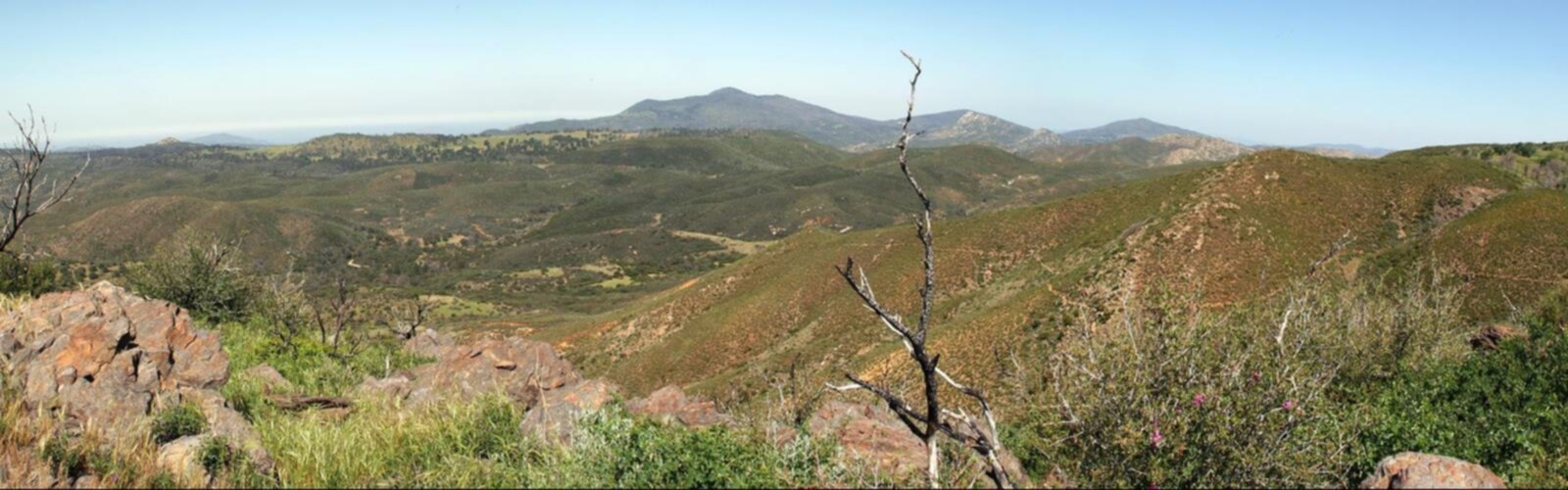

Ready to explore Noble Mountain, New York? Here's everything you need to know before you go!
Discover the trail
Oh no! We don't have any photos 😢
This trail hasn't been captured yet. Be the first to share your adventure!Trail description
Noble Mountain stands as one of the Adirondacks' most rewarding hiking destinations, offering a substantial climb through diverse terrain that culminates in spectacular panoramic views. Located in the heart of New York's Adirondack region, this mountain provides an authentic wilderness experience that showcases the best of what this legendary outdoor playground has to offer.
The Trail Experience
The summit trail at Noble Mountain delivers a challenging yet accessible adventure with 892 meters of elevation gain spread over well-maintained paths. Despite being classified as an easy hike, the significant elevation change means you'll want to budget 6 to 8 hours for the complete experience, allowing time to fully appreciate the journey and the destination.
The trail begins by winding through dense, lush forests where the canopy creates a natural cathedral overhead. As you progress upward, the forest composition shifts, offering hikers a living lesson in Adirondack ecology. The diverse flora changes with elevation, and you'll have excellent opportunities to spot the region's wildlife along the way. The path itself is well-maintained, making navigation straightforward while still providing that authentic backcountry feel.
What sets Noble Mountain apart is how the trail gradually reveals its rewards. Rather than a steep, punishing climb, the ascent offers natural rest points and scenic overlooks that provide glimpses of what awaits at the summit. These intermediate viewpoints serve as perfect spots for catching your breath while taking in partial views of the surrounding Adirondack peaks and pristine lakes below.
Summit Views and Rewards
The summit of Noble Mountain delivers on its promise with breathtaking 360-degree views that justify every step of the climb. From the top, you'll see the classic Adirondack landscape spread out in all directions—rolling peaks extending to the horizon, mirror-like lakes nestled between forested ridges, and the vast wilderness that makes this region so special. The panoramic vista encompasses the surrounding Adirondack peaks, each offering its own character and appeal to the landscape.
The summit provides ample space for rest and reflection, making it an ideal spot for an extended break or lunch with a view. The open rock faces and clearings offer multiple vantage points, so even if you encounter other hikers, there's plenty of room to find your own peaceful spot to soak in the scenery.
Seasonal Considerations and Planning
Noble Mountain offers year-round access, with each season bringing its own distinct character to the hiking experience. Fall transforms the mountainside into a tapestry of vibrant colors, making it one of the premier foliage destinations in the region. Winter brings tranquil snowscapes that create an entirely different but equally beautiful hiking environment, though proper winter gear and experience become essential.
The Adirondack weather can be unpredictable regardless of season, making proper preparation crucial. Dressing in layers is always advisable, as conditions can vary significantly between the trailhead and summit. Essential gear should include plenty of water, snacks for the longer hiking duration, and a reliable map or GPS device. Given the 6 to 8 hour timeframe, starting early in the day is recommended to ensure you have adequate daylight for the descent.
Beyond the Mountain
Noble Mountain serves as an excellent base for exploring the broader Hamilton County region. The nearby towns of Morehouse and Nobleboro provide charming stops that offer a glimpse into authentic Adirondack community life. These small communities serve as gateways to additional outdoor adventures and provide essential services for visiting hikers.
For those looking to extend their outdoor adventure, Herkimer County lies within reach and features unique geological formations and historical attractions like Fort Noble. The area's rich history adds another dimension to your visit, connecting the natural beauty with the human stories that have shaped this region.
Water enthusiasts will find excellent opportunities along the Boquet River and North Fork, where fishing conditions are ideal for both novice and experienced anglers. The serene waters provide a perfect contrast to the mountain hiking experience. Round Pond offers additional water-based recreation, including kayaking opportunities and peaceful shoreline spots perfect for relaxation after a challenging day on the trails.
Natural Setting and Conservation
The trail experience at Noble Mountain goes beyond just reaching the summit. The journey itself invites you to slow down and connect with the natural environment. The forest provides a soundtrack of rustling leaves and bird songs that creates a meditative atmosphere throughout the hike. Natural clearings and lakeside areas near the mountain offer perfect spots for picnicking, either as part of your summit day or as separate, more leisurely outings.
The Game Commission's active management ensures these natural habitats remain protected and pristine for future generations of hikers and wildlife alike. This conservation effort is evident in the trail's condition and the healthy ecosystem you'll observe throughout your visit.
For those exploring the broader area, Ohio Hill's scenic routes provide additional hiking options and can be precisely located using longitude coordinates for GPS navigation. This attention to accessibility and navigation reflects the region's commitment to providing excellent outdoor recreation opportunities while maintaining the wild character that makes the Adirondacks so special.
The Essential Hiking Checklist
Everything you need for your next hike. Bilingual, printable, 1 page.
Get your free hiking checklistRecommended gear for this trail
As an Amazon Associate I earn from qualifying purchases.


Ready to go?
Everything you need to know before you goStarting Point
To access the hiking trails, you can start at the primary trailhead located at the end of Crane Pond Road. From the town of Schroon Lake, head east on Alder Meadow Road, then continue onto Crane Pond Road until you reach the parking area. Note that Crane Pond Road is a rough dirt road and may not be suitable for all vehicles. An alternative starting point is from the trailhead on Route 74 near Paradox Lake; park in the designated lot and follow signs to the trail.
When?
How much?
As an Amazon Associate I earn from qualifying purchases.
Affiliate links — LGPO may earn a commission at no extra cost to you.
- Hiking shoes Essential
- → Salomon Elixir Tour Mid WP · 203.38 $
- Layered clothing Essential
- Rain jacket Essential
- Trekking poles
- → Black Diamond Trail Ergo Cork · 69.99 $
- Headlamp
- → Petzl Actik Core 625 · 103.95 $
FAQ - Frequently asked questions
Everything you need to knowSimilar hikes nearby
Discover other trails you might enjoy

Algonquin Peak, New York
Adirondacks

Big Slide Mountain, New York
Adirondacks

Boundary Peak, New York
Adirondacks
Crane Mountain
Adirondacks
Avalanche Pass
Adirondacks
Ampersand Mountain, New York
Adirondacks
Hiking near Lake Placid
0 trails to explore ~28 km away
We work hard to provide the most up-to-date and error-free data possible. If something seems incorrect, let us know! Your contribution helps the whole community.
Hikers' opinions
Be the first to review!
No hiker has shared their experience yet. Share your impressions and help other hikers!