

Ready to explore Delaware and Raritan Canal State Park Trails? Here's everything you need to know before you go!
Discover the trail

Trail description
The Delaware and Raritan Canal State Park Trails offer one of the most unique and historically rich hiking experiences in the greater Philadelphia region. Running alongside the old Delaware and Raritan Canal, this linear trail system follows a towpath that was once used by mules hauling cargo barges in the 19th century. Today, that same flat, packed-surface path gives hikers, cyclists, and nature lovers a peaceful corridor through a landscape that feels surprisingly removed from the surrounding suburban sprawl.
What Makes This Trail System Stand Out
What sets the Delaware and Raritan Canal State Park Trails apart from most hiking destinations in the area is the combination of history, accessibility, and natural beauty along a continuous waterway. The canal itself is a National Historic Landmark, and walking the towpath means you're literally retracing the footsteps of 19th-century laborers and mule drivers who kept commerce moving between Philadelphia and New York. That historical layer adds real depth to what might otherwise be a simple flat walk.
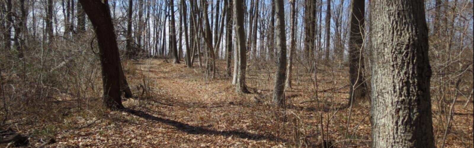
The trail runs through a mix of environments — open meadows, dense riparian woodland, and stretches where the canal sits right beside the Delaware River. Depending on where you access the trail, the scenery shifts noticeably. Some sections feel wild and quiet, with tall trees arching over the water and birdsong filling the air. Others pass through small towns where you can grab a coffee or a bite to eat before heading back out.
The Terrain
The towpath itself is flat and wide, making it one of the more accessible trail experiences in the region. The surface is generally packed gravel or packed earth, which holds up well in dry conditions but can get muddy after heavy rain. Because there's essentially no elevation change along the canal corridor, this is a trail system that welcomes hikers of all fitness levels — from families with young kids to older adults looking for a long, easy walk with good scenery.
The flatness also means the trail is popular with cyclists, so hikers should expect to share the path. It's generally a friendly, low-conflict mix, but it's worth staying aware, especially on busy weekend afternoons when bike traffic picks up.
Nature and Wildlife Along the Canal
The canal corridor functions as a genuine wildlife habitat, and the riparian environment along the water's edge supports a wide variety of bird species. Herons are a common sight, standing motionless in the shallows or lifting off with that slow, prehistoric wingbeat. Kingfishers dart along the water, and in the warmer months, the banks come alive with frogs, turtles, and the occasional water snake. Wildflowers line the edges of the path through spring and summer, and the tree canopy turns spectacular in fall.
Because the trail follows the water for its entire length, you're almost always within sight or sound of the canal. That constant presence of water gives the whole experience a calm, meditative quality that's hard to find on more rugged, elevation-heavy trails.
Access and Parking
One of the practical advantages of a linear trail system like this one is that there are multiple access points along the route. You can pick an entry point that suits your schedule, your energy level, or simply where you happen to be coming from. Parking is available at several trailheads along the canal, and many of the small towns along the route have public parking nearby.
Because the trail is linear rather than a loop, many hikers choose to do an out-and-back from a single access point, walking as far as feels right before turning around. Others arrange a car shuttle to walk a longer one-way section. Both approaches work well depending on how much time you have.
Tips for Your Visit
- Wear appropriate footwear: The packed gravel surface is easy on the feet, but after rain it can get slippery and muddy in spots. Trail runners or light hiking shoes are a solid choice.
- Bring water: The trail is exposed in several sections, and on warm days the sun can be intense. There aren't always water sources or facilities at every access point, so carry what you need.
- Watch for cyclists: The towpath is a shared-use trail. Stay to the right and listen for bikes coming from behind, especially on narrower sections.
- Check conditions after rain: Some sections of the towpath can become quite muddy following heavy precipitation. If you're planning a longer outing, it's worth checking recent trail reports before you head out.
- Explore the towns along the route: Several charming small communities sit right along the canal corridor. Taking a break to walk through one of them adds a nice dimension to the experience.
The Historical Context
The Delaware and Raritan Canal was built in the 1830s and operated as a major commercial waterway for decades, carrying coal, lumber, and other goods between the Delaware River and Raritan Bay. At its peak, it was one of the busiest canals in the United States. The towpath you walk today is the same path that mules once traveled, pulling loaded barges through the water beside them. The canal was eventually rendered obsolete by the railroads, but it survived largely intact and was designated a state park, preserving both the waterway and the towpath for public use.
Walking this trail, you'll pass old lock structures, stone bridges, and other remnants of that industrial past. These features aren't just interesting to look at — they give the trail a sense of place and continuity that connects your walk to a much longer story about the landscape and the people who shaped it.
Who This Trail Is Best For
The Delaware and Raritan Canal State Park Trails are an excellent choice for hikers who want a long, easy walk with consistent scenery and a strong sense of history. The flat terrain makes it ideal for beginners, families, and anyone looking for a low-impact outing. More experienced hikers who want a challenge in terms of elevation won't find it here, but those who enjoy covering distance in a beautiful, historically layered environment will find plenty to appreciate. It's also a great option when you want to get outside without committing to a technically demanding route.
The Essential Hiking Checklist
Everything you need for your next hike. Bilingual, printable, 1 page.
Get your free hiking checklistRecommended gear for this trail
As an Amazon Associate I earn from qualifying purchases.


Ready to go?
Everything you need to know before you goWhen?
How much?
As an Amazon Associate I earn from qualifying purchases.
Affiliate links — LGPO may earn a commission at no extra cost to you.
- Hiking shoes Essential
- → Salomon Elixir Tour Mid WP · 203.38 $
- Layered clothing Essential
- Rain jacket Essential
- Trekking poles
- → Black Diamond Trail Ergo Cork · 69.99 $
- Headlamp
- → Petzl Actik Core 625 · 103.95 $
FAQ - Frequently asked questions
Everything you need to knowHiking near Trenton
0 trails to explore ~47 km away
We work hard to provide the most up-to-date and error-free data possible. If something seems incorrect, let us know! Your contribution helps the whole community.
Hikers' opinions
Be the first to review!
No hiker has shared their experience yet. Share your impressions and help other hikers!