


Ready to explore Mount Chapman, North Carolina_Tennessee? Here's everything you need to know before you go!
Discover the trail
Oh no! We don't have any photos 😢
This trail hasn't been captured yet. Be the first to share your adventure!Trail description
Mount Chapman sits on the border between North Carolina and Tennessee, deep inside Great Smoky Mountains National Park. It's one of the highest peaks in the entire Appalachian range, and while it doesn't get the same foot traffic as some of the more famous summits in the Smokies, that's actually part of what makes it worth the effort. If you're looking for a serious backcountry experience away from the crowds, this is the kind of destination that delivers.
The Mountain and Its Setting
Mount Chapman straddles the state line along the Appalachian Trail corridor, sitting within one of the most ecologically rich protected areas in the eastern United States. The terrain here is rugged and remote — this isn't a casual day hike destination. The approach involves sustained climbing through dense old-growth forest, and the upper elevations take on a distinctly boreal character, with spruce-fir forest replacing the hardwoods lower down. That transition is one of the defining features of hiking at this elevation in the Smokies.
The summit area is heavily forested, so don't expect sweeping panoramic views from the top. What you get instead is a genuine sense of wilderness — the kind that's increasingly rare in the eastern U.S. The forest here feels ancient and undisturbed, and on a clear day you can catch glimpses through the trees that remind you just how high you've climbed.
Trail Character and Terrain
The routes that access Mount Chapman are demanding. The terrain is steep in sections, and the trails are maintained at a backcountry standard — meaning they're well-marked but not groomed. Roots, rocks, and uneven footing are the norm rather than the exception. Trekking poles are a genuine asset here, especially on the descent.
The Appalachian Trail runs along the ridgeline in this area, and most approaches to Mount Chapman involve traveling a stretch of it. The ridge itself offers a different kind of hiking than the valley trails — exposed to weather, with dramatic elevation changes and a sense of being truly on the spine of the mountains. Wind can be significant at the higher elevations, and conditions can shift quickly.
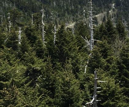
The spruce-fir ecosystem at the upper elevations is fragile and ecologically significant. Much of the Fraser fir in the Smokies has been affected by the balsam woolly adelgid, an invasive insect, and the standing dead trees are a visible reminder of that ongoing challenge. It's a sobering but important part of understanding this landscape.
What to Expect on the Ground
Because Mount Chapman is a backcountry destination within Great Smoky Mountains National Park, you need to plan accordingly. The park requires backcountry permits for overnight camping, and reservations for designated campsites must be made in advance. If you're planning a multi-day trip to properly explore this area, that permit process is non-negotiable.
Day hikers can access the area without a permit, but the distances involved make this a long and serious undertaking. Start early, carry more water than you think you'll need, and be realistic about turnaround times. The trails in this part of the park are not heavily patrolled, and self-sufficiency matters.
Cell service is essentially nonexistent in the backcountry of the Smokies. Download your maps offline before you go, and make sure someone knows your itinerary. A paper map and compass are worth having as backup.
Wildlife and Natural Environment
Great Smoky Mountains National Park is one of the most biodiverse areas in North America, and the Mount Chapman area is no exception. Black bears are present throughout the park, including at these elevations. Proper food storage is required — bear canisters or hanging your food at designated sites — and this is enforced, not just suggested. Encounters with wildlife are part of the experience here, and respecting the animals and their habitat is part of what keeps this place wild.
The high-elevation forest supports a range of bird species, and the transition zones between forest types are particularly active. The quiet of the backcountry makes it easier to notice what's around you — a real contrast to the busier trailheads elsewhere in the park.
Practical Information
- Location: Great Smoky Mountains National Park, on the North Carolina–Tennessee border
- Park entry: Great Smoky Mountains National Park charges an entrance fee. Check the National Park Service website for current rates and pass options.
- Backcountry permits: Required for overnight stays. Reservations must be made through the park's backcountry permit system in advance.
- Dogs: Dogs are not permitted on backcountry trails in Great Smoky Mountains National Park.
- Leave No Trace: Pack out everything you pack in. The backcountry here is managed to minimize human impact, and that standard is worth upholding.
- Weather: High-elevation conditions in the Smokies can be unpredictable year-round. Afternoon thunderstorms are common in summer, and the upper ridges can see ice and snow well into spring and again in fall. Layer up and check forecasts before heading out.
- Navigation: Carry a detailed map of the park's backcountry trail system. The National Geographic Trails Illustrated map for Great Smoky Mountains National Park covers this area well.
Who This Hike Is For
Mount Chapman is best suited for experienced hikers who are comfortable with long days, significant elevation gain, and genuine backcountry conditions. It's not a destination for beginners or those looking for a quick summit. But for hikers who want to earn their miles and experience one of the most remote and ecologically significant corners of the Smokies, it's a compelling objective that rewards the effort put into it.
The Essential Hiking Checklist
Everything you need for your next hike. Bilingual, printable, 1 page.
Get your free hiking checklistRecommended gear for this trail
As an Amazon Associate I earn from qualifying purchases.


Ready to go?
Everything you need to know before you goWhen?
How much?
As an Amazon Associate I earn from qualifying purchases.
Affiliate links — LGPO may earn a commission at no extra cost to you.
- Hiking shoes Essential
- → Salomon Elixir Tour Mid WP · 203.38 $
- Layered clothing Essential
- Rain jacket Essential
- Trekking poles
- → Black Diamond Trail Ergo Cork · 69.99 $
- Headlamp
- → Petzl Actik Core 625 · 103.95 $
FAQ - Frequently asked questions
Everything you need to knowSimilar hikes nearby
Discover other trails you might enjoy

Hinch Mountain, Tennessee
East Tennessee
Alexander Knob, Tennessee
East Tennessee
Cosby Knob, North Carolina_Tennessee
East Tennessee

Tricorner Knob, Tennessee_North Carolina
East Tennessee
Mount Collins, North Carolina_Tennessee
East Tennessee
John Muir Trail Tennessee
East Tennessee
Hiking near Pittsburgh
0 trails to explore ~601 km away
We work hard to provide the most up-to-date and error-free data possible. If something seems incorrect, let us know! Your contribution helps the whole community.
Hikers' opinions
Be the first to review!
No hiker has shared their experience yet. Share your impressions and help other hikers!