

Ready to explore Mount Collins, North Carolina_Tennessee? Here's everything you need to know before you go!
Discover the trail
Oh no! We don't have any photos 😢
This trail hasn't been captured yet. Be the first to share your adventure!Trail description
Mount Collins sits at the boundary of North Carolina and Tennessee, deep in the heart of Great Smoky Mountains National Park. It's one of those summits that serious Smokies hikers know well — not because it's flashy, but because it sits along the Appalachian Trail in one of the most remote and rewarding stretches of the park's high country. The mountain straddles the state line along the main Smokies ridgeline, putting you literally on the border between two states with every step.
This is high-elevation backcountry. The terrain up here is rugged, the spruce-fir forest is dense and atmospheric, and the sense of being genuinely away from the crowds is real — especially compared to the more trafficked peaks in the park. If you've done Clingmans Dome and want to push further into the ridge, Mount Collins is a natural next objective.
The Terrain and What to Expect
Mount Collins is situated along the Appalachian Trail on the Smokies ridgeline, between Clingmans Dome to the northeast and Silers Bald to the southwest. The summit itself is forested — you won't get a wide-open panoramic view from the top — but the surrounding ridge offers glimpses through the trees, and the journey along the AT through this section is consistently beautiful.
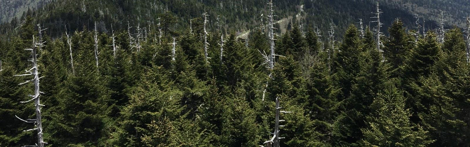
The forest up here is dominated by Fraser fir and red spruce, the classic high-elevation ecosystem of the southern Appalachians. It's a different world from the lower-elevation hardwood forests. The air is cooler, the light filters differently through the dense canopy, and the ground is carpeted with mosses and ferns. This ecosystem is also ecologically significant — the Fraser fir has faced serious pressure from the balsam woolly adelgid, an invasive insect, and the standing dead trees you'll see on the ridge are a visible reminder of that ongoing struggle.
The ridgeline trail is rocky and rooted in sections, typical of the AT through the Smokies. Footing requires attention, particularly when wet. Fog and clouds move through this high country frequently, which adds to the atmosphere but also means you should be prepared for reduced visibility and rapidly changing conditions.
Access and Trailheads
The most common approach to Mount Collins is from the Clingmans Dome trailhead, which is accessible via Clingmans Dome Road off Newfound Gap Road (US-441). From the Clingmans Dome parking area, hikers can connect to the Appalachian Trail and head southwest along the ridgeline toward Mount Collins. There is also a spur trail — the Mount Collins Spur — that connects the AT to the Sugarland Mountain Trail, giving hikers additional route options.
Clingmans Dome Road is typically closed from December 1 through March 31 due to winter conditions, which affects access to this trailhead seasonally. When the road is closed, reaching Mount Collins requires a significantly longer approach from Newfound Gap or other trailheads.
Mount Collins Shelter, a backcountry shelter located near the summit, is a key landmark for anyone planning an overnight trip along this section of the AT. Like all backcountry shelters in Great Smoky Mountains National Park, it requires a backcountry permit to use. Reservations can be made through the park's backcountry permit system.
Great Smoky Mountains National Park — What You Need to Know
Mount Collins is entirely within Great Smoky Mountains National Park. There is no entrance fee to access the park — it remains one of the few major national parks in the United States that does not charge admission. However, a backcountry permit is required for any overnight camping, including use of the Mount Collins Shelter.
Dogs are not permitted on trails within Great Smoky Mountains National Park. This is a firm park-wide rule, so leave your dog at home or at a pet-friendly accommodation outside the park boundary.
Cell service is unreliable to nonexistent along the high ridgeline. Download your maps offline before you go, and make sure someone knows your itinerary.
Wildlife and Natural Environment
The high-elevation spruce-fir zone along the Smokies ridgeline supports a distinct set of wildlife. Black bears are present throughout the park, including at higher elevations — proper food storage is mandatory, and bear canisters or the shelter's bear cables must be used for overnight trips. Wild boar have also historically impacted this area of the park.
Birders will find the high-elevation forest worth the effort. Species associated with the boreal-like conditions of the spruce-fir zone, including red-breasted nuthatches and various warblers, are present in this habitat. The ecological character of this ridgeline is genuinely different from what you find at lower elevations in the Smokies, and that distinction is part of what makes hiking here feel like a separate experience.
Tips for Hiking Mount Collins
- Start early. Afternoon thunderstorms are common in the Smokies, especially in summer. Being on the exposed ridgeline late in the day is not where you want to be when weather rolls in.
- Layer up. Temperatures at this elevation are noticeably cooler than in the valleys. Even on warm days, bring an extra layer — conditions can shift quickly.
- Check road status. Clingmans Dome Road closes seasonally. Confirm it's open before planning your trip if you're going outside the summer and fall window.
- Secure your food. Bear activity is real in this park. Use the shelter's bear cables or a canister — this isn't optional.
- Get your backcountry permit in advance. If you're planning an overnight at Mount Collins Shelter, permits are required and shelter space is limited. Book through the park's official system before your trip.
- Wear appropriate footwear. The rocky, rooted AT through this section demands solid trail shoes or boots with good grip, especially in wet conditions.
Why Mount Collins Stands Out on the Smokies Ridgeline
Mount Collins doesn't get the same name recognition as Clingmans Dome or Charlies Bunion, but that's part of its appeal. It sits in a stretch of the Appalachian Trail that rewards hikers who push past the most accessible viewpoints and into the quieter, wilder sections of the park's high country. The combination of the state-line ridgeline, the old-growth spruce-fir atmosphere, and the relative solitude compared to nearby landmarks makes this a destination worth seeking out for anyone who wants to experience the Smokies beyond the parking lots.
The Essential Hiking Checklist
Everything you need for your next hike. Bilingual, printable, 1 page.
Get your free hiking checklistRecommended gear for this trail
As an Amazon Associate I earn from qualifying purchases.


Ready to go?
Everything you need to know before you goWhen?
How much?
As an Amazon Associate I earn from qualifying purchases.
Affiliate links — LGPO may earn a commission at no extra cost to you.
- Hiking shoes Essential
- → Salomon Elixir Tour Mid WP · 203.38 $
- Layered clothing Essential
- Rain jacket Essential
- Trekking poles
- → Black Diamond Trail Ergo Cork · 69.99 $
- Headlamp
- → Petzl Actik Core 625 · 103.95 $
FAQ - Frequently asked questions
Everything you need to knowSimilar hikes nearby
Discover other trails you might enjoy

Hinch Mountain, Tennessee
East Tennessee
Alexander Knob, Tennessee
East Tennessee
Mount Chapman, North Carolina_Tennessee
East Tennessee
Cosby Knob, North Carolina_Tennessee
East Tennessee

Tricorner Knob, Tennessee_North Carolina
East Tennessee
John Muir Trail Tennessee
East Tennessee
Hiking near Pittsburgh
0 trails to explore ~619 km away
We work hard to provide the most up-to-date and error-free data possible. If something seems incorrect, let us know! Your contribution helps the whole community.
Hikers' opinions
Be the first to review!
No hiker has shared their experience yet. Share your impressions and help other hikers!