


Ready to explore Silver Star Trail? Here's everything you need to know before you go!
Discover the trail

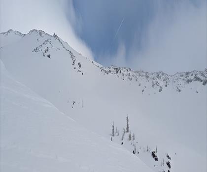
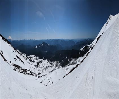
Photos: U.S. Forest Service- Pacific Northwest Region — Domaine public (Wikimedia Commons)
Trail description
Location and Approach
Silver Star Mountain is located near Yacolt, Washington, approximately 1 hour 45 minutes from Portland. The trail begins from the Silver Star North Trailhead at the south edge of the parking lot. The route climbs through open forest before joining an old jeep trail, eventually reaching a junction with Ed's Trail where hikers encounter the first of the scenic highlights: a fantastic view of Mt. Hood framed in a distinctive gap, with a huge cliff on the right and green mountains on the left.
The Terrain and Trail Character
Unlike typical Pacific Northwest hiking, Silver Star Mountain combines forested approaches with open alpine terrain and rocky scrambling sections. The trail ascends through mixed forest and meadow, transitioning to more exposed terrain with panoramic views of five Cascade volcanoes. The climb is steady and sustained, with elevation gains ranging from 1,240 to 1,460 feet depending on the route variant chosen.
The exposed scramble sections near the summit require careful footwork and moderate scrambling ability — the rocky summit block demands attention but remains accessible to hikers with solid basic skills. These scrambles are the defining feature of the upper mountain, providing the sense of accomplishment and adventure that makes the route memorable.
Seasonal Characteristics and Views
The best seasons for this hike are late spring through fall (May through November), with optimal conditions typically from summer into early fall when wildflowers may still be visible and weather is most stable. From elevated sections, you gain sweeping sightlines across the surrounding Cascade landscape and distant volcanic peaks. On clear days, the panoramic vistas are exceptional and reward the physical effort of the ascent.
The relatively open nature of portions of the trail — compared to heavily forested alternatives on the west side of the Cascades — means that weather exposure is genuine. Afternoon thunderstorms are possible, particularly in summer, and conditions can shift quickly. The lack of dense forest cover also means sun exposure is significant; expect to feel the warmth of direct sunlight throughout much of the hike.
Wildlife and Natural History
The semi-open forest and meadow habitat supports wildlife encounters including mule deer and various bird species. Raptors utilize the air currents around the mountain. The relative quiet of this trail — compared to heavily trafficked west-side routes — means wildlife and solitude are realistic parts of the experience.
Practical Information
- Water: There is no reliable water source along the route. Carry sufficient water for the entire hike, accounting for sun exposure and physical exertion, especially in summer.
- Sun Protection: The open sections provide minimal shade. Hat, sunscreen, and sun-protective clothing are essential.
- Footwear: Trail runners or light hiking boots with solid traction are appropriate. Rocky scramble sections benefit from good grip and ankle support.
- Weather Preparedness: Check the forecast before departing. Conditions can change rapidly, and afternoon thunderstorms are possible. Be prepared to descend if weather deteriorates.
- Crowding: This is a popular trail, particularly on weekends. Plan for shared trail experiences.
- Dogs: Dogs are welcome but must remain on leash at all times.
Getting There
Access is via vehicle to the Silver Star North Trailhead. Parking is available at the trailhead. Approach roads are generally well-maintained but may include unpaved sections; a standard passenger vehicle is typically adequate, though high clearance can be beneficial if conditions are rough.
Who This Trail Is For
Silver Star Mountain suits hikers comfortable with moderate scrambling, sustained elevation gain, and open alpine terrain. The route requires basic mountaineering skills and good weather judgment. It is not overly technical but does demand careful foot placement on rocky sections. Hikers with solid fundamentals and appropriate preparation will find this a deeply satisfying outing with rewarding summit views.
Recommended gear for this trail
As an Amazon Associate I earn from qualifying purchases.


Ready to go?
Everything you need to know before you goWhen?
How much?
As an Amazon Associate I earn from qualifying purchases.
Affiliate links — LGPO may earn a commission at no extra cost to you.
- Hiking shoes Essential
- → Salomon Elixir Tour Mid WP · 203.38 $
- Layered clothing Essential
- Rain jacket Essential
- Trekking poles
- → Black Diamond Trail Ergo Cork · 69.99 $
- Headlamp
- → Petzl Actik Core 625 · 103.95 $
FAQ - Frequently asked questions
Everything you need to know
25 hikes under 2 hours from Montreal
Distance, elevation, parking and season for each one. The ones we go back to ourselves.
Get the guideSimilar hikes nearby
Discover other trails you might enjoy

Hiking near Victoria
93 trails to explore ~307 km away
We work hard to provide the most up-to-date and error-free data possible. If something seems incorrect, let us know! Your contribution helps the whole community.
Hikers' opinions
Be the first to review!
No hiker has shared their experience yet. Share your impressions and help other hikers!