
Ready to explore Hurricane Ridge? Here's everything you need to know before you go!
Discover the trail



Available trails
| TrailTrails | Dist.Distance | GainElevation | Est. timeEstimated time | Difficulty | GPX |
|---|---|---|---|---|---|
|
|
0.8 km | 67 m | ≈ 17min | ||
|
|
2.62 km | 213 m | ≈ 55min | ||
|
|
6.12 km | — | |||
|
Beginner
|
0.4 km | — | Beginner | ||
|
Beginner
|
0.8 km | — | Beginner |
Trail description
A summer trailhead area in Olympic National Park
Hurricane Ridge is 17 miles south of Port Angeles on Hurricane Ridge Road, off Mount Angeles Road. According to the National Park Service (NPS), the road is open throughout summer, but it may be closed at any time because of weather conditions. The NPS notes a number of hiking trails here, from ridgetop traverses to steep trails. In winter, the Hurricane Ridge Winter Sports Club operates lifts when weather permits.
Trails from Hurricane Ridge
The NPS area brochure (last updated February 29, 2024) gives the following lengths, in miles and one way unless noted.
- Cirque Rim: 0.5 mi (0.80 km), easy paved trail, under 50 ft of elevation change; views of Port Angeles and the Strait of Juan de Fuca.
- Big Meadow: 0.25 mi (0.40 km), easy paved trail across open meadows with views of the Olympics; under 50 ft of elevation change.
- High Ridge: 0.5 mi (0.80 km) loop, partially paved, +220 ft (67 m); it climbs to 360° views and a 0.1 mi dead-end spur to Sunrise Point.
- Klahhane Ridge: 3.8 mi (6.12 km). The first 2.8 miles follow a ridge to a junction with the Klahhane Switchback Trail, with +250 ft (76 m) over that stretch. An additional mile on the Switchback Trail climbs 800 ft (244 m) to Klahhane Ridge.
- Hurricane Hill: paved trail, 1.6 mi, about +700 ft (213 m); described below.
- Wolf Creek: dirt trail that descends 8 mi (12.9 km), -3,772 ft, to Whiskey Bend in the Elwha Valley.
- Little River: dirt trail that descends 8 mi (12.9 km), -4,073 ft, to Little River Road.
- Hurricane Hill/Elwha: dirt trails that descend from Hurricane Hill through meadows and steep forested switchbacks, 6 mi (9.7 km), -5,250 ft, to the start of Whiskey Bend Road.
Hurricane Hill: the panorama
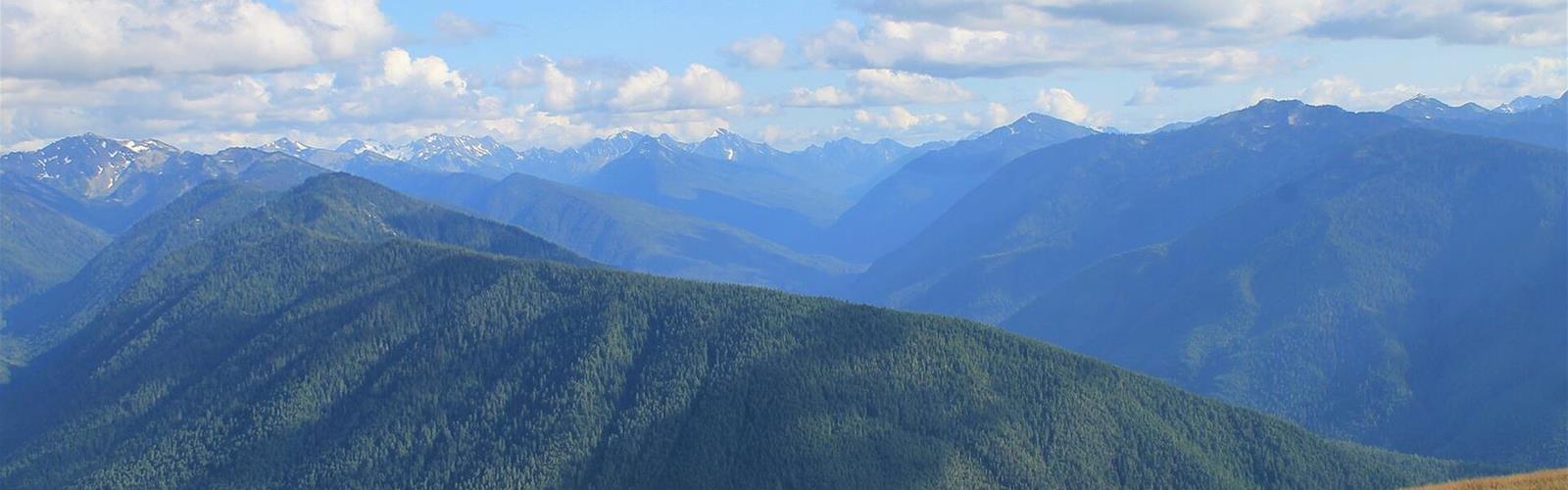
The NPS describes a paved trail that climbs to a panoramic view of mountains and saltwater: 1.6 mi one way (8,600 ft, or 2.62 km, in the park's accessibility information) with about 700 ft of climbing. The trailhead is at the end of Hurricane Hill Road, beyond the Hurricane Ridge parking area. At the top there are 360-degree views in clear weather, and views to the north of Griff Peak, Vancouver Island and the Strait of Juan de Fuca.
The grade is not uniform. According to NPS accessibility information, the typical running slope over the first 2,700 feet (about 820 m) is under 5%, with one 150-foot stretch at 7 to 9%. From 2,700 to 3,700 feet the trail is extremely steep, with grades of 10 to 18%. The NPS calls the hike strenuous past that point and suggests it as a place to consider turning back.
Snow, wind and weather
Hurricane Ridge receives 30 to 35 feet of snow a year, and the NPS says it lingers into summer; it asks visitors to stay on snow or on designated trails to protect the meadows. Winds gusting over 75 mph (120 km/h) buffet the ridge, which gave it its name.
Parking, services and rules
The area map shows the trails, parking and restrooms. Restrooms are available, but there is no gift shop or food service: the Hurricane Ridge Day Lodge burned down on May 7, 2023. Picnic Areas A and B (summer only), with paved trails, are one mile beyond the Hurricane Ridge parking area.
According to the NPS, Hurricane Hill Road (1.5 miles, not suitable for RVs or buses) leads from the Hurricane Ridge parking area to the Hurricane Hill trailhead. Overnight camping is not permitted in the Hurricane Ridge parking lots.
Pets and bicycles are not permitted on paved or dirt trails, and the NPS asks visitors not to take pets on any trails. The Olympic National Park entrance fee is US$30 per private vehicle, valid for seven days; the park does not accept cash.
Services and amenities
Everything you need for your next hike. Bilingual, printable, 1 page.
Get your free hiking checklistRecommended gear for this trail
As an Amazon Associate I earn from qualifying purchases.


Ready to go?
Everything you need to know before you goStarting Point
Hurricane Ridge is 17 miles south of Port Angeles on Hurricane Ridge Road, off Mount Angeles Road. The Hurricane Hill trail starts at the end of Hurricane Hill Road, beyond the Hurricane Ridge parking area.
When?
How much?
As an Amazon Associate I earn from qualifying purchases.
Affiliate links — LGPO may earn a commission at no extra cost to you.
- Hiking shoes Essential
- → Salomon Elixir Tour Mid WP · 203.38 $
- Layered clothing Essential
- Rain jacket Essential
- Trekking poles
- → Black Diamond Trail Ergo Cork · 69.99 $
- Headlamp
- → Petzl Actik Core 625 · 103.95 $
FAQ - Frequently asked questions
Everything you need to knowSimilar hikes nearby
Discover other trails you might enjoy

Hiking near Victoria
105 trails to explore ~52 km away
We work hard to provide the most up-to-date and error-free data possible. If something seems incorrect, let us know! Your contribution helps the whole community.
Hikers' opinions
Be the first to review!
No hiker has shared their experience yet. Share your impressions and help other hikers!