

Ready to explore Rogers Pass? Here's everything you need to know before you go!
Discover the trail
Trail description
Description
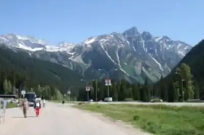
Rogers Pass sits at the heart of Glacier National Park in British Columbia's Kootenay Rockies, cutting through the Selkirk Mountains at 1,330 meters elevation. It's one of those places where Canadian history and raw mountain wilderness overlap in a way that's genuinely hard to find elsewhere. The pass has served as a transportation corridor for over a century, and today it functions as a trailhead hub giving hikers access to terrain that ranges from easy forested walks to serious alpine routes.
The Selkirks have a character distinct from the nearby Rocky Mountains. They receive enormous amounts of precipitation—much of it as snow—which feeds active glaciers visible from many trails and sustains dense old-growth forests in the valleys. The combination of ice, ancient trees, and dramatic peaks creates a hiking environment that feels both lush and austere depending on where you are on the mountain.
Getting Your Bearings
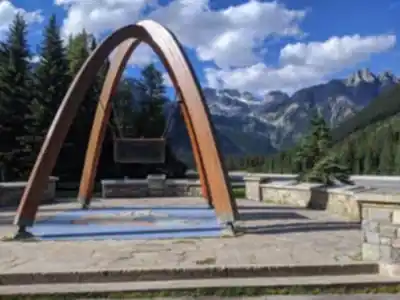
The Rogers Pass Discovery Centre is the natural starting point for any visit. It sits right at the pass and provides current trail conditions, weather updates, and detailed exhibits on the area's history. Before heading out on any route, it's worth stopping in—conditions here can shift quickly, and the staff are a reliable source of up-to-date information on what's accessible.
Most trails branch out from the Discovery Centre area, which makes logistics straightforward. Parking is available on-site, and the centre itself gives you a solid orientation to the landscape before you set foot on the trail.
The Loop Brook Trail
For a first visit or a shorter outing, the Loop Brook Trail is the go-to option. At 6 kilometers with only 133 meters of elevation gain, it's rated easy and takes around two hours to complete—a comfortable pace that leaves time to actually stop and look around rather than just moving through.
The trail follows an old Canadian Pacific Railway grade, which makes for smooth, even footing throughout. That railway history is woven into the walk itself: you'll pass concrete foundations and rusted remnants of historic trestles, physical evidence of the engineering effort that once pushed a rail line through this mountain corridor. The remnants are scattered enough that they feel like genuine discoveries rather than staged exhibits.
The forest along Loop Brook is the other defining feature. Massive western red cedars and western hemlocks create a canopy dense enough to feel cathedral-like, even on bright days. The trail runs alongside the brook for much of its length, so the sound of moving water is a constant companion. Several small waterfalls drop down the valley walls, and the overall atmosphere is cool and shaded—welcome on a warm summer day.
Beyond the Easy Routes
Rogers Pass offers considerably more than gentle valley walks for hikers looking to push further. The Asulkan Valley Trail is the main option for those wanting a real climb. It starts in dense forest and gains significant elevation as it follows the drainage of the Asulkan Glacier, gradually opening up into alpine terrain with views of surrounding peaks and the glacier itself.
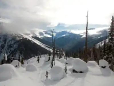
The character of the trail changes as you ascend. Lower sections move through old-growth forest before the route crosses avalanche paths where the trees give way to slide alder and open meadows. In summer, these clearings fill with wildflowers—Indian paintbrush, mountain aster, and fireweed among them—set against a backdrop of ice and rock. Higher up, the trail becomes rockier and more demanding, with loose terrain and potential snow coverage even in late summer. This is a route that rewards experience and proper preparation.
Wildlife
The elevation range around Rogers Pass supports a wide variety of wildlife. Mountain goats are among the most reliably spotted large mammals—their white coats stand out against dark rock faces on the slopes above treeline, and they tend to hold their ground rather than flee. Grizzly bears and black bears are both present in the area, particularly in late summer and fall when berry crops are abundant. Making noise on the trail and traveling in groups is standard practice here, not just a precaution.
Hoary marmots are common in the alpine zones, their sharp whistles carrying across open basins. Pikas inhabit the talus fields and rockslides. In the forests, gray jays and Clark's nutcrackers are frequent trail companions, while golden eagles and hawks work the higher elevations. The diversity reflects the range of habitats compressed into a relatively small area.
Historical Context
Rogers Pass was surveyed in 1881 by Major A.B. Rogers as part of the Canadian Pacific Railway's push to connect the country coast to coast. The rail line through the pass was completed in 1885, but the extreme avalanche hazard and relentless snowfall made it one of the most dangerous sections of track in North America. Numerous lives were lost to avalanches before the decision was made to abandon the surface route in favor of the Connaught Tunnel in 1916.
The Discovery Centre covers this history in depth, with exhibits on the engineering challenges, the avalanche disasters, and the eventual construction of the Trans-Canada Highway through the pass. The ongoing avalanche control programs that keep the highway open today are also part of the story—Rogers Pass remains one of the most actively managed avalanche zones in Canada.
When to Go
The reliable hiking window runs from late June through September. Early in the season, snowmelt feeds impressive waterfalls and the crowds are thinner, but higher routes may still be snow-covered or muddy. By mid-July, most trails are accessible and the wildflower season is underway, with blooms moving up in elevation as the snowpack retreats. September brings clearer skies and fall colors at lower elevations, though early snowfall is possible and conditions can deteriorate quickly.
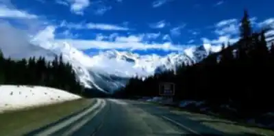
Weather at Rogers Pass is influenced directly by Pacific storm systems, and conditions can go from clear to stormy in a matter of hours. Layering appropriately and checking the forecast before heading out isn't optional here—it's just part of hiking in this part of the Selkirks.
Recommended gear for this trail


Ready to go?
Everything you need to know before you goStarting Point
To access the hiking trails, head to the rogers pass Discovery Centre located along the Trans-Canada Highway (Highway 1). The address is 9520 Trans-Canada Hwy, Glacier National Park, BC V0E 2S0. This serves as a primary starting point for various trailheads in the area. There are several parking lots available near the Discovery Centre where you can leave your vehicle before embarking on your hike.
When?
How much?
- Hiking shoes Essential
- → Salomon Elixir Tour Mid WP · 203.38 $
- Layered clothing Essential
- Rain jacket Essential
- Trekking poles
- → Black Diamond Trail Ergo Cork · 69.99 $
- Headlamp
- → Petzl Actik Core 625 · 103.95 $
FAQ - Frequently asked questions
Everything you need to knowThe Essential Hiking Checklist
Everything you need for your next hike. Bilingual, printable, 1 page.
Download the free checklistSimilar hikes nearby
Discover other trails you might enjoy

Emerald Lake
Kootenay Rockies

Golden Skybridge
Kootenay Rockies

Mount Stephen
Kootenay Rockies
Bugaboo Provincial Park
Kootenay Rockies
Magog, Lake
Kootenay Rockies
Iceline Trail
Kootenay Rockies
Hiking near Banff
187 trails to explore ~136 km away
We work hard to provide the most up-to-date and error-free data possible. If something seems incorrect, let us know! Your contribution helps the whole community.
Hikers' opinions