


Ready to explore Sechelt Inlet? Here's everything you need to know before you go!
Discover the trail
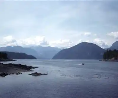
Trail description
Sechelt Inlet represents one of British Columbia's most spectacular fjord systems, carving deep into the Coast Mountains and offering outdoor enthusiasts a pristine wilderness experience. This dramatic waterway extends inland from the Strait of Georgia, creating a network of protected waters surrounded by towering peaks, dense coastal forests, and cascading waterfalls that define the rugged beauty of the Pacific Northwest.
Geography and Setting
The inlet stretches approximately 40 kilometers inland, forming a narrow corridor between steep mountain walls that rise dramatically from the water's edge. Ancient glacial activity carved this deep channel, leaving behind a landscape of granite cliffs, hanging valleys, and U-shaped formations that showcase the powerful forces that shaped this region. The surrounding peaks create a natural amphitheater, with elevations climbing rapidly from sea level to over 1,500 meters, providing a stunning backdrop for any outdoor adventure.
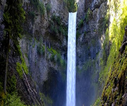
Dense temperate rainforest blankets the mountainsides, dominated by towering Douglas fir, western red cedar, and hemlock trees. The forest floor supports a rich understory of ferns, salmonberry, and devil's club, creating the lush green tapestry characteristic of coastal British Columbia. Numerous creeks and seasonal waterfalls cascade down the steep slopes, particularly impressive during spring snowmelt and autumn rains.
Access and Approach
Reaching Sechelt Inlet requires careful planning, as the area remains largely undeveloped and accessible primarily by water. Most visitors arrive by boat, kayak, or seaplane, launching from various points along the Sunshine Coast. The inlet's protected waters make it popular among sea kayakers seeking multi-day expeditions, though the scale and remoteness demand proper preparation and experience.
Several established camping areas and anchorages provide overnight options for those exploring the inlet's full length. The remote nature means visitors must be completely self-sufficient, carrying all necessary supplies including food, water purification, and emergency equipment.
Hiking Opportunities
While Sechelt Inlet itself is primarily a marine environment, the surrounding landscape offers numerous hiking possibilities for those willing to explore beyond established trails. Old logging roads provide access into the lower valleys, though many have become overgrown and require route-finding skills to navigate safely.
The steep terrain means most hiking involves significant elevation gain over relatively short distances. Creek beds and natural ridgelines offer the most feasible routes, though hikers should expect challenging conditions including dense vegetation, unstable slopes, and potentially dangerous creek crossings during high water periods.
Several prominent peaks surrounding the inlet attract experienced mountaineers and scramblers. These ascents typically involve bushwhacking through thick forest before emerging onto open slopes and rocky terrain near treeline. The rewards include spectacular views over the inlet system and surrounding Coast Mountain peaks.
Wildlife and Ecology
The inlet supports a diverse ecosystem both above and below the waterline. Black bears are common throughout the forested areas, particularly during salmon runs when they congregate near creek mouths. Mountain goats inhabit the higher elevations and steep cliff faces, while deer browse in the lower valleys and clearings.
Marine life thrives in the inlet's nutrient-rich waters. Seals and sea lions are frequently spotted, and orcas occasionally venture into the deeper sections. The protected waters provide important habitat for various seabird species, including cormorants, loons, and eagles that nest in the tall trees along the shoreline.
During salmon spawning seasons, the inlet comes alive with activity as various species return to their natal streams. This annual migration supports the entire ecosystem, from the bears and eagles that feast on the salmon to the forest itself, which benefits from the marine-derived nutrients.
Seasonal Considerations
Summer provides the most favorable conditions for exploring Sechelt Inlet, with stable weather patterns and warmer temperatures making water-based activities more comfortable. The long daylight hours of summer also provide extended time for exploration and photography.
Spring brings dramatic waterfalls as snowmelt swells the numerous creeks feeding into the inlet. However, this season also means higher water levels and potentially dangerous conditions for creek crossings and lower elevation hiking.
Fall offers spectacular colors as the deciduous trees and understory plants change, creating vibrant contrasts against the evergreen forest. Weather becomes more unpredictable during this season, with increased precipitation and the possibility of early snow at higher elevations.
Winter transforms the inlet into a stark but beautiful landscape, with snow-covered peaks reflected in the dark waters. However, severe weather, shortened daylight hours, and challenging access conditions make winter exploration suitable only for the most experienced and well-equipped adventurers.
Planning Your Visit
The remote nature of Sechelt Inlet demands thorough preparation and self-reliance. Weather conditions can change rapidly, and the steep terrain surrounding the inlet can create localized weather patterns that differ significantly from coastal forecasts. Visitors should carry appropriate gear for sudden temperature drops and precipitation.
Communication devices become essential given the area's remoteness and lack of cell coverage. Satellite communicators or emergency beacons provide crucial safety backup for those venturing into the backcountry areas surrounding the inlet.
Water sources are generally abundant, but proper filtration or purification is necessary. The numerous creeks and streams provide fresh water, though quality can vary depending on upstream conditions and seasonal factors.
Recommended gear for this trail
As an Amazon Associate I earn from qualifying purchases.


Ready to go?
Everything you need to know before you goWhen?
How much?
As an Amazon Associate I earn from qualifying purchases.
Affiliate links — LGPO may earn a commission at no extra cost to you.
- Hiking shoes Essential
- → Salomon Elixir Tour Mid WP · 203.38 $
- Layered clothing Essential
- Rain jacket Essential
- Trekking poles
- → Black Diamond Trail Ergo Cork · 69.99 $
- Headlamp
- → Petzl Actik Core 625 · 103.95 $
FAQ - Frequently asked questions
Everything you need to know
25 hikes under 2 hours from Montreal
Distance, elevation, parking and season for each one. The ones we go back to ourselves.
Get the guideSimilar hikes nearby
Discover other trails you might enjoy
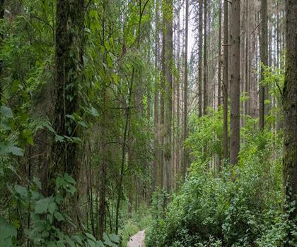
Bridle Path
Vancouver Coast Mountains
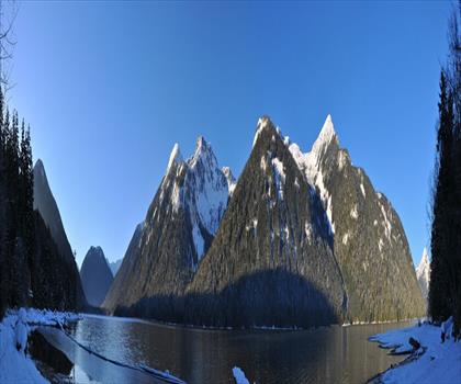
Flora Lake
Vancouver Coast Mountains

Alouette Mountain
Vancouver Coast Mountains
Williamson Lake
Vancouver Coast Mountains
Brandywine Mountain
Vancouver Coast Mountains

Coliseum Mountain
Vancouver Coast Mountains
Hiking near Nanaimo
212 trails to explore ~46 km away
We work hard to provide the most up-to-date and error-free data possible. If something seems incorrect, let us know! Your contribution helps the whole community.
Hikers' opinions
Be the first to review!
No hiker has shared their experience yet. Share your impressions and help other hikers!