
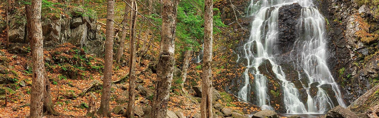

Ready to explore Hays Falls? Here's everything you need to know before you go!
Discover the trail
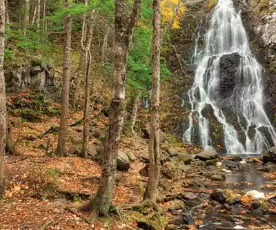
Photos: Nicolas Raymond from Bethesda, Maryland, USA — CC BY 2.0 (Wikimedia Commons)
Trail description
Hays Falls sits quietly in New Brunswick's Saint John River Valley, offering the kind of forest-and-water escape that feels substantial without eating up your whole day. Just a short drive from Woodstock, this 3.2-kilometer hike delivers you to a scenic waterfall in about 54 minutes of walking through genuine woodland terrain.
What sets Hays Falls apart is how it manages to feel remote and wild despite its accessibility. The 98 meters of elevation gain is spread out gently enough to keep this hike in easy territory, but the trail itself moves through legitimately rugged forest where you'll encounter roots, rocks, and the kind of uneven footing that reminds you you're in natural terrain, not on a groomed path.
The trail experience
The path to Hays Falls winds through dense forest where the canopy creates a natural tunnel effect, filtering sunlight into dappled patterns on the forest floor. You'll start on packed dirt that gradually becomes more challenging as roots snake across the trail and rocky sections require more attention to your footing. This isn't technical hiking, but it's genuine trail walking where sturdy boots make a real difference in your comfort and confidence.
The forest here feels alive in the way that less-trafficked areas do. Bird calls echo through the trees, and you'll notice the gradual shift in sound as you approach the water—the forest quiet giving way to the steady rush of the falls. The terrain rolls gently upward, with the elevation gain spread across the entire route rather than concentrated in steep sections, making it manageable for most fitness levels while still providing a sense of accomplishment.
As you near the falls, the character of the forest changes. The trees open up slightly, and you'll catch glimpses of the rocky terrain that frames the waterfall. The final approach involves navigating around larger rocks and potentially wet surfaces, where that careful footing becomes especially important.
At the waterfall
Hays Falls cascades over a series of rocky ledges into a crystal-clear pool that serves as the natural centerpiece of this forest clearing. The water drops cleanly over the rock shelves, creating both the visual drama of the falling water and the satisfying sound that makes this spot feel like a genuine retreat from everyday noise.
The rocky ledges around the falls provide multiple vantage points, so you're not stuck with a single viewing angle. You can position yourself for wide shots that capture the full cascade and surrounding forest, or move closer for detailed views of the water moving over the rock formations. The clear pool at the base reflects the surrounding greenery and creates additional photographic opportunities.
The area around the falls opens up enough to accommodate small groups without feeling crowded. There's room to spread out a picnic, sit on the rocks, or simply find your own spot to take in the scene. The combination of moving water, solid rock surfaces, and forest backdrop creates a natural amphitheater where you can settle in for as long as you want.
Seasonal considerations
Hays Falls offers year-round access, with each season bringing its own character to the experience. Summer visits provide the clearest views of the pool and the most refreshing mist from the falls after your walk through the forest. The water flow is typically strong, and the contrast between the cool, shaded forest and the open area around the falls is most pronounced.
Autumn transforms the forest approach into a corridor of vibrant color, with the mixed hardwood forest putting on a display that makes the walk as rewarding as the destination. The fallen leaves can make the trail more challenging in spots, requiring extra attention to footing, but the visual payoff is substantial.
Winter and spring each bring their own appeal—spring with higher water flow and the fresh green of new growth, winter with the stark beauty of the falls against snow-covered rocks and bare trees. The trail remains accessible, though winter conditions obviously require appropriate preparation and potentially different footwear choices.
Who should hike here
The easy difficulty rating combined with genuine forest terrain makes Hays Falls work for a broad range of hikers. Beginners will find it challenging enough to feel like a real hike without being overwhelming, while experienced hikers can enjoy it as a quick outing with a solid destination. The moderate length means it's not a huge time commitment, but the terrain and payoff are substantial enough to feel worthwhile.
Families with older children who are comfortable on uneven terrain will find this a good introduction to more natural trail conditions. The relatively short distance means energy levels are less of a concern, but the rocky areas around the falls require supervision and good judgment about where kids can safely explore.
For photographers, the combination of forest textures, rock formations, and moving water provides plenty of subject matter, while the variety of viewpoints around the falls allows for different compositions and lighting conditions throughout the day.
Practical preparation
Sturdy hiking boots are essential for this trail. The combination of roots, rocks, and potentially wet surfaces around the falls makes good footwear a safety issue as much as a comfort consideration. The rocky ledges near the waterfall can be slippery, and confident footing makes the difference between enjoying the area and worrying about your next step.
Pack water and snacks even for this relatively short hike. Having supplies allows you to take your time at the falls without feeling rushed to get back, and staying hydrated and energized makes the return trip more enjoyable. A small daypack keeps your hands free for balance on the more challenging sections of trail.
Consider bringing a camera or phone in a protective case, as the mist around the falls can create moisture issues for electronics. The photographic opportunities are worth capturing, but protecting your equipment lets you focus on enjoying the experience rather than worrying about your gear.
The leave-no-trace principle is especially important at destinations like Hays Falls that maintain their appeal partly through feeling undeveloped and natural. Pack out everything you bring in, stay on established trails, and avoid disturbing the rock formations or water features that make this spot special for other visitors.
The Essential Hiking Checklist
Everything you need for your next hike. Bilingual, printable, 1 page.
Get your free hiking checklistRecommended gear for this trail
As an Amazon Associate I earn from qualifying purchases.


Ready to go?
Everything you need to know before you goStarting Point
The easiest way to get to the start of the trails at the hays falls is to drive to the town of Haysville, which is located on Route 845 in New Brunswick. Once you reach Haysville, you will need to park your car and then walk to the falls. The walk from the parking lot to the falls is about 10 minutes.
When?
How much?
As an Amazon Associate I earn from qualifying purchases.
Affiliate links — LGPO may earn a commission at no extra cost to you.
- Hiking shoes Essential
- → Salomon Elixir Tour Mid WP · 203.38 $
- Layered clothing Essential
- Rain jacket Essential
- Trekking poles
- → Black Diamond Trail Ergo Cork · 69.99 $
- Headlamp
- → Petzl Actik Core 625 · 103.95 $
FAQ - Frequently asked questions
Everything you need to knowSimilar hikes nearby
Discover other trails you might enjoy

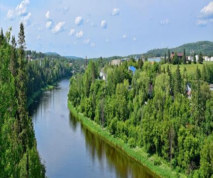
Hiking near Fredericton
11 trails to explore ~71 km away
We work hard to provide the most up-to-date and error-free data possible. If something seems incorrect, let us know! Your contribution helps the whole community.
Hikers' opinions
Be the first to review!
No hiker has shared their experience yet. Share your impressions and help other hikers!