

Ready to explore Mountain Road? Here's everything you need to know before you go!
Discover the trail
Trail description
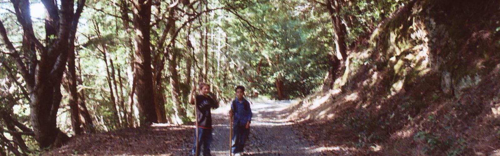
Mountain Road on the Glooscap Trail is a solid moderate hike that earns its reputation through a combination of varied terrain, steady elevation gain, and views that open up in a genuinely satisfying way as you climb. At 9 kilometers with 300 meters of elevation gain, it's the kind of trail that gives you a real workout without being punishing — plan for about 3 hours and 45 minutes on the trail.
What the Trail Is Like
The hike starts on gentler ground, which works in your favor. Your legs get a chance to settle in before the trail asks more of you in the middle sections, where the elevation gain becomes more consistent and the terrain gets a bit more technical. Rocky stretches and root-crossed paths keep you paying attention underfoot, and after wet weather, expect some muddy patches that can make footing slippery.
As you gain elevation, the forest character shifts noticeably. The lower sections move through dense canopy where the light filters down in patches and the air stays cool even on warmer days. Higher up, the trees thin out and the landscape opens, giving you a clearer sense of where you are and how far you've come. That transition — from enclosed forest to open ridge — is one of the more satisfying moments the trail delivers.
The 9-kilometer distance means you're out there long enough to really settle into the hike. This isn't a quick out-and-back where you barely have time to find your rhythm. By the time you reach the upper sections, you've earned the views.
The Views
Several overlooks punctuate the upper portion of Mountain Road, each positioned to take advantage of the rolling landscape that defines this part of Nova Scotia. From these spots, you can see how the forested valleys fold between hills, creating the layered, textured scenery that makes the Glooscap Trail region worth the drive. On a clear day, the views stretch far enough to give you a real sense of scale.
These overlooks are also the natural places to stop, eat something, and take your time. They're spaced well enough that you don't feel like you're rushing between rest stops, and they offer enough variety in perspective that each one feels worth pausing at rather than just checking off.
Wildlife Along the Way
The trail moves through enough different habitat zones that wildlife sightings are a genuine possibility rather than a long shot. White-tailed deer show up most often during early morning or late afternoon hikes, particularly in the transition areas between forest and more open terrain. Red foxes are present in the area, though they tend to stay out of sight — muddy sections of trail are often where you'll find their tracks rather than the animals themselves.
Bird activity is consistent throughout the hike. Woodpeckers and nuthatches are regulars in the lower forested sections, while the more open upper terrain attracts species that prefer edge habitats. If you're moving quietly and not in a rush, you'll notice more.
The Glooscap Connection
The trail system takes its name from Glooscap, a central figure in Mi'kmaq tradition — a transformer who shaped the landscape and passed on knowledge about living in relationship with the natural world. That connection isn't just a naming convention. This region has been home to Mi'kmaq people for thousands of years, and the landscapes you're moving through carry that history. It's worth holding onto as you hike, especially when you're standing at an overlook looking out over terrain that has been known and traveled long before any trail was marked.
What to Bring
Hiking boots with solid ankle support are the right call here. The mix of rocky sections, roots, and potential mud means trail runners are workable but boots give you more confidence on the trickier stretches. Bring more water than you think you need — the steady elevation gain over 9 kilometers adds up, and there's no reliable water source on trail.
Pack layers even if the forecast looks warm. Elevation and Nova Scotia's coastal weather patterns mean conditions can shift faster than expected, and being caught underdressed on an exposed ridge is an unpleasant way to end an otherwise good day out.
A camera is worth the extra weight given the overlooks, but the views are good enough that you'll want to spend time actually looking rather than just shooting — give yourself permission to do both.
The Essential Hiking Checklist
Everything you need for your next hike. Bilingual, printable, 1 page.
Get your free hiking checklistRecommended gear for this trail
As an Amazon Associate I earn from qualifying purchases.


Ready to go?
Everything you need to know before you goStarting Point
The mountain road is located in the town of Truro, Nova Scotia. To get to the start of the trails, take exit 14 from Highway 102 and head east on the mountain road. The trailhead is located at the end of the road.
When?
How much?
As an Amazon Associate I earn from qualifying purchases.
Affiliate links — LGPO may earn a commission at no extra cost to you.
- Hiking shoes Essential
- → Salomon Elixir Tour Mid WP · 203.38 $
- Layered clothing Essential
- Rain jacket Essential
- Trekking poles
- → Black Diamond Trail Ergo Cork · 69.99 $
- Headlamp
- → Petzl Actik Core 625 · 103.95 $
FAQ - Frequently asked questions
Everything you need to knowSimilar hikes nearby
Discover other trails you might enjoy

Gully Lake
Northumberland Shore
Black Brook Falls
Northumberland Shore
Wentworth Falls
Northumberland Shore
Trenton Park
Northumberland Shore
Caribou/Munroes Island Provincial Park
Northumberland Shore
Melmerby Beach Provincial Park
Northumberland Shore
Hiking near Truro
70 trails to explore ~40 km away
We work hard to provide the most up-to-date and error-free data possible. If something seems incorrect, let us know! Your contribution helps the whole community.
Hikers' opinions
Be the first to review!
No hiker has shared their experience yet. Share your impressions and help other hikers!