

Ready to explore Wentworth Falls? Here's everything you need to know before you go!
Discover the trail
Trail description
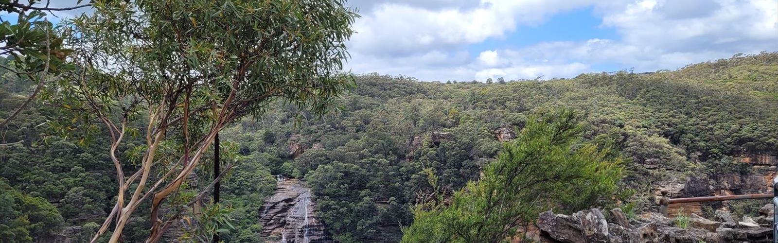
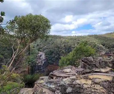
Wentworth Falls is an easy out and back walk from Highway 4 roadside to a scenic waterfall. The main trail itself is flat and very short, leading quickly to the falls with minimal elevation gain. For those seeking more challenge, an optional path on the left of the falls allows you to climb the hill, with a rope near the top to assist on loose rock sections. This optional route provides additional elevation gain for hikers wanting to extend the experience.
The falls themselves are the main draw, tumbling down rocky ledges. Multiple viewing platforms provide different perspectives of the cascade without competing for the single best spot.
The Trail
The route is well-marked with solid footing, though sections near the falls can be slippery when wet — worth keeping in mind if you're bringing kids or hiking after rain.
Most reasonably active hikers will complete the out-and-back in around 1.5 hours, with time built in for stops at the falls. Solid footwear with grip is recommended on rocky sections near the cascade.
Optional Summit Route
An unmarked path on the left of the falls allows hikers to climb the hill with additional elevation gain. A rope near the summit assists on loose rock sections. This extension is suitable for those comfortable with basic scrambling and loose terrain.
Seasonal Considerations
Spring is when the falls run at their strongest, fed by snowmelt from the surrounding hills. The water volume is noticeably higher than in late summer, and the forest floor comes alive with early growth.
Fall brings color contrast that makes this kind of hike particularly photogenic — the golden and red foliage against the white water is a combination that's hard to beat.
Winter hiking here is possible but requires preparation. Snow covers the trail and ice can form around the falls and on exposed ledges. Appropriate footwear with traction is essential.
Summer is the most popular season, though the falls may run lower by late August depending on rainfall. The shaded forest trail makes the heat manageable.
What to Know Before You Go
The main hike is rated easy with short distance and clear trail marking. Solid footwear with grip is always a better choice than sandals or flat-soled shoes on this terrain.
Wentworth Falls sits within the broader Glooscap Trail region. The waterfall hike works well as a standalone outing or as part of a longer day exploring what the region has to offer.
The Essential Hiking Checklist
Everything you need for your next hike. Bilingual, printable, 1 page.
Get your free hiking checklistRecommended gear for this trail
As an Amazon Associate I earn from qualifying purchases.


Ready to go?
Everything you need to know before you goStarting Point
The easiest way to get to the start of the trails at the wentworth falls is to drive there.
When?
How much?
As an Amazon Associate I earn from qualifying purchases.
Affiliate links — LGPO may earn a commission at no extra cost to you.
- Hiking shoes Essential
- → Salomon Elixir Tour Mid WP · 203.38 $
- Layered clothing Essential
- Rain jacket Essential
- Trekking poles
- → Black Diamond Trail Ergo Cork · 69.99 $
- Headlamp
- → Petzl Actik Core 625 · 103.95 $
FAQ - Frequently asked questions
Everything you need to knowSimilar hikes nearby
Discover other trails you might enjoy

Gully Lake
Northumberland Shore
Black Brook Falls
Northumberland Shore
Melmerby Beach Provincial Park
Northumberland Shore
Trenton Park
Northumberland Shore

Caribou/Munroes Island Provincial Park
Northumberland Shore
Amherst Shore Provincial Park
Northumberland Shore
Hiking near Truro
70 trails to explore ~33 km away
We work hard to provide the most up-to-date and error-free data possible. If something seems incorrect, let us know! Your contribution helps the whole community.
Hikers' opinions
Be the first to review!
No hiker has shared their experience yet. Share your impressions and help other hikers!