
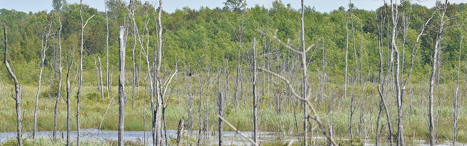
Ready to explore MacGregor Point Provincial Park? Here's everything you need to know before you go!
Discover the trail
Available trails
| TrailTrails | Dist.Distance | GainElevation | Difficulty | GPX |
|---|---|---|---|---|
|
Beginner
|
1.6 km | — | Beginner | |
|
Beginner
|
4.7 km | — | Beginner | |
|
Beginner
|
1.2 km | — | Beginner | |
|
Beginner
|
0.8 km | — | Beginner | |
|
Beginner
|
7.2 km | — | Beginner | |
|
Beginner
|
1.2 km | — | Beginner | |
|
Beginner
|
3.5 km | — | Beginner | |
|
Intermediate
|
3.8 km | — | Intermediate |
Trail description
The trails
These are the hiking trails on Ontario Parks' Activities page.
- Tower Trail: 3.5 km, loop, easy. It circles the Ducks Unlimited Canada Wetland, with a two-storey observation tower and a bird hide at water level. Compacted gravel and boardwalk. The first 1.2 km carry the Forest Therapy Trail signs.
- Huron Fringe Trail: 1.2 km, loop, easy. Boardwalk past Turtle Pond and Ash Swamp, with viewing platforms and interpretive signs. Accessible for people with disabilities.
- Old Shore Road Trail: 7.2 km, linear, easy. A shoreline trail linking the park's north and south borders, with viewing platforms at Pitcher Plant Marl, Seiche Pond, Cranberry Bog and Watersnake Pond.
- Deer Run Trail: 4.7 km, loop, easy. It crosses the park interior and connects the main entrance, the three campgrounds and the Park Store. Its extension (1.6 km) links to the Rotary Way and Gore Drain trails toward Port Elgin.
- Lake Ridge Trail: 3.8 km, loop, moderate. It follows a shoreline ridge of glacial Lake Nipissing, with a boardwalk over a former beaver pond. Rough terrain, sturdy shoes recommended; bicycles not permitted.
- Kempf's Trail: 0.8 km, easy, connects the main park road to Old Shore Road. Rotary Way: 1.2 km, easy, links the park to Port Elgin through wooded areas and county road crossings.
Birds and wetlands
Ontario Parks cites the park for migrating birds, including Black-crowned Night Heron and American Egret. The Huron Fringe Birding Festival is held in spring.
Beaches and dogs
The park has no buoyed swimming areas and no lifeguards. The Day Use Beach is about 50 m long, sandy with rocky sections; Camper's Beach is wide and sandy; the Huron Campground Beach is very rocky. Ontario Parks counts one dog beach and one pet exercise area. The Activities page allows leashed dogs (6 ft maximum) at the Day Use Beach and the Huron Campground Beach but not at Camper's Beach, while the general rule bans dogs from beaches except the designated one: check with the park before bringing a dog.
Winter
Cross-country skiing is on Deer Run (4.6 km, loop, easy) and Tomsett (5.9 km, loop, easy), track-set when conditions allow; dogs are prohibited when the ski trails are open. Snowshoeing and hiking are permitted on trails that are not track-set. Two skating surfaces, lit until 10 p.m.: a 400 m trail in the Cedar Lane section of Algonquin Campground and an ice pad at the Visitor Centre. Skating parking uses two-hour timeslots, reservable up to five days ahead. Cross-country skiing fees are included in the daily vehicle permit.
Permit and facilities
Every vehicle in the park needs a valid permit (digital or physical) and must park in a designated area (minimum fine $30 otherwise). The daily permit amount is not published for this park: call 519-389-9056. The park has seven comfort stations, a park store, a Visitor Centre and three playgrounds. No equipment rentals are offered in the park (bikes, skis, snowshoes, skates); the Activities page says outfitters in the area rent canoes, kayaks and paddleboards.
Services and amenities
Everything you need for your next hike. Bilingual, printable, 1 page.
Get your free hiking checklistRecommended gear for this trail
As an Amazon Associate I earn from qualifying purchases.


Ready to go?
Everything you need to know before you goStarting Point
1593 Bruce Road 33, Port Elgin, Ontario. The park is just south of Port Elgin. Ontario Parks gives no detailed directions; the map point is on the park access road, near the entrance.
When?
Park open January 1 to December 31, 2026. Ontario Parks publishes no hours for facilities.
How much?
As an Amazon Associate I earn from qualifying purchases.
Affiliate links — LGPO may earn a commission at no extra cost to you.
- Hiking shoes Essential
- → Salomon Elixir Tour Mid WP · 203.38 $
- Layered clothing Essential
- Rain jacket Essential
- Trekking poles
- → Black Diamond Trail Ergo Cork · 69.99 $
- Headlamp
- → Petzl Actik Core 625 · 103.95 $
FAQ - Frequently asked questions
Everything you need to knowOutings near MacGregor Point Provincial Park
Discover other trails you might enjoy
Inverhuron Provincial Park
Bruce Peninsula, Southern Georgian Bay and Lake Simcoe · 16.5 km away
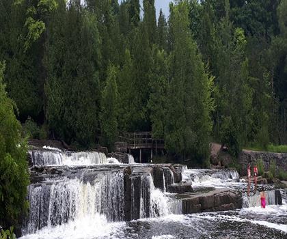
Sauble Falls Provincial Park
Bruce Peninsula, Southern Georgian Bay and Lake Simcoe · 32.9 km away
Inglis Falls Conservation Area
Bruce Peninsula, Southern Georgian Bay and Lake Simcoe · 43.2 km away
Harrison Park
Bruce Peninsula, Southern Georgian Bay and Lake Simcoe · 43.8 km away

Story Book Park
Bruce Peninsula, Southern Georgian Bay and Lake Simcoe · 47.0 km away
Walters Falls
Bruce Peninsula, Southern Georgian Bay and Lake Simcoe · 60.1 km away
Hiking near Kitchener
144 trails to explore ~132 km away
We work hard to provide the most up-to-date and error-free data possible. If something seems incorrect, let us know! Your contribution helps the whole community.
Hikers' opinions
Be the first to review!
No hiker has shared their experience yet. Share your impressions and help other hikers!