
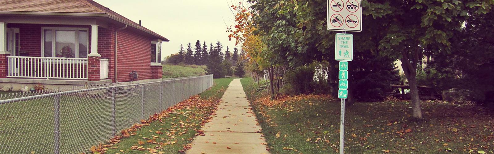

Ready to explore Grand Trunk Trail? Here's everything you need to know before you go!
Discover the trail
Photos: Muhammad Imran Saeed from City of London, Canada — CC BY 2.0 (Wikimedia Commons)
Trail description
The Grand Trunk Trail is a historic rail trail located in Southwest Ontario, Canada. Built along a former Grand Trunk Railway corridor, this trail offers a flat, accessible route that connects communities and natural areas across the region. Whether you're out for a casual walk, a bike ride, or a longer outing on foot, the Grand Trunk Trail delivers a relaxed, low-key experience that's well-suited to a wide range of users.
The Trail Experience
What makes the Grand Trunk Trail stand out in Southwest Ontario is its railway heritage. The old rail bed provides a consistently level surface, which means no significant climbs or descents — just a straightforward, easygoing path that lets you focus on the scenery and the rhythm of the walk. The corridor winds through a mix of open farmland, woodlots, and small-town edges, giving you a genuine feel for the rural landscape of this part of Ontario.
The trail surface varies along its length, transitioning between packed gravel, crushed limestone, and natural surfaces depending on the section you're on. This makes it accessible for most fitness levels and suitable for families with kids, older adults, and anyone looking for a relaxed outing without technical terrain.
Railway Heritage
The Grand Trunk Trail follows the route of the old Grand Trunk Railway, one of Canada's earliest and most significant rail networks. Walking or cycling this corridor, you're literally tracing the path that once connected communities across Ontario by steam locomotive. Old railway infrastructure — including remnants of the original rail bed and occasional historical markers — adds a layer of interest to the journey that goes beyond just the natural surroundings.
This historical context is part of what gives the trail its identity. It's not just a converted path; it's a piece of Ontario's transportation history that's been repurposed for public recreation, and that story is woven into the landscape the whole way through.
Terrain and Surroundings
The landscape along the Grand Trunk Trail reflects the character of Southwest Ontario's agricultural heartland. Open fields stretch out on either side of the corridor in many sections, with hedgerows and tree lines breaking up the view. Woodlot sections offer shade and a change of pace, with the canopy closing in and the light filtering through depending on the season.
Because the trail follows a former railway corridor, it cuts through the landscape in a very direct, linear way — you get long sightlines in both directions, which gives the trail an open, unhurried feel. It's the kind of place where you can see a long way ahead and just settle into a comfortable pace.
Who It's For
The Grand Trunk Trail is a strong choice for:
- Families with young children — the flat terrain and wide path make it manageable for little legs and strollers
- Cyclists — the rail trail format is well-suited to cycling, and the level grade keeps it accessible for casual riders
- Hikers looking for an easy outing — no technical skills required, just comfortable footwear and a willingness to cover some ground
- History enthusiasts — the railway heritage adds genuine interest for anyone curious about Ontario's past
- Dog walkers — the open corridor and manageable terrain make it a practical choice for getting out with a dog
Practical Information
The Grand Trunk Trail is a multi-use trail, meaning you'll share the path with cyclists, walkers, and potentially other non-motorized users. Keep that in mind when planning your outing — especially on weekends when the trail tends to see more traffic near community access points.
Access points are distributed along the trail's length, allowing you to join the route at multiple locations rather than committing to a single trailhead. This flexibility is useful if you want to do an out-and-back of a specific length or if you're planning a point-to-point trip with a vehicle shuttle.
The trail is generally open year-round, though conditions underfoot will vary significantly by season. In winter, sections may be snow-covered or icy, so appropriate footwear matters. Spring can bring soft or muddy patches, particularly in lower-lying areas. Summer and fall tend to offer the most consistent conditions for walking and cycling.
What to Bring
- Water — services are limited along the corridor, so carry enough for your planned distance
- Sun protection — open sections of the trail offer little shade, especially in summer
- Appropriate footwear — trail runners or sturdy walking shoes work well; road shoes are fine on the harder-packed sections
- A map or downloaded route — cell coverage can be inconsistent in rural areas, so having your route saved offline is a good habit
Getting There
The Grand Trunk Trail is located in Southwest Ontario and can be accessed from several communities along its route. Check local trail maps or the trail's managing organization for current access point locations, parking availability, and any seasonal closures or maintenance updates before heading out.
The trail sits within a region that's well-connected by provincial highways, making it reachable from larger centres in Southwest Ontario without a long drive.
A Note on the Trail's Character
The Grand Trunk Trail isn't the kind of place that's going to challenge you physically or leave you breathless at a summit viewpoint. What it offers instead is something different — a long, open corridor through a working rural landscape, with a genuine piece of Ontario history running beneath your feet. It's the kind of trail that rewards a slower pace and a bit of curiosity about the land and the communities it passes through.
For anyone in Southwest Ontario looking for an accessible, historically grounded outing that works for the whole family or a casual afternoon on the bike, the Grand Trunk Trail is a solid and worthwhile option.
The Essential Hiking Checklist
Everything you need for your next hike. Bilingual, printable, 1 page.
Get your free hiking checklistRecommended gear for this trail
As an Amazon Associate I earn from qualifying purchases.


Ready to go?
Everything you need to know before you goWhen?
How much?
As an Amazon Associate I earn from qualifying purchases.
Affiliate links — LGPO may earn a commission at no extra cost to you.
- Hiking shoes Essential
- → Salomon Elixir Tour Mid WP · 203.38 $
- Layered clothing Essential
- Rain jacket Essential
- Trekking poles
- → Black Diamond Trail Ergo Cork · 69.99 $
- Headlamp
- → Petzl Actik Core 625 · 103.95 $
FAQ - Frequently asked questions
Everything you need to knowSimilar hikes nearby
Discover other trails you might enjoy
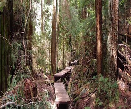
Lynn Valley Trails
Southwest Ontario
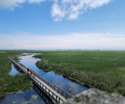
Point Pelee National Park High Point, Ontario
Southwest Ontario
Oxford Thames River Trail
Southwest Ontario

Pinery Provincial Park
Southwest Ontario
Ojibway Prairie Provincial Nature Reserve
Southwest Ontario
Springbank Park
Southwest Ontario
Hiking near Sydney
22 trails to explore ~7567 km away
We work hard to provide the most up-to-date and error-free data possible. If something seems incorrect, let us know! Your contribution helps the whole community.
Hikers' opinions
Be the first to review!
No hiker has shared their experience yet. Share your impressions and help other hikers!