
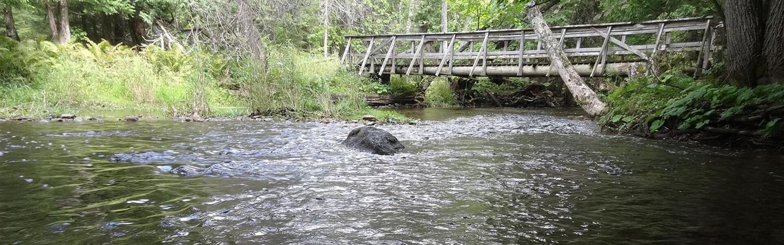

Ready to explore Boyne Valley Provincial Park? Here's everything you need to know before you go!
Discover the trail
Available trails
| TrailTrails | Dist.Distance | GainElevation | TimeDuration | Difficulty | GPX |
|---|---|---|---|---|---|
|
|
2.7 km | — | 36min | ||
|
|
6.3 km | — | 1h30 | ||
|
|
0.07 km | — | 15min |
Trail description
A park without facilities
Boyne Valley is a Natural Environment class park, established in 1985, covering 431 hectares. Ontario Parks describes it as a non-operating park: no facilities other than hiking trails. The Boyne River flows east through the Orangeville and Singhampton moraines. The park has hardwood forest, open fields, bottomland and swamp. Hunting is not permitted; fishing is.
The Bruce Trail loop
The Bruce Trail crosses the park and, according to Ontario Parks, gives access to an excellent lookout in the northern part. A 6.3 km loop, hiked by the author of the Ontario Hiking guide, combines the Bruce Trail (white blazes) and the Boyne Valley Side Trail (blue blazes, 2.7 km). Allow about 2 hours, not counting photo stops. The loop crosses four bridges and 60 m of boardwalk over the Boyne River and its wider sections. Another guide, Ontario Nature Trails, mentions a steep ravine descent before the blue side trail's junction, 1.2 km from the start, and advises checking an up-to-date Bruce Trail guide before you go.
Murphy's Pinnacle
From the Bruce Trail, a 70 m side trail leads to Murphy's Pinnacle, a small grassy hill and one of the highest points on the Primrose Moraine, formed by glacial retreat over 12,000 years ago. The view is panoramic; Toronto may be visible on a clear day. LGPO's pages on this lookout are linked below.
The Primrose extension
The Ontario Hiking guide also mentions the Primrose Loop Side Trail (4.3 km extra), which it did not hike. On OpenStreetMap, a segment named "Primrose Loop" is tagged "no access": check on the ground or with the Bruce Trail before planning it. This page does not count it in the loop.
Parking and markers
The main parking area is at the end of Centre Road, south of Side Road 5, with room for about ten vehicles. From the lot, walk about 100 m south to reach the main Bruce Trail. There is no staff, no washroom and no fee posted by Ontario Parks. According to Ontario Hiking, no trail map is posted on site: bring your own. To reach Ontario Parks: (705) 435-2498 (mail: c/o Earl Rowe Provincial Park, PO Box 872, Alliston, ON L9R 1W1).
Dogs and rules
Ontario Parks welcomes dogs in all its parks, on a leash no longer than 2 m, except on beaches and in posted areas. The Boyne Valley page says nothing specific about dogs. Stay on the marked trails.
Services and amenities
No services: non-operating park, with no staff or washrooms.
This information may vary by season.
The Essential Hiking Checklist
Everything you need for your next hike. Bilingual, printable, 1 page.
Get your free hiking checklistRecommended gear for this trail
As an Amazon Associate I earn from qualifying purchases.


Ready to go?
Everything you need to know before you goStarting Point
At the end of Centre Road, south of Side Road 5. According to Ontario Parks, the park is about 20 km north of Orangeville and 4 km east of Shelburne. From the lot, 100 m south leads to the main Bruce Trail; follow the white blazes.
When?
How much?
As an Amazon Associate I earn from qualifying purchases.
Affiliate links — LGPO may earn a commission at no extra cost to you.
- Hiking shoes Essential
- → Salomon Elixir Tour Mid WP · 203.38 $
- Layered clothing Essential
- Rain jacket Essential
- Trekking poles
- → Black Diamond Trail Ergo Cork · 69.99 $
- Headlamp
- → Petzl Actik Core 625 · 103.95 $
FAQ - Frequently asked questions
Everything you need to knowAlternatives and suggestions
For the lookout alone, see Murphy's Pinnacle Lookout and Murphys Pinnacle, Ontario. They describe the same viewpoint, inside the park.
Similar hikes nearby
Discover other trails you might enjoy
North Maple Regional Park
York, Durham and Headwaters
Murphys Pinnacle, Ontario
York, Durham and Headwaters
Vicki Barron Lakeside Trail
York, Durham and Headwaters

Hockley Valley
York, Durham and Headwaters

Eldred King Woodlands
York, Durham and Headwaters
Wismer Park
York, Durham and Headwaters
Hiking near Barrie
146 trails to explore ~46 km away
We work hard to provide the most up-to-date and error-free data possible. If something seems incorrect, let us know! Your contribution helps the whole community.
Hikers' opinions
Be the first to review!
No hiker has shared their experience yet. Share your impressions and help other hikers!