Hiking Parc Linéaire Le P'tit Train du Nord - panoramic view  tree outdoor landscape nature mountain sky autumn plant cloud background lake painting forest surrounded distance
--°C
Loading...
See forecast →

Hiking in Parc Linéaire Le P'tit Train du Nord: trails, map and practical info

Laurentides • Quebec

4.6 Appreciated by 14 hikers
François Dumaine
By François DumaineContributor since 2015Updated 23/06/2026
Difficulty
Easy
Distance
232 km
Elevation
195 ft
Duration
Variable selon section
Max altitude
200 ft

Built on a historic railway corridor, this 232 km linear trail through Quebec's Laurentides offers easy hiking with minimal elevation gain. Progress through forests, lakes, and charming villages at your own pace—multiple access points let you choose your distance.

Recommended for :
Beginners

Ready to explore Parc Linéaire Le P'tit Train du Nord? Here's everything you need to know before you go!

Discover the trail

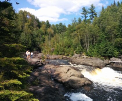
Oh no! We don't have any photos 😢

This trail hasn't been captured yet. Be the first to share your adventure!

Trail description

{
"distance_paragraph": "

Stretching over 234 kilometers, Parc Linéaire Le P'tit Train du Nord is one of the longest linear parks in Canada. Because it's built on an old rail bed, the route is generally gentle and accessible — the elevation change along the corridor stays around 200 meters across the full length, which means you're rarely dealing with anything steep.

"
}

Services and amenities

Parking Icon Parking

This information may vary by season.

Recommended gear for this trail

LGPO Pick
Elixir Tour Mid WP
Salomon
Elixir Tour Mid WP
4.5 (2847 reviews)
Waterproof mid-height boot ideal for rocky terrain
203.38 $
See price
Daylite Plus 20L
Osprey
Daylite Plus 20L
4.7 (3215 reviews)
Lightweight and versatile for day hikes
109.99 $
See price
Most Popular
Wide Mouth 1L
Nalgene
Wide Mouth 1L
4.8 (12540 reviews)
Unbreakable and BPA-free — a hiking essential
23.11 $
See price
Best Value
Trail Ergo Cork
Black Diamond
Trail Ergo Cork
4.4 (1456 reviews)
Comfortable cork grip for long ascents
69.99 $
See price
Actik Core 625
Petzl
Actik Core 625
4.6 (1893 reviews)
USB rechargeable with 600 lumens for early starts
103.95 $
See price
Affiliate links — LGPO may earn a commission at no extra cost to you.

Ready to go?

Everything you need to know before you go

Where?

Address
Not available
GPS coordinates
46.2032715, -74.68450059999999
Phone
Not available

Starting Point

To access the hiking trails, you can start at several trailheads along the route. Here are some options:

  1. Saint-Jérôme Trailhead: Located at 160 Rue de la Gare, Saint-Jérôme, QC J7Z 2C2. This is a popular starting point with parking available nearby.

  2. Sainte-Adèle Trailhead: You can begin your hike from this location at 1000 Rue Valiquette, Sainte-Adèle, QC J8B 2M3. Parking facilities are accessible here as well.

  3. Val-David Trailhead: Situated at 2525 Rue de l'Église, Val-David, QC J0T 2N0. There is parking available for those starting their hike from this point.

  4. Mont-Tremblant Trailhead: Start your journey from 1886 Chemin du Village, Mont-Tremblant, QC J8E 1K4. Parking is provided in the vicinity.

Each of these trailheads offers convenient access to the hiking trails and has parking facilities to accommodate visitors.

When?

Opening hours
No information
Varies by season
Best season
Fall
Spectacular colors
Best time
Early morning
Less crowded
Weather (next days)
Loading

How much?

Entry fees
Adult
Not available
Child
What to bring?
Gear
Download the PDF checklist
Water & food
2L minimum
No water point on the trail
Bring energy snacks for a 4h+ hike
Good to know
Park rules
No dogs
Safety
Download the GPX before you go
Limited cellular coverage on the trail
Slippery after rain
Be careful on rocky sections
In an emergency
Emergency
911
Parking GPS
46.2032715, -74.68450059999999
Center
Not available

Hikers' opinions

4.6
10 Reviews
M
Michael
Feb 15, 2026
Completed the full 200km route from Mont Laurier to Saint-Jerome over four days with my family. The northern sections offer beautiful forest scenery and peaceful riding, though some asphalt areas have potholes that require attention. Trail infrastructure is excellent with rest stops every 5-10km featuring picnic tables and washrooms. The converted train stations now serve as charming cafés and visitor centers.
S
Sarah
Jan 28, 2026
Absolutely stunning trail for cycling enthusiasts! The flat terrain makes it perfect for all skill levels, and the scenery around Lac Raymond and Val-David is breathtaking. We encountered deer, wild turkeys, and various birds along the way. The trail surface varies between paved sections and hard-packed stone, but it's well-maintained overall. Highly recommend the shuttle service from Saint-Jerome to start at Mont Laurier.
D
David
Dec 10, 2025
Mixed experience on this famous rail trail. While the concept is fantastic and the route passes through beautiful Laurentian landscapes, some sections need maintenance work. The first 80km from Mont Laurier has challenging potholes and rough patches, though efforts have been made to mark these hazards. The southern sections near Mont Tremblant are in much better condition and more scenic.
E
Emma
Nov 22, 2025
Wonderful multi-use pathway that's perfect for family outings. We cycled from Val-David to Sainte-Agathe and enjoyed the forested route with stream crossings and lush landscapes. The trail can get busy near popular towns like Mont Tremblant, but there's plenty of space for cyclists and walkers to coexist safely. Great facilities including covered rest areas and distance markers every kilometer.
J
James
Oct 18, 2025
Outstanding cycling experience on this 232km linear park! The gentle gradients make it ideal for long-distance touring, and the old railway stations converted into cafés add charm to the journey. Particularly enjoyed the sections around Lac des Sables and the artistic community in Val-David. Trail is open year-round and transforms into cross-country ski routes in winter. A true gem in the Laurentians!

FAQ - Frequently asked questions

Everything you need to know
Easy
195.00 m
200.00 m
Variable selon section
No
No
Yes, Parc Linéaire Le P'tit Train du Nord is rated as Easy difficulty, making it an excellent choice for beginners, families, and hikers of all skill levels. The gentle terrain and 200 m elevation gain ensure an accessible experience for most visitors.
The duration is variable depending on which section you choose to hike, as the trail spans 232 km with multiple trailheads. Plan your time based on the specific segment you intend to explore.
Parc Linéaire Le P'tit Train du Nord stretches 232 km in total. However, you don't need to hike the entire length—you can choose to explore individual sections starting from any of the four main trailheads.
Parc Linéaire Le P'tit Train du Nord follows the route of a historic railway, offering scenic views through the Laurentides region. The trail passes through charming communities including Saint-Jérôme, Sainte-Adèle, Val-David, and Mont-Tremblant, combining nature with cultural heritage.
Didn't find your answer?
Free 1 pages

The Essential Hiking Checklist

Everything you need for your next hike. Bilingual, printable, 1 page.

Download the free checklist
Top 10 best hiking in Laurentides
Our ranking based on hiker reviews

Hiking near Laval

97 trails to explore ~100 km away

View trails
Did you spot an error?

We work hard to provide the most up-to-date and error-free data possible. If something seems incorrect, let us know!

Update : June 2026