

Ready to explore Sommet Morin Heights? Here's everything you need to know before you go!
Discover the trail


Trail description
Description
Sommet Morin Heights is one of those spots in the Laurentides that earns its reputation without making a big deal about it. You get real forest, a genuine summit viewpoint, and a trail that's accessible enough for most people without feeling like a tourist shortcut. It's a solid choice whether you're after a quiet morning in the woods or a half-day outing with a payoff view at the top.
The hike itself
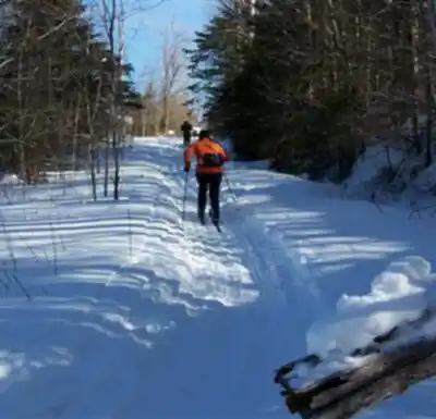
The main trail comes in at 3.2 km with 180 m of elevation gain, and most people finish it in around 3 hours and 15 minutes—though that number shifts depending on how often you stop and how much time you spend at the top. The difficulty is rated easy, which holds up in practice: the climbing is gradual enough that you won't feel like you're grinding, but there are stretches where you'll notice the ascent and settle into a slower pace.
The trail character is very much what you'd expect from the Laurentides—winding forest paths, good tree cover, and a terrain that keeps changing just enough to stay interesting. You're not walking a straight line up a slope; the route curves through the woods, which makes the elevation gain feel more manageable and gives you something to look at as you go. The footing is generally straightforward, without the kind of technical scrambling that would put off a newer hiker.
Shade is one of the underrated advantages here. On warmer days, the forest canopy keeps things cooler than you'd expect, and the sound of wind moving through the trees makes for a genuinely pleasant walk. It's the kind of hike where you can hold a conversation the whole way up without running out of breath—good for groups with mixed fitness levels.
The summit viewpoint
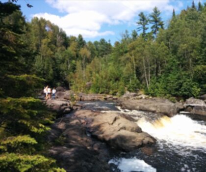
The view at the top is the natural reward for the climb, and it delivers. From the summit, you get wide, open sightlines across the Laurentides—mountains and valleys spread out in front of you in a way that makes the effort feel well worth it. It's a good place to stop for a proper break: eat something, drink water, take photos. If you're hiking with others, it's also a natural gathering point before you head back down.
The summit view is the kind that works in multiple seasons—green and layered in summer, dramatic and open once the leaves drop in fall. Either way, the elevation gives you enough height to feel like you've actually gone somewhere.
Wildlife and what to watch for on the trail
The forested sections of the trail are active with local wildlife, and if you move at a relaxed pace and stay aware, you'll often catch movement or sounds off the trail. The best approach is simple: slow down through the quieter stretches, take short pauses where the trail opens up, and keep your eyes on the treeline rather than just the path in front of you. You're more likely to notice something interesting when you're not focused entirely on the next step.
Beyond hiking: other activities on site
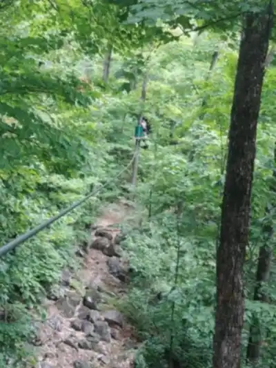
Hiking is the main draw, but Sommet Morin Heights also supports other activities depending on the season. In the warmer months, mountain biking and zip-lining are available on site, which makes it a practical destination for groups where not everyone wants to spend the day on foot. The mix of activities means the energy around the trailhead can vary—some days it's quiet and trail-focused, other days there's more going on.
In winter, the area shifts into a skiing and snowboarding destination. The terrain that makes for a pleasant hike in summer becomes a snow-covered landscape built around winter sports. If you're visiting in the cold months, expect a completely different atmosphere—less about trail time, more about lifts and groomed runs.
Facilities and practical details
The site is set up to be easy to navigate from the moment you arrive. There's parking on site, so getting started doesn't require any guesswork. Along the trail, information boards help with orientation—useful if you're new to the network or just want to confirm you're on the right path without constantly checking your phone. Rest areas are available if you need to take a break mid-hike.
After your outing, nearby cafes and restaurants make it easy to extend the day with a meal. It's a natural way to wrap up a morning hike—get back to the car, clean up, and head somewhere local for food rather than driving straight home.
Who this hike works well for
- Newer hikers: the easy rating is accurate, and the summit view gives you a real sense of accomplishment without requiring advanced skills or gear.
- Families and mixed groups: the manageable distance and elevation make it workable for a range of ages and fitness levels, especially with rest areas along the way.
- Experienced hikers looking for a relaxed outing: at 3.2 km and 180 m of gain, this fits well as a low-key half-day where the goal is fresh air and a good view rather than pushing distance.
- What to bring: hiking boots, a daypack, water, and something to eat at the summit—especially if you plan to linger for photos.
The information boards on the trail are worth paying attention to, particularly if you're unfamiliar with the network—they'll keep you oriented and help you make the most of the route without second-guessing yourself along the way.
Services and amenities
This information may vary by season.
Recommended gear for this trail


Ready to go?
Everything you need to know before you goStarting Point
To get to the start of the trails at the sommet morin heights in Laurentides, take Highway 15 north to exit 66. Turn left onto Rue Principale and continue for 2.5 km. Turn right onto Chemin du Sommet and continue for 1 km. The trailhead will be on your left.
When?
How much?
- Hiking shoes Essential
- → Salomon Elixir Tour Mid WP · 203.38 $
- Layered clothing Essential
- Rain jacket Essential
- Trekking poles
- → Black Diamond Trail Ergo Cork · 69.99 $
- Headlamp
- → Petzl Actik Core 625 · 103.95 $
FAQ - Frequently asked questions
Everything you need to knowThe Essential Hiking Checklist
Everything you need for your next hike. Bilingual, printable, 1 page.
Download the free checklistSimilar hikes nearby
Discover other trails you might enjoy
Parc De La Rivière Doncaster
Laurentides

Parc Du Domaine Vert
Laurentides

Parc national d'Oka
Laurentides

Sommet Saint-Sauveur
Laurentides

Mont Condor
Laurentides

Montagne Du Dépôt Et Montagne Du Caribou
Laurentides
Hiking near Laval
97 trails to explore ~54 km away
We work hard to provide the most up-to-date and error-free data possible. If something seems incorrect, let us know! Your contribution helps the whole community.
Hikers' opinions