
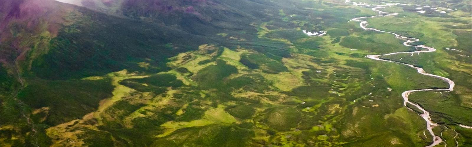

Ready to explore Canol Road? Here's everything you need to know before you go!
Discover the trail
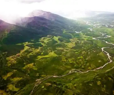
Photos: Anthony DeLorenzo from Whitehorse, Yukon, Canada — CC BY 2.0 (Wikimedia Commons)
Trail description
The Canol Road is one of the most remote and historically significant routes in the Yukon, stretching through some of the most untouched wilderness in northern Canada. Built during World War II as part of a massive wartime infrastructure project, this road — and the corridor surrounding it — offers a raw, off-the-beaten-path experience that draws adventurers, history buffs, and wilderness travelers looking for something far beyond the typical trail.
Historical Background
The Canol Road was constructed between 1942 and 1944 by the United States Army Corps of Engineers as part of the Canol Project — a pipeline and road system designed to transport oil from Norman Wells, Northwest Territories, to a refinery in Whitehorse. The project was a massive wartime undertaking, built under extreme conditions in one of the harshest environments on the continent. When the war ended, the pipeline was abandoned almost immediately, and the road fell into disuse. What remains today is a corridor steeped in history, with rusting equipment, abandoned infrastructure, and remnants of the wartime effort scattered along the route. Walking or driving through this area is like stepping into a forgotten chapter of North American history.
The Terrain and Landscape
The Canol Road corridor passes through a stunning and varied landscape in the Whitehorse area of the Yukon. The terrain is classic subarctic wilderness — open tundra, boreal forest, river valleys, and rugged mountain passes. The land here is largely untouched, and that's a big part of the appeal. You won't find manicured trails or interpretive signs every few hundred meters. What you will find is genuine backcountry: creek crossings, soft ground, exposed ridgelines, and the kind of silence that's hard to come by anywhere else.
The landscape shifts as you move through the corridor. Dense spruce forest gives way to open alpine terrain, and river valleys cut through the surrounding hills. Wildlife is abundant in this part of the Yukon — the area is home to caribou, moose, wolves, grizzly bears, and a wide range of bird species. Travelers should be bear-aware at all times and carry appropriate safety equipment.
What to Expect on the Ground
This is not a groomed hiking trail. The Canol Road is a rough, largely unmaintained route that demands self-sufficiency and solid backcountry skills. Route-finding can be challenging in places, and conditions underfoot vary considerably depending on the season and recent weather. River crossings can be significant obstacles, particularly during spring runoff or after heavy rain. There are no bridges on many of the crossings, and water levels can change quickly.
Navigation skills are essential here. A GPS device and topographic maps are strongly recommended — don't rely solely on a phone signal, as coverage is essentially nonexistent through most of the corridor. Anyone heading out on the Canol Road should be comfortable with wilderness travel, have experience with off-trail navigation, and be prepared for rapidly changing weather conditions typical of the Yukon.
Wartime Artifacts and Points of Interest
One of the things that makes the Canol Road genuinely unique is the concentration of wartime artifacts still visible along the route. Rusting vehicles, machinery, pipeline sections, and camp remnants are scattered throughout the corridor, left largely as they were when the project was abandoned. These artifacts are protected, and visitors are expected to leave everything in place. The sheer scale of what was built — and then left behind — gives the route a haunting, almost surreal quality that's unlike anything else in the region.
Exploring these remnants is a highlight for many visitors, offering a tangible connection to a remarkable and often overlooked piece of wartime history in northern Canada.
Access and Logistics
The Canol Road is accessed from the Whitehorse area in the Yukon. The South Canol Road (Yukon Highway 6) is accessible by vehicle and connects to the Robert Campbell Highway, making it the more commonly traveled section. The North Canol Road, which crosses into the Northwest Territories, is a much more remote and challenging route that requires serious preparation and is typically only attempted by experienced backcountry travelers with appropriate vehicles or on foot.
There are no services along the route — no gas stations, no facilities, no emergency services within easy reach. Anyone planning a trip along the Canol Road should be fully self-sufficient, carry extra fuel if traveling by vehicle, and file a trip plan with a trusted contact before heading out. The Yukon government and local emergency services recommend registering your trip with the RCMP or a local contact who can raise the alarm if you don't return as planned.
Best Time to Visit
The Canol Road corridor is most accessible during the summer months, when snow has melted and river levels have stabilized after spring runoff. Midsummer offers the longest daylight hours — a genuine advantage in the Yukon, where summer days can stretch well past midnight. Fall brings dramatic color to the tundra and boreal forest, and wildlife activity tends to increase as animals prepare for winter. Early and late season travel requires extra caution due to unpredictable weather and road conditions.
Who This Route Is For
The Canol Road is best suited to experienced backcountry travelers — hikers, overlanders, and wilderness adventurers who are comfortable operating in remote, unsupported environments. It is not a destination for beginners or those looking for a casual day outing. The rewards, however, are significant: genuine wilderness, extraordinary historical context, and a sense of remoteness that's increasingly rare to find.
- Experience level: Experienced backcountry travelers recommended
- Navigation: GPS and topographic maps essential
- Wildlife: Grizzly bears, wolves, caribou, moose present — carry bear spray
- Services: None along the route — full self-sufficiency required
- Trip planning: File a trip plan before departure
- Artifacts: Wartime remnants are protected — leave everything in place
The Canol Road corridor is a rare opportunity to travel through living history in one of the most remote and beautiful corners of the Yukon — a place where the land has largely reclaimed what was left behind, and where the wilderness still very much sets the terms.
The Essential Hiking Checklist
Everything you need for your next hike. Bilingual, printable, 1 page.
Get your free hiking checklistRecommended gear for this trail
As an Amazon Associate I earn from qualifying purchases.


Ready to go?
Everything you need to know before you goWhen?
How much?
As an Amazon Associate I earn from qualifying purchases.
Affiliate links — LGPO may earn a commission at no extra cost to you.
- Hiking shoes Essential
- → Salomon Elixir Tour Mid WP · 203.38 $
- Layered clothing Essential
- Rain jacket Essential
- Trekking poles
- → Black Diamond Trail Ergo Cork · 69.99 $
- Headlamp
- → Petzl Actik Core 625 · 103.95 $
FAQ - Frequently asked questions
Everything you need to knowHiking near Jasper
82 trails to explore ~1254 km away
We work hard to provide the most up-to-date and error-free data possible. If something seems incorrect, let us know! Your contribution helps the whole community.
Hikers' opinions
Be the first to review!
No hiker has shared their experience yet. Share your impressions and help other hikers!