
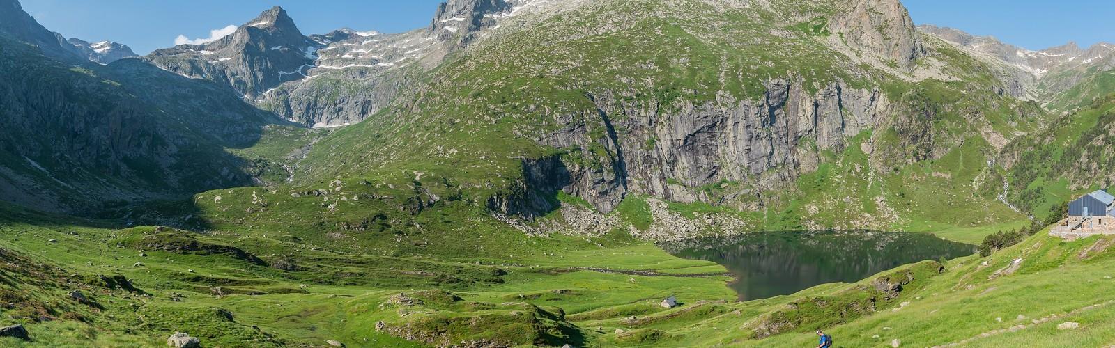

Ready to explore Le Refuge d'Espingo? Here's everything you need to know before you go!
Discover the trail
Oh no! We don't have any photos 😢
This trail hasn't been captured yet. Be the first to share your adventure!Trail description
Le Refuge d'Espingo sits at 2,066 meters in the heart of the Hautes-Pyrénées, and it earns its reputation as one of the most rewarding destinations in the French Pyrenees. Whether you're planning an overnight stay or pushing through as a day hike, the 14-kilometer round trip with 700 meters of elevation gain delivers a full mountain experience — varied terrain, dramatic scenery, and a genuine sense of altitude.
Getting Started: The Lac d'Oô Trailhead
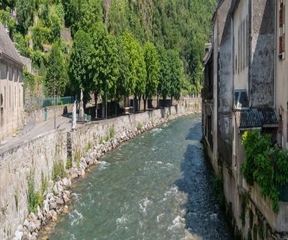
The hike begins at the Lac d'Oô parking area. Arrive early, especially on summer weekends — the lot fills up fast and there are no services on site, so come with everything you need. The trail wastes no time establishing its character: a wide, well-maintained path climbs steadily through mixed forest, with the Neste d'Oô rushing alongside for much of the lower section. It's a pleasant warm-up that gives your legs time to find their rhythm before things get more serious.
As the forest thins, the cirque walls start revealing themselves above the treeline. The scale of the landscape begins to register here, and it only grows more impressive as you gain elevation.
Lac d'Oô: A Natural Waypoint
Reaching Lac d'Oô marks a clear transition point on the route. The lake's turquoise water against the surrounding rock is one of those views that stops you mid-stride. A lot of day visitors turn around here, which means the trail beyond sees noticeably less traffic — and the terrain reflects that shift. The path becomes rougher, the environment more exposed, and the mountain starts demanding your full attention.
This is also where the 700-meter elevation gain starts making itself felt. The upper section climbs through boulder fields and across granite slabs where careful foot placement matters, particularly on the descent. Trekking poles are genuinely useful here, not just a comfort item.
The Upper Trail: Where It Gets Real
The stretch between Lac d'Oô and the refuge is where the hike earns its Hard rating. The trail follows old shepherding routes — you can still spot the stone walls and terraces built by generations of mountain pastoralists — but the terrain is uncompromising. Exposed rock, scree sections, and the sustained climb over the final push require solid fitness and sure footing.
The payoff is the panorama that opens up as you gain height. The Pic du Midi d'Ossau anchors the southern horizon, and the Néouvielle massif fills the view to the north. On a clear day, the sense of scale is hard to overstate — you're looking across a landscape that extends well beyond any single valley or ridge.
Weather moves fast at this elevation. Plan for a 15 to 20 degree Celsius temperature swing between the trailhead and the refuge. Mornings often start cool with valley fog, afternoons bring strong sun on the upper slopes, and thunderstorms can build quickly in the afternoon. An early start — which also helps with parking — gives you the best chance of reaching the refuge before conditions deteriorate.
Snow and Seasonal Conditions
North-facing slopes and shaded gullies hold snow well into June. Early season hikers should carry microspikes or light traction devices and check conditions before heading out. The trail is generally accessible from May through October, but the window shifts year to year depending on snowpack. After mid-September, fresh snowfall can change the upper trail significantly, affecting both footing and visibility.
The Refuge Itself
The Refuge d'Espingo is built from local stone in the classic Pyrenean mountain style — functional, solid, and suited to the conditions it has to handle. It operates seasonally, typically from June through September, with exact dates depending on snow and weather. During the operating season, the refuge serves meals and offers overnight accommodation, which opens up a completely different way to experience this part of the mountains.
Staying overnight lets you explore the surrounding terrain without the pressure of a same-day return. The nearby Lac d'Espingo is an easy walk from the refuge and offers a quieter, more contemplative setting than the busier Lac d'Oô below. More ambitious objectives — surrounding summits, high passes into Spain — become realistic options when you're not racing the clock. Reservations are strongly recommended during peak season; confirm operating dates before committing to a multi-day itinerary.
Evenings at the refuge have their own appeal. Once the afternoon hikers have headed back down, the pace slows considerably. The light on the peaks at dusk, the drop in temperature, and the absence of light pollution make for exceptional stargazing conditions.
Wildlife Along the Route
The elevation range covered on this hike supports a solid cross-section of Pyrenean wildlife. Marmots are a near-certainty in the alpine meadows — you'll usually hear their sharp whistle before you spot them. Isards, the Pyrenean chamois, inhabit the upper slopes and rocky terrain, though they tend to keep their distance from the main trail. Golden eagles are regularly seen working the thermals above the cirque walls.
The botanical variety is worth paying attention to as well. The transition from valley wildflowers to specialized alpine plants happens gradually as you climb, with peak blooming typically running from late June through early August.
What to Know Before You Go
- Distance: 14 km
- Elevation gain: 700 m
- Estimated time: 5h30
- Difficulty: Hard
- Trailhead: Lac d'Oô parking area — arrive early, no services on site
- Footwear: Sturdy hiking boots with ankle support are essential; the upper trail is rocky and uneven
- Early season: Microspikes recommended until snow clears from north-facing slopes, typically by late June
- Refuge season: Generally June through September; reservations strongly recommended for overnight stays
- Weather: Conditions change fast — start early and be prepared for significant temperature variation between the trailhead and the refuge
The Essential Hiking Checklist
Everything you need for your next hike. Bilingual, printable, 1 page.
Get your free hiking checklistRecommended gear for this trail
As an Amazon Associate I earn from qualifying purchases.


Ready to go?
Everything you need to know before you goWhen?
How much?
As an Amazon Associate I earn from qualifying purchases.
Affiliate links — LGPO may earn a commission at no extra cost to you.
- Hiking shoes Essential
- → Salomon Elixir Tour Mid WP · 203.38 $
- Layered clothing Essential
- Rain jacket Essential
- Trekking poles
- → Black Diamond Trail Ergo Cork · 69.99 $
- Headlamp
- → Petzl Actik Core 625 · 103.95 $
FAQ - Frequently asked questions
Everything you need to knowSimilar hikes nearby
Discover other trails you might enjoy
Hiking near Sydney
22 trails to explore ~4728 km away
We work hard to provide the most up-to-date and error-free data possible. If something seems incorrect, let us know! Your contribution helps the whole community.
Hikers' opinions
Be the first to review!
No hiker has shared their experience yet. Share your impressions and help other hikers!