

Ready to explore Refuge du Lac d'Oô? Here's everything you need to know before you go!
Discover the trail
Trail description
The hike to Refuge du Lac d'Oô is one of the Hautes-Pyrénées' most popular mountain destinations. The main day-hike route from Granges d'Astau covers approximately 6.3 km with around 350-390 meters of elevation gain, making it a moderate to moderately-hard hike that typically takes 2h30 to 3h. What you get in return is a glacial lake sitting in a dramatic cirque, a working mountain refuge, and scenery that makes the effort feel completely worth it.
Getting to the Trailhead
The hike starts at the Granges d'Astau parking area. This is the standard departure point, and it fills up fast on summer weekends and holidays. Getting there early isn't just good advice — it's practically necessary if you want a spot. Plan your start accordingly, especially if you're visiting in July or August.
The Ascent: What to Expect on the Trail
The trail wastes little time getting to work. From the parking area, the path follows a mountain stream upward through dense beech and fir forest. The forest section is pleasant — the canopy keeps things cool, and the sound of rushing water stays with you through the lower elevations. The footing here is generally good, though sections can get muddy after rain or during spring snowmelt.
As you gain elevation, the trees thin out and the landscape opens up. This transition is one of the more satisfying parts of the hike — the shift from enclosed forest to open alpine terrain happens gradually, and the views start building before you realize it. The middle section of the trail crosses several small streams and passes through alpine meadows where marmots are a regular presence. You'll likely hear them before you see them; their sharp warning whistles carry well across open slopes. Keep an eye on the meadows during the morning hours when they're most active.
The upper section gets rockier as you approach the lake. The terrain requires attention to footing, particularly on wet rock, and this is where sturdy hiking boots earn their keep. The elevation gain is spread gradually across the route, so the gradient is steady rather than punishing in short bursts — but there's no flat section to recover on. Budget 2h30 to 3 hours for the ascent depending on your pace and fitness level, and don't rush the final approach.
Lac d'Oô and the Refuge
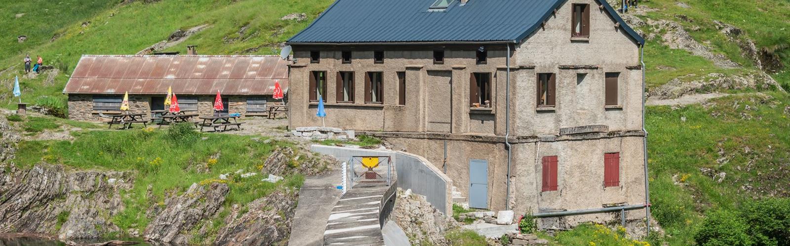
The lake reveals itself as you crest the final rise, and it's genuinely striking. Lac d'Oô sits in a glacial cirque enclosed by steep rock walls and peaks that push toward the Spanish border. The water runs deep blue-green, shifting in tone as the light changes through the day. Early morning is when the surface is calmest and the reflections are sharpest — another reason to start the hike early rather than late.
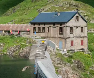
The refuge sits at the lake's edge, positioned to make the most of the setting while offering real shelter from mountain weather. It functions as both a destination for day hikers and a base for those pushing into the higher terrain above. If you're planning an overnight stay, reservations during the summer season are essential — this is a well-known destination and the refuge fills up. The hut serves meals and provides accommodation, which makes it a legitimate option for extending your time in the area rather than rushing back down the same afternoon.
Wildlife and Geology
Beyond the marmots, the area sees golden eagles and other raptors working the thermals above the cirque. The alpine meadows below the lake support a strong wildflower display through the summer, including gentians and alpine roses alongside endemic Pyrenean species. The geological story of the area is written into the landscape itself — the cirque was carved by glaciers, and polished granite surfaces and scattered erratic boulders throughout the upper terrain are direct evidence of that history. It's the kind of place where the landscape makes sense once you understand what shaped it.
Practical Notes
- Distance: Approximately 6.3 km (one way to the refuge)
- Elevation gain: 350-390 m
- Difficulty: Moderate to Moderately Hard
- Estimated time: 2h30 to 3 hours
- Trailhead: Granges d'Astau parking area
- Hiking season: Late May through October, conditions permitting
Carry enough water for the full ascent — there are limited refill opportunities between the trailhead and the lake. The refuge has water available once you arrive. Layered clothing and rain gear are standard requirements; afternoon thunderstorms are common in the summer months, and the exposed terrain around the lake offers no shelter from sudden weather changes. An early start addresses both the parking situation and the afternoon weather risk in one move.
What Makes This Hike Stand Out
The Hautes-Pyrénées has no shortage of good mountain hikes, but the combination of a well-defined objective, a functioning refuge at the destination, and the quality of the lake setting puts Refuge du Lac d'Oô in a different category. The cirque geography means the scenery arrives all at once rather than being spread thinly across the route — you work for it, and then it's in front of you. For hikers comfortable with sustained elevation gain and rocky terrain near the top, this is one of the more satisfying day hikes the region offers.
The Essential Hiking Checklist
Everything you need for your next hike. Bilingual, printable, 1 page.
Get your free hiking checklistRecommended gear for this trail
As an Amazon Associate I earn from qualifying purchases.


Ready to go?
Everything you need to know before you goWhen?
How much?
As an Amazon Associate I earn from qualifying purchases.
Affiliate links — LGPO may earn a commission at no extra cost to you.
- Hiking shoes Essential
- → Salomon Elixir Tour Mid WP · 203.38 $
- Layered clothing Essential
- Rain jacket Essential
- Trekking poles
- → Black Diamond Trail Ergo Cork · 69.99 $
- Headlamp
- → Petzl Actik Core 625 · 103.95 $
FAQ - Frequently asked questions
Everything you need to knowSimilar hikes nearby
Discover other trails you might enjoy
Hiking near Sydney
22 trails to explore ~4726 km away
We work hard to provide the most up-to-date and error-free data possible. If something seems incorrect, let us know! Your contribution helps the whole community.
Hikers' opinions
Be the first to review!
No hiker has shared their experience yet. Share your impressions and help other hikers!