
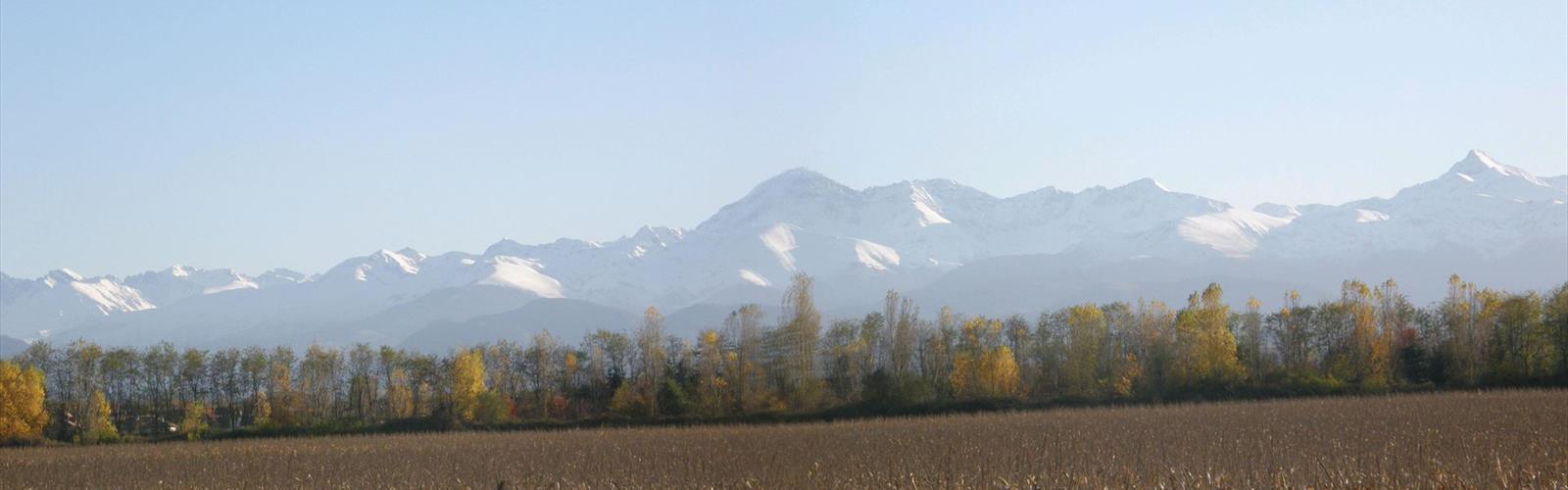

Ready to explore Lac de Soues? Here's everything you need to know before you go!
Discover the trail


Photos: Vasnic — CC BY-ND (Flickr) FAP — CC BY-SA (Wikimedia Commons) Sotos — CC BY (Wikimedia Commons) Florent Abel — CC BY-SA (Wikimedia Commons)
Trail description
Lac de Soues delivers one of the most accessible alpine lake experiences in the Hautes-Pyrénées — and that's exactly what makes it worth your time. The 8.5-kilometer moderate trail reaches a glacial lake tucked into a dramatic cirque, with only 10 meters of elevation gain along the way. In a mountain range known for punishing climbs, that combination is genuinely rare.
The route starts from the village of Soues and follows well-marked paths through a landscape that shifts gradually from pastoral valley to wilder mountain terrain. Because you're not grinding uphill the whole time, you actually get to look around — at the peaks rising ahead, the stone walls and grazing sheep in the lower sections, the boulders left behind by ancient glaciers as you get closer to the lake. The flat profile isn't a compromise. It's the whole point.
Terrain and Trail Experience
The trail surface changes enough to keep things interesting across the full 8.5 kilometers. Early on, you're moving through traditional Pyrenean farmland — packed earth paths, stone walls, open pasture. It feels unhurried, and the mountain backdrop ahead gives you something to walk toward without demanding anything from your legs just yet.
Further along, the terrain gets rougher. Glacial moraines create a rolling, boulder-strewn landscape, and the path alternates between packed dirt, rocky stretches, and occasional stream crossings. None of it is technically difficult, but it does require solid footing. Lightweight trail runners might feel unstable on the rockier sections, especially if conditions are wet — proper hiking boots are the right call here regardless of the minimal elevation change.
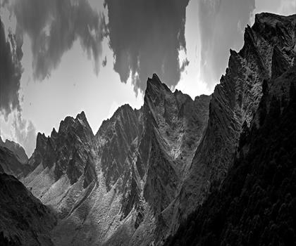
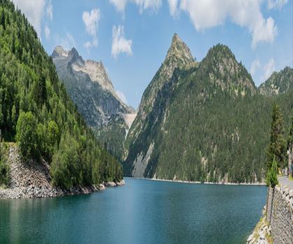
The final stretch before the lake is where the setting really opens up. The cirque comes into view gradually, with limestone cliffs and scree slopes rising sharply around the water. The lake itself sits quietly at the base of all that vertical rock, and the contrast between the easy approach and the dramatic surroundings is striking. It feels more remote than the trail stats would suggest.
What Sets This Hike Apart
Most alpine lakes in the Hautes-Pyrénées require a serious climb to reach. Lac de Soues is the exception. The 10-meter elevation gain means the trail is genuinely accessible to a wide range of hikers — families with kids, older adults, people returning to hiking after time off. That's not a knock on the destination. The cirque setting is legitimately impressive, the kind of scenery that usually sits behind 600 meters of vertical gain somewhere else in the range.
The flat approach also makes it practical to carry things you'd normally leave in the car. Camera gear, a proper picnic, extra layers — none of it becomes a burden when you're not hauling it uphill for two hours. The lake makes a good spot to settle in for a while, and the changing light on the surrounding cliffs gives photographers plenty to work with throughout the day.
For anyone spending time in the Hautes-Pyrénées and building a week of hiking, Lac de Soues fits naturally as a lower-intensity day between bigger objectives. It's not a consolation prize — it's a genuinely different kind of mountain experience that holds its own.
Seasonal Considerations
The trail is accessible from late spring through early fall. Late spring brings the lake to its highest water levels following snowmelt, and the surrounding meadows see strong wildflower displays during this period. Summer offers the most stable weather and warmest temperatures, which makes it the most popular window — expect more company on the trail, especially on weekends.
Early fall tends to bring clearer skies and cooler, more comfortable hiking temperatures. The wildflowers are gone by then, but the light is often better and the crowds thin out noticeably. Winter access isn't recommended — snow accumulation and avalanche risk in the cirque area make the route unsafe despite its gentle grade.
Afternoon thunderstorms are a real possibility during summer in the Hautes-Pyrénées, and the lake's exposed cirque location offers little shelter. Starting early gives you the best chance of reaching the lake and heading back before weather moves in.
Practical Planning Notes
The moderate difficulty rating here is about trail length and varied terrain, not technical challenge. The 8.5 kilometers and estimated 2 hours 15 minutes still require reasonable fitness and proper preparation — don't let the low elevation gain lead you to underestimate the distance.
- Footwear: Hiking boots are recommended. Rocky sections and potential mud make the trail harder to navigate in lightweight shoes.
- Water: Sources along the route are limited. Carry enough for the full round trip.
- Parking: Available in the village of Soues, but fills up fast on summer weekends and holidays. An early start solves both the parking problem and the afternoon weather risk.
- Navigation: The trail is well-marked throughout. A topographic map of the area is still worth having, both for navigation confidence and for identifying the peaks surrounding the cirque.
- Leave No Trace: The lake environment is pristine. Pack out everything you bring in.
The trailhead is clearly marked from the village center, and basic facilities are available in Soues before you set out. The lake itself is the logical spot for a break or lunch — plan your timing accordingly and give yourself enough margin to enjoy it without rushing the return.
The Essential Hiking Checklist
Everything you need for your next hike. Bilingual, printable, 1 page.
Get your free hiking checklistRecommended gear for this trail
As an Amazon Associate I earn from qualifying purchases.


Ready to go?
Everything you need to know before you goWhen?
How much?
As an Amazon Associate I earn from qualifying purchases.
Affiliate links — LGPO may earn a commission at no extra cost to you.
- Hiking shoes Essential
- → Salomon Elixir Tour Mid WP · 203.38 $
- Layered clothing Essential
- Rain jacket Essential
- Trekking poles
- → Black Diamond Trail Ergo Cork · 69.99 $
- Headlamp
- → Petzl Actik Core 625 · 103.95 $
FAQ - Frequently asked questions
Everything you need to knowSimilar hikes nearby
Discover other trails you might enjoy
Hiking near Sydney
22 trails to explore ~4674 km away
We work hard to provide the most up-to-date and error-free data possible. If something seems incorrect, let us know! Your contribution helps the whole community.
Hikers' opinions
Be the first to review!
No hiker has shared their experience yet. Share your impressions and help other hikers!