

Ready to explore Les Gorges de Colombières? Here's everything you need to know before you go!
Discover the trail
Trail description
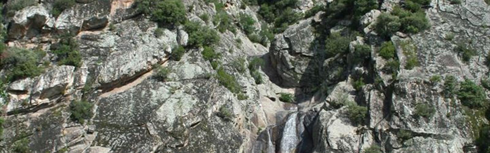
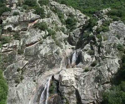
The Gorges de Colombières cut through the rugged terrain of the Hérault department in Occitania, carving one of the most dramatic canyon systems in the Haut-Languedoc Regional Natural Park. Over millennia, water has done relentless work on the limestone here, sculpting narrow passages between towering cliff faces and leaving behind a landscape that feels genuinely wild. This is the kind of place that earns its reputation through sheer geological spectacle rather than any manufactured appeal.
The gorges play with scale in a way that keeps you off balance in the best possible sense. Tight corridors of pale stone suddenly open into broader valley sections, then close back in again without warning. The cliff faces themselves are worth studying up close — layered, weathered, and textured in ways that tell a long geological story. Mediterranean vegetation grips the rocky ledges wherever it can find purchase, adding unexpected greenery against all that exposed stone.
The Hike
At 8 km with 650 meters of elevation gain, this is a moderate route that takes most hikers around 3 hours to complete. That elevation number is worth taking seriously — 650 meters over 8 km means you're working consistently, and some of the ascents are genuinely steep where the trail navigates the cliff faces. You'll want solid footwear and a reasonable base level of fitness before committing to this one.
The trail covers a lot of different terrain in a relatively short distance. You'll move between exposed rocky scrambles, shaded riverside paths, and sections that follow the canyon rim with open views across the gorge system. Some stretches run directly along the gorge floor, where massive boulders and rock formations create a maze-like environment that feels completely cut off from the outside world. Other sections climb high enough above the river that you get a full read on the canyon's scale — the kind of perspective that makes the effort worthwhile.
Trail surfaces shift throughout the route. Well-maintained dirt paths give way to rocky sections where natural stone steps have been worn smooth over time. In places, the route follows old pathways that local inhabitants once used to move between settlements — you're walking lines that predate recreational hiking by centuries. The most demanding sections require sure footing and a reasonable head for heights, particularly where the trail hugs the cliff faces above the river.
Natural Environment
The ecological variety here tracks closely with the terrain. Sun-exposed upper sections support classic Mediterranean vegetation — drought-tolerant, aromatic, and well-adapted to the heat and thin soils. Drop down toward the river and the conditions shift noticeably: cooler, moister, and home to different plant communities that create distinct microhabitats throughout the canyon. The contrast between these zones is one of the things that makes the Gorges de Colombières feel like more than just a single landscape.
The river running through the gorges is the engine behind all of it. Its clear water reflects the cliff walls above and supports aquatic life throughout the canyon. The river's character changes as it moves through the gorge — calm pools alternate with rushing sections where the water has carved particularly narrow channels through the rock. Those pools are genuinely inviting on a warm day.
Raptors are a regular presence here, riding thermals between the cliff faces. The protection afforded by the regional natural park designation keeps the area genuinely wild, and wildlife encounters are common, particularly during quieter hours. The isolation of the gorge floor, in particular, creates conditions where you're more likely to share the space with the local fauna than with other hikers.
Water Activities
The Gorges de Colombières aren't just a hiking destination. The river corridor also supports canoeing and kayaking, offering a completely different angle on the same landscape. Paddling through the narrow sections of the gorge opens up areas that trail hikers simply can't reach — secluded beaches, hidden swimming holes, and passages where the cliff walls close in tight on both sides. It's a legitimate alternative way to experience the place, not just an add-on.
Water levels shift with the seasons. Higher flows in spring and autumn make for more dynamic paddling but demand more skill and attention. Summer brings lower, calmer water that works well for beginners, though some shallow sections may require portaging. The combination of hiking and paddling options makes the gorges a strong candidate for a multi-day trip, where you can experience the landscape from both the rim and the river.
Practical Notes
- Distance: 8 km
- Elevation gain: 650 m
- Difficulty: Moderate
- Estimated time: 3h05
The Mediterranean climate of the Hérault means the gorges are accessible year-round, but the experience varies significantly by season. Spring brings reliable water levels and wildflowers on the canyon walls. Autumn offers comfortable hiking temperatures and good color along the river corridor. Summer hiking requires an early start — the elevation gain becomes genuinely punishing in afternoon heat, and you'll want to carry more water than you think you need. Winter visits are quieter, with sharper air and better long-distance visibility, though higher sections can see ice or snow, and shorter days require tighter trip planning.
Whatever the season, the Gorges de Colombières reward hikers who come prepared and take their time — this is a landscape that gives back in proportion to the attention you bring to it.
The Essential Hiking Checklist
Everything you need for your next hike. Bilingual, printable, 1 page.
Get your free hiking checklistRecommended gear for this trail
As an Amazon Associate I earn from qualifying purchases.


Ready to go?
Everything you need to know before you goStarting Point
The trailhead for Les Gorges de Colombières is located in Saint-Gervais-sur-Mare, in the Occitanie region. To get there, take the D618 towards Saint-Gervais-sur-Mare. In the center of the village, turn right into Rue du Pont Vieux and continue to the trailhead parking lot.
When?
How much?
As an Amazon Associate I earn from qualifying purchases.
Affiliate links — LGPO may earn a commission at no extra cost to you.
- Hiking shoes Essential
- → Salomon Elixir Tour Mid WP · 203.38 $
- Layered clothing Essential
- Rain jacket Essential
- Trekking poles
- → Black Diamond Trail Ergo Cork · 69.99 $
- Headlamp
- → Petzl Actik Core 625 · 103.95 $
FAQ - Frequently asked questions
Everything you need to knowSimilar hikes nearby
Discover other trails you might enjoy
Hiking near Sydney
22 trails to explore ~4869 km away
We work hard to provide the most up-to-date and error-free data possible. If something seems incorrect, let us know! Your contribution helps the whole community.
Hikers' opinions
Be the first to review!
No hiker has shared their experience yet. Share your impressions and help other hikers!