

Ready to explore Cascade d'Autoire? Here's everything you need to know before you go!
Discover the trail
Trail description
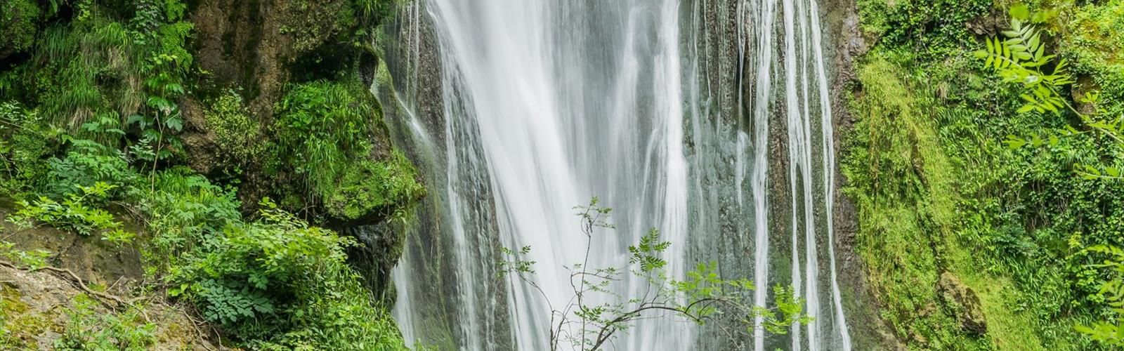
The Cascade d'Autoire is one of the standout natural features in the Lot department, and for good reason. A 30-meter waterfall dropping down sheer limestone cliffs near Autoire village in the Quercy Blanc area — it's the kind of place that earns its reputation. At just 2.5 km with 210 meters of elevation gain, this hike punches well above its weight in terms of scenery delivered per kilometer walked.
The trail starts right from the village of Autoire, which is worth a few minutes of your time before you even hit the path. The honey-colored stone houses and traditional Quercy architecture set the tone for what's ahead — this is a landscape shaped by limestone, and everything here, from the buildings to the cliffs to the trail underfoot, reflects that geology.
On the Trail
The route climbs steadily from the village, gaining those 210 meters at a pace that feels manageable rather than punishing. The elevation is spread out well enough that you're never grinding up a brutal pitch — it's a consistent, rhythmic ascent that most hikers handle comfortably within the estimated 1 hour 15 minutes round trip.
Early on, the trail moves through mixed woodland — oak, ash, and wild cherry — that provides decent shade and a bit of that enclosed, forest-trail feeling before the landscape opens up. The limestone underfoot is the real character of this hike. You're walking on what was once an ancient seabed, now carved into ridges, shelves, and cliff faces by centuries of water erosion. The dry stone walls that occasionally line the path are a reminder that people have been working this land for a very long time.
As the trail climbs, the vegetation shifts toward more open Causses terrain — juniper, wild thyme, and in spring, orchid species that bloom across the rocky ground. The exposed sections offer views back across the Autoire valley that give you a sense of how much height you've gained without it feeling like a slog.
The final approach to the waterfall is where the hike earns its payoff. You hear it before you see it — the sound builds as you close in, and the limestone amphitheater that frames the cascade amplifies everything. The reveal, when it comes, is genuinely impressive. Several natural vantage points let you take in both the waterfall and the valley spread out behind you.
The Waterfall Itself
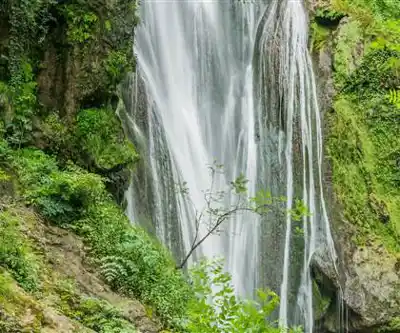
The cascade drops 30 meters down pale limestone cliffs, and the contrast between the white water and the golden-grey rock is striking. The flow varies considerably depending on the season — spring and post-rain visits will show you the waterfall at its most powerful, while summer can bring a more modest flow during dry stretches. Either way, the setting — the cliff face, the natural bowl, the acoustics — holds up regardless of water volume.
The area immediately around the base of the falls stays noticeably cooler and more humid than the surrounding trail, which makes it a natural rest stop, especially on warmer days. That said, the limestone here gets slippery when wet, so watch your footing near the waterfall and on any wet rock sections.
Wildlife and Plants
The cliffs above the waterfall are worth scanning for birds of prey — buzzards are a regular presence, and peregrine falcons have been spotted working the thermals above the limestone faces. The mixed woodland section of the trail is productive for songbirds, particularly in the early morning. If birdwatching is part of your agenda, an early start pays off here.
The botanical diversity along this trail reflects the combination of Mediterranean climate and limestone geology that defines the Causses. Rock-dwelling plants colonize the cliff faces, while the wetter ground near the waterfall supports a noticeably different plant community. Spring is the peak season for wildflowers, including the orchid species that thrive in the thin, rocky soils of the open Causses sections.
Practical Notes
Parking is available near the village center in Autoire, and the trailhead is easy to find from there. The path is well-marked and requires no navigation skills beyond following the signs. Sturdy hiking shoes are the right call — the rocky limestone terrain and the wet conditions near the waterfall make trail runners or proper hiking footwear a better choice than casual sneakers.
- Distance: 2.5 km
- Elevation gain: 210 m
- Estimated time: 1h15
- Difficulty: Easy
- Trailhead: Autoire village center
This hike works well for families with kids who are comfortable on uneven terrain. The elevation gain is gradual enough that it's not overwhelming for younger hikers, but the rocky sections and cliff-edge vantage points mean you'll want to keep an eye on small children. The trail is not suitable for strollers or wheelchairs.
Carry water — there's nothing reliable along the route, and the waterfall itself isn't a drinking source. Sun protection matters on the exposed upper sections during summer. A light rain jacket is worth throwing in your pack year-round, since conditions in this part of the Lot can shift quickly.
Connecting Trails
The Cascade d'Autoire trail connects with the broader trail network in the region, so if 2.5 km feels like a warm-up rather than a destination, there are options to extend the day. Local hiking maps available in Autoire show the connections clearly and can help you piece together a longer loop that takes in more of the surrounding plateau and valley landscape.
The trail also fits naturally into a broader visit to this corner of the Lot — Autoire itself is worth exploring before or after the hike, and the surrounding Causses offer plenty of other routes for those spending more than a day in the area.
The Essential Hiking Checklist
Everything you need for your next hike. Bilingual, printable, 1 page.
Get your free hiking checklistRecommended gear for this trail
As an Amazon Associate I earn from qualifying purchases.


Ready to go?
Everything you need to know before you goWhen?
How much?
As an Amazon Associate I earn from qualifying purchases.
Affiliate links — LGPO may earn a commission at no extra cost to you.
- Hiking shoes Essential
- → Salomon Elixir Tour Mid WP · 203.38 $
- Layered clothing Essential
- Rain jacket Essential
- Trekking poles
- → Black Diamond Trail Ergo Cork · 69.99 $
- Headlamp
- → Petzl Actik Core 625 · 103.95 $
FAQ - Frequently asked questions
Everything you need to knowSimilar hikes nearby
Discover other trails you might enjoy

Hiking near Sydney
22 trails to explore ~4722 km away
We work hard to provide the most up-to-date and error-free data possible. If something seems incorrect, let us know! Your contribution helps the whole community.
Hikers' opinions
Be the first to review!
No hiker has shared their experience yet. Share your impressions and help other hikers!