

Ready to explore High Peaks Trail? Here's everything you need to know before you go!
Discover the trail
Trail description
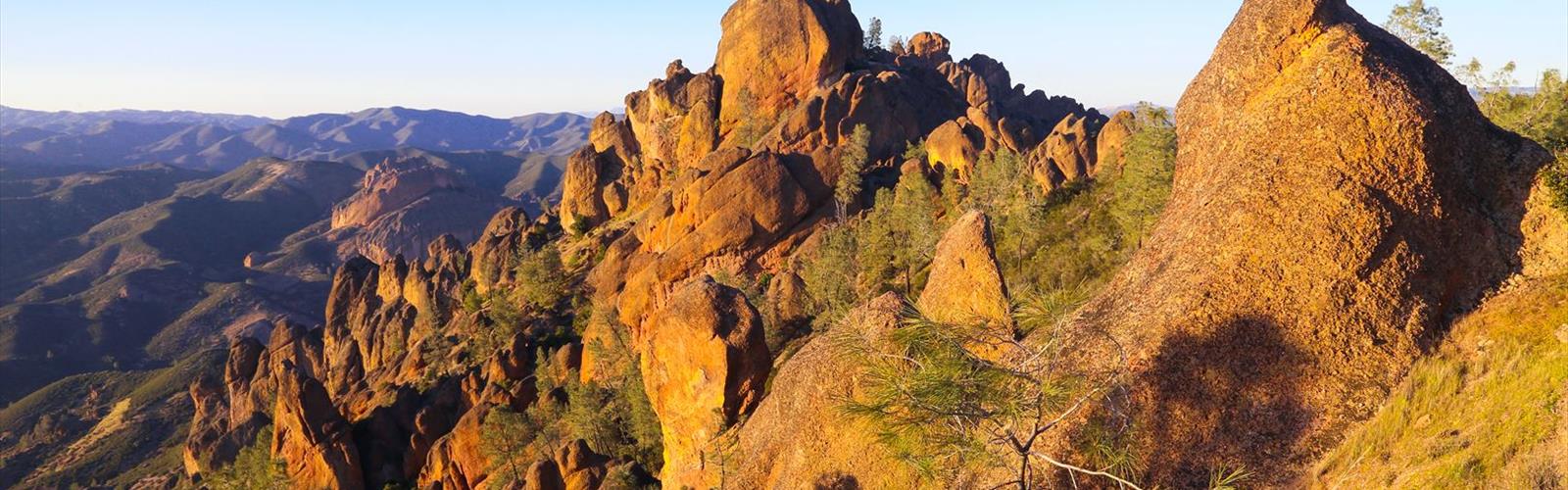
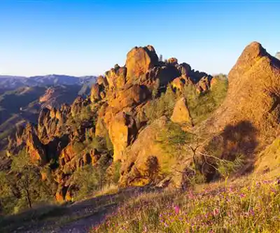
The High Peaks Trail is one of the most rewarding hikes in Pinnacles National Park, located in California's Gold Country region. It takes you through the heart of the park's dramatic volcanic rock formations, offering a route that feels genuinely adventurous without requiring technical climbing skills. If you're looking for a trail that delivers big views, interesting terrain, and a real sense of accomplishment, this one delivers.
The Terrain
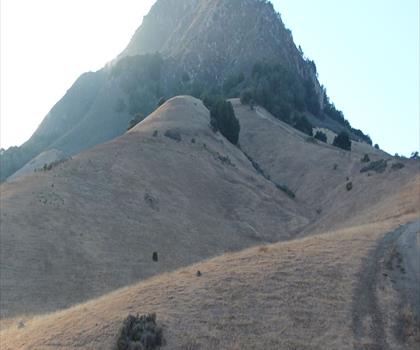
The trail winds through Pinnacles' signature landscape — towering spires of ancient volcanic rock, narrow passages carved into cliff faces, and open chaparral slopes that give way to sweeping ridgeline views. The rock formations here are the eroded remnants of an ancient volcano, and the trail puts you right in the middle of them. You'll move through sections where the path squeezes between boulders, climb steep stone staircases cut directly into the rock face, and emerge onto exposed ridges where the views open up in every direction.
The trail involves some genuine elevation gain with sections of hand-over-foot scrambling on fixed metal railings and carved steps. It's not technical, but it does require sure footing and a reasonable level of fitness. The exposure on some of the ridge sections can feel significant — this isn't a flat nature walk.
What Makes This Trail Stand Out
What sets the High Peaks Trail apart from most hikes in the region is the variety packed into a single route. You're not just walking through one type of landscape — you're moving through chaparral, climbing into rocky pinnacles, crossing open ridgelines, and descending back through canyon terrain. The transitions keep the hike engaging from start to finish.
The rock formations themselves are genuinely striking. The spires and crags of Pinnacles don't look like anything else in California — they have a raw, almost otherworldly quality that makes the hike feel more remote than it actually is. On clear days, the views from the high points stretch across the Salinas Valley and into the surrounding hills.
Pinnacles is also one of the few places in North America where you have a realistic chance of spotting California condors in the wild. The park has been central to the condor recovery program, and these massive birds are regularly seen soaring above the high peaks. Keep your eyes on the sky, especially near the exposed ridgeline sections.
Wildlife and Nature
Beyond condors, the park supports a diverse range of wildlife. Prairie falcons, golden eagles, and various raptors are common sights along the ridgeline. The chaparral slopes are home to mule deer, bobcats, and a variety of lizards and snakes. Spring brings wildflower blooms across the hillsides, with poppies, lupine, and shooting stars adding color to the rocky terrain.
The park is also known for its bat populations — Pinnacles hosts one of the largest known colonies of Townsend's big-eared bats in California, though you're more likely to encounter them in the talus caves than on the High Peaks Trail itself.
Practical Information
Pinnacles National Park charges an entrance fee, so plan accordingly. The park has two separate entrances — east and west — and they are not connected by road. The High Peaks Trail is accessible from both sides, but the trailheads and parking areas differ depending on which entrance you use. Check which side you're entering from before you go, as this affects your route options and logistics significantly.
Parking can fill up quickly, especially on weekends and during peak season. Arriving early in the morning is strongly recommended. The park does not allow dogs on trails, so leave your pets at home. Bikes are also restricted to paved roads within the park.
Tips for the Hike
- Start early. The exposed ridgeline sections get hot fast once the sun is up, and parking fills quickly on weekends.
- Bring more water than you think you need. The terrain is exposed and the climb is real — heat and exertion add up quickly.
- Wear sturdy footwear. The carved rock staircases and uneven terrain make trail runners or hiking boots a much better choice than casual shoes.
- Watch for rattlesnakes. They're present in the park, particularly on warm sunny days when they like to bask on rocks near the trail.
- Look up regularly. Condor sightings are most common near the high points of the trail — scanning the thermals above the ridgeline gives you the best chance of spotting one.
- Check conditions before you go. The park website posts current trail conditions, closures, and any seasonal restrictions that may affect access.
Getting There
Pinnacles National Park is located in central California. As noted above, the east and west entrances are separate — confirm which entrance provides access to your intended trailhead before leaving home. GPS can sometimes route visitors to the wrong entrance, so double-checking on the park's official site or a reliable map is worth the extra minute.
The High Peaks Trail is one of those routes that earns its reputation — the combination of dramatic rock scenery, genuine physical challenge, and the possibility of a condor sighting overhead makes it a standout experience in California hiking.
The Essential Hiking Checklist
Everything you need for your next hike. Bilingual, printable, 1 page.
Get your free hiking checklistRecommended gear for this trail
As an Amazon Associate I earn from qualifying purchases.


Ready to go?
Everything you need to know before you goWhen?
How much?
As an Amazon Associate I earn from qualifying purchases.
Affiliate links — LGPO may earn a commission at no extra cost to you.
- Hiking shoes Essential
- → Salomon Elixir Tour Mid WP · 203.38 $
- Layered clothing Essential
- Rain jacket Essential
- Trekking poles
- → Black Diamond Trail Ergo Cork · 69.99 $
- Headlamp
- → Petzl Actik Core 625 · 103.95 $
FAQ - Frequently asked questions
Everything you need to knowSimilar hikes nearby
Discover other trails you might enjoy

Saddle Peak, California
Central Coast
Indians Road
Central Coast
Pinnacles National Park
Central Coast

Stearns Wharf
Central Coast
Bishop Peak, California
Central Coast

Black Hill, California
Central Coast
Hiking near Victoria
93 trails to explore ~1340 km away
We work hard to provide the most up-to-date and error-free data possible. If something seems incorrect, let us know! Your contribution helps the whole community.
Hikers' opinions
Be the first to review!
No hiker has shared their experience yet. Share your impressions and help other hikers!