

Ready to explore Sierra Azul Open Space Preserve? Here's everything you need to know before you go!
Discover the trail
Trail description
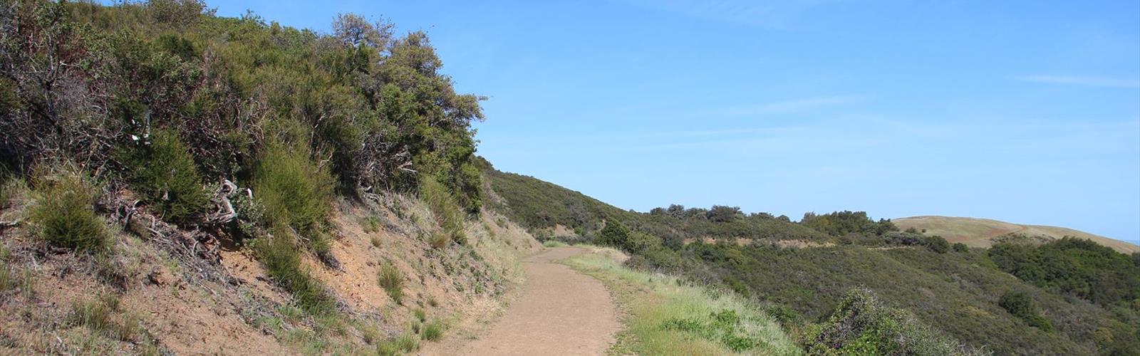
Sierra Azul Open Space Preserve is one of the largest open space preserves in the Santa Clara Valley, stretching across the rugged ridgelines and steep chaparral-covered slopes of the Diablo Range south of San Jose. Managed by the Midpeninsula Regional Open Space District, this preserve offers a genuinely wild experience that feels a world away from the surrounding urban sprawl — yet it's remarkably accessible from the South Bay.
The landscape here is dramatic and uncompromising. Expect exposed ridges, dense chaparral, oak woodlands, and sweeping views that stretch across the Santa Clara Valley on clear days. This is not a manicured park with paved paths and interpretive signs at every turn — Sierra Azul is raw, open space in the truest sense, and that's exactly what draws people back.
The Terrain
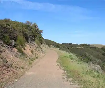
Sierra Azul's terrain is defined by its elevation changes and the character of the Diablo Range. The preserve sits on a series of ridges and canyons where the vegetation shifts between dense chaparral — manzanita, chamise, coyote brush — and pockets of blue oak and coast live oak woodland tucked into the shadier drainages. The ground can be rocky and loose in places, and many of the trails follow old ranch roads that cut directly up and over ridgelines without much mercy for your legs.
The exposed nature of the terrain means you'll feel the sun and wind in full force on most routes. Shade is limited, especially on the upper ridges, so planning your visit around the time of day and season matters here more than at many other preserves in the region.
What to Expect on the Trail
Sierra Azul has a network of trails and fire roads that range from relatively moderate ridge walks to sustained climbs that will push even experienced hikers. The preserve is large enough that you can string together longer loops or out-and-back routes depending on your starting point and how much elevation you're willing to take on.
The Kennedy Road trailhead and the Lexington Reservoir area are among the more commonly used access points, each offering a different entry into the preserve's trail network. From the upper ridges, on a clear day, the views extend across the valley toward the Santa Cruz Mountains to the west and deeper into the Diablo Range to the east — the kind of panorama that makes the climb feel worth every step.
Wildlife sightings are common here. The preserve's size and relative wildness make it good habitat for deer, coyotes, raptors, and the occasional mountain lion. Keep your eyes open, especially in the early morning or late afternoon.
Dogs and Bikes
Dogs are not permitted in Sierra Azul Open Space Preserve. This is a firm policy across the preserve, so leave your four-legged hiking partner at home for this one. Mountain bikes are allowed on designated trails and fire roads within the preserve — check the Midpeninsula Regional Open Space District's current trail use map before heading out, as permitted routes can vary by section of the preserve.
Access and Parking
Sierra Azul has multiple access points spread across its large footprint, and the right trailhead for you depends on which part of the preserve you want to explore. Parking is available at several entry points, and access to the preserve is free. There are no fees to enter.
Because the preserve covers a significant amount of terrain across different road access points, it's worth checking the Midpeninsula Regional Open Space District website before your visit to confirm which trailheads are currently open and whether any seasonal closures are in effect. Some areas of the preserve may be closed during or after periods of heavy rain to protect the trails.
What Makes Sierra Azul Stand Out
In a region full of excellent open space preserves, Sierra Azul earns its place as a standout for a few specific reasons:
- Scale and solitude: It's one of the largest preserves in the Midpeninsula system, which means you can get genuinely away from the crowds, especially if you push past the first mile or two from any trailhead.
- Authentic chaparral experience: This isn't a gentle woodland stroll. The chaparral ecosystem here is dense, aromatic, and alive — particularly striking after winter rains when the hillsides green up, or in late summer when the dry grasses turn gold against the blue sky.
- Ridge views: The upper elevations deliver some of the best panoramic views in the South Bay area, with sightlines that reward the effort it takes to get there.
- Proximity to the city: Despite feeling remote, the preserve is within easy reach of San Jose and the surrounding communities, making it a practical escape for locals who want real wilderness without a long drive.
Tips Before You Go
- Bring more water than you think you need. There are no water sources on the trails, the terrain is exposed, and the climbs are real. Running out of water on a hot day on an open ridge is a situation you want to avoid.
- Start early. The exposed ridges get hot quickly once the sun is up, especially in spring and summer. An early start also gives you the best chance of clear views before any afternoon haze rolls in.
- Wear sun protection. Shade is scarce on most routes. A hat, sunscreen, and sun-protective clothing are practical, not optional.
- Check trail conditions. Some trails in the preserve can become slippery or eroded after rain. The Midpeninsula Regional Open Space District posts current conditions and closures on their website.
- Know your route before you go. The preserve is large and the trail network can be confusing without a map. Download a trail map or use an offline mapping app — cell service can be unreliable in the canyons and on some ridges.
Who It's Best For
Sierra Azul Open Space Preserve is best suited to hikers and trail runners who are comfortable with sustained elevation gain, exposed terrain, and self-sufficiency on the trail. It's not the right pick for a casual family stroll with young kids, but for anyone looking for a genuine workout with serious views and a wild feel close to the South Bay, it delivers consistently.
The Essential Hiking Checklist
Everything you need for your next hike. Bilingual, printable, 1 page.
Get your free hiking checklistRecommended gear for this trail
As an Amazon Associate I earn from qualifying purchases.


Ready to go?
Everything you need to know before you goWhen?
How much?
As an Amazon Associate I earn from qualifying purchases.
Affiliate links — LGPO may earn a commission at no extra cost to you.
- Hiking shoes Essential
- → Salomon Elixir Tour Mid WP · 203.38 $
- Layered clothing Essential
- Rain jacket Essential
- Trekking poles
- → Black Diamond Trail Ergo Cork · 69.99 $
- Headlamp
- → Petzl Actik Core 625 · 103.95 $
FAQ - Frequently asked questions
Everything you need to knowSimilar hikes nearby
Discover other trails you might enjoy

California Street
Gold Country
California National Historic Trail
Gold Country
Stony Hill, California
Gold Country
Stony Point, California
Gold Country
Sunset Point, California
Gold Country
Union Hill, California
Gold Country
Hiking near Victoria
93 trails to explore ~1258 km away
We work hard to provide the most up-to-date and error-free data possible. If something seems incorrect, let us know! Your contribution helps the whole community.
Hikers' opinions
Be the first to review!
No hiker has shared their experience yet. Share your impressions and help other hikers!