
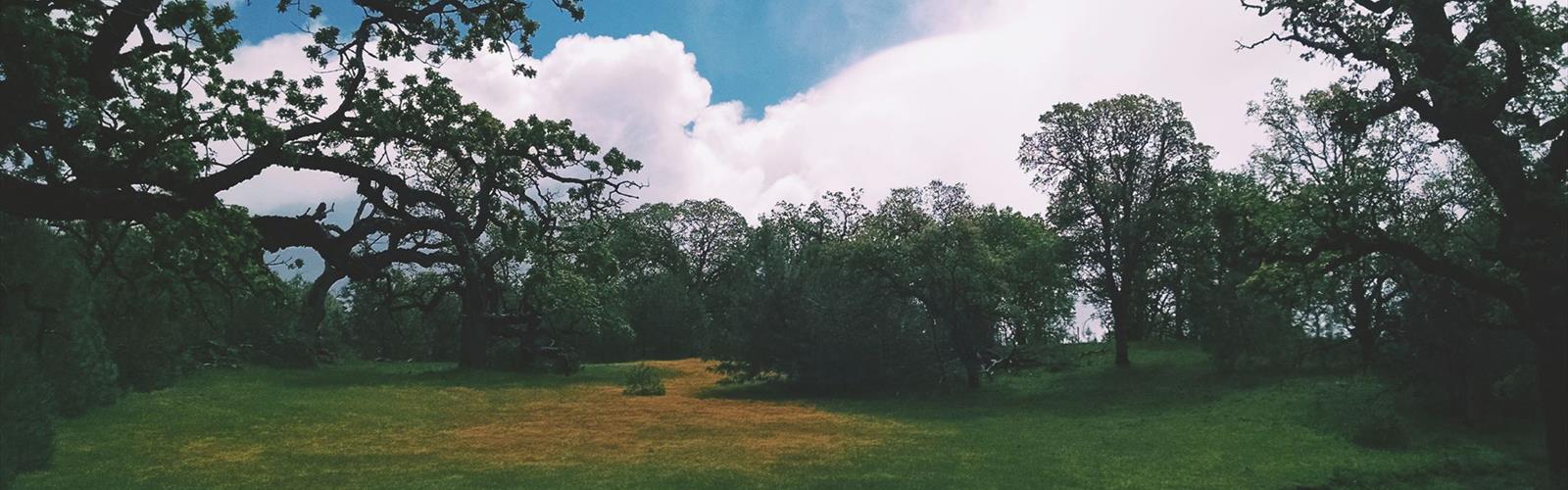

Ready to explore Rose Peak, California? Here's everything you need to know before you go!
Discover the trail
Trail description
Rose Peak is one of the most rewarding summit hikes in the East Bay, and it holds a special distinction: it's the highest point in Alameda County. Sitting at the far eastern edge of the Ohlone Wilderness, this peak draws hikers who want a genuine backcountry feel without leaving the Bay Area behind. The views from the top stretch across the Central Valley, the Coast Ranges, and on a clear day, the Sierra Nevada — a payoff that's hard to match anywhere in the region.
The Ohlone Wilderness Setting
Rose Peak sits within the Ohlone Wilderness, a rugged stretch of land managed jointly by the East Bay Regional Park District. This is not a manicured trail system. The Ohlone Wilderness Trail is a point-to-point route that cuts through remote, rolling terrain — golden grasslands, oak woodlands, and steep ridgelines that feel genuinely wild. The area is named in recognition of the Ohlone people, the Indigenous inhabitants of this region for thousands of years before European contact.
Access to the Ohlone Wilderness requires a permit, which is a key detail to sort out before you show up at the trailhead. The East Bay Regional Park District issues wilderness permits, and you'll need one to legally hike through this area. It's a straightforward process, but skipping it means you're not getting in.
What the Terrain Is Actually Like
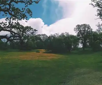
The approach to Rose Peak is not a casual stroll. The trail gains significant elevation through open grassland ridges and exposed hillsides. There's very little shade on the upper sections, which matters a lot in summer. The terrain is classic California coastal range: steep in places, with loose footing on some of the drier slopes, and deeply satisfying when you're moving through it at a good pace.
The trail passes through a landscape that shifts noticeably as you climb. Lower sections move through oak woodland and chaparral. Higher up, the vegetation thins out and the ridgeline opens up completely. Wind is a constant companion near the summit — bring a layer even if it's warm at the trailhead.
Wildlife is a real part of the experience here. The Ohlone Wilderness is home to tule elk, which were reintroduced to the area and have established a visible herd. Seeing them on the hillside is one of those moments that reminds you how much wildness still exists close to a major metropolitan area. Golden eagles, red-tailed hawks, and a range of other raptors work the thermals above the ridgelines regularly.
The Summit Experience
The summit of Rose Peak itself is a broad, grassy high point with a benchmark marker. There's no dramatic rocky scramble at the top — the peak is more of a rounded summit that opens up in every direction. That openness is exactly what makes it worth the effort. The Central Valley spreads out to the east, hazy and vast. The Bay Area's familiar geography — the bay itself, the bridges, the urban sprawl — sits to the west. When conditions are right, the snow-capped Sierra Nevada appears on the eastern horizon, which is a genuinely striking sight from a Bay Area trailhead.
The summit is exposed, so plan accordingly. Early morning starts are strongly recommended, both to beat the heat on the climb and to catch the clearest views before afternoon haze builds up.
Practical Information
A few logistics are worth knowing before you head out:
- Wilderness permit required: You need an Ohlone Wilderness Trail permit from the East Bay Regional Park District. These can be obtained in advance and are required for access.
- Water sources: There are limited water sources along the trail, but conditions vary. Carrying enough water for the full day is essential — do not rely on finding water en route without confirming current conditions.
- Dogs: Dogs are not permitted in the Ohlone Wilderness. This is a firm rule, not a suggestion.
- Leave No Trace: The wilderness designation means this area is managed for minimal impact. Pack out everything you bring in.
- Trailhead access: The most common starting point for Rose Peak is Del Valle Regional Park, which has parking facilities and serves as the southern gateway to the Ohlone Wilderness Trail.
- Fees: Del Valle Regional Park charges a parking fee. Check current rates with the East Bay Regional Park District before your visit.
When to Go
Spring is the standout season for this hike. The hills are green, wildflowers push through the grasslands, and temperatures are manageable. The tule elk are active and visible. Fall can also be excellent — cooler temperatures and good visibility make the long climb more comfortable. Summer is doable but demanding: the exposed ridgeline bakes under the California sun, and starting before dawn is not an exaggeration if you want to summit comfortably. Winter brings rain and occasionally muddy, slippery conditions on the steeper sections.
Who This Hike Is For
Rose Peak is a serious day hike. The distance and elevation gain put it firmly in the challenging category, and it's not a good choice for beginners or young children without significant hiking experience. That said, it's entirely achievable for fit hikers who are comfortable with long days on trail. The reward — a genuine wilderness summit with panoramic views in the heart of the Bay Area — is proportional to the effort required.
If you're looking for a hike that genuinely feels like an escape from the urban Bay Area, and you're willing to earn it, Rose Peak delivers exactly that.
The Essential Hiking Checklist
Everything you need for your next hike. Bilingual, printable, 1 page.
Get your free hiking checklistRecommended gear for this trail
As an Amazon Associate I earn from qualifying purchases.


Ready to go?
Everything you need to know before you goWhen?
How much?
As an Amazon Associate I earn from qualifying purchases.
Affiliate links — LGPO may earn a commission at no extra cost to you.
- Hiking shoes Essential
- → Salomon Elixir Tour Mid WP · 203.38 $
- Layered clothing Essential
- Rain jacket Essential
- Trekking poles
- → Black Diamond Trail Ergo Cork · 69.99 $
- Headlamp
- → Petzl Actik Core 625 · 103.95 $
FAQ - Frequently asked questions
Everything you need to knowSimilar hikes nearby
Discover other trails you might enjoy
Hawk Hill, California
Bay Area
Don Edwards San Francisco Bay National Wildlife Refuge
Bay Area
Mount Hamilton, California
Bay Area
Redwood Regional Park
Bay Area
Pelican Hill, California
Bay Area
Point Reyes, California
Bay Area
Hiking near Victoria
93 trails to explore ~1220 km away
We work hard to provide the most up-to-date and error-free data possible. If something seems incorrect, let us know! Your contribution helps the whole community.
Hikers' opinions
Be the first to review!
No hiker has shared their experience yet. Share your impressions and help other hikers!